Download
1 / 41
410 likes | 461 Views
Learn about atmospheric pressure, wind formation, cyclones, anticyclones, and general atmospheric circulation patterns. Explore El Niño phenomenon impacts and how to recognize El Niño and La Niña events. Enhance your knowledge of weather dynamics.

E N D
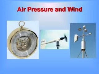
Atmospheric pressure • Force exerted by the weight of the air above • Decreases with increasing altitude • Units of measurement • Millibar (mb) – standard sea level pressure is 1013.2 mb • Inches of mercury – standard sea level pressure is 29.92 inches of mercury
Wind • Horizontal movement of air • Out of areas of high pressure • Into areas of low pressure • Controls of wind • Pressure gradient force • Isobars – lines of equal air pressure • Pressure gradient – pressure change over distance
Wind • Controls of wind • Coriolis effect • Friction
Wind • Upper air winds • Generally blow parallel to isobars – called geostrophic winds • Jet stream • "River" of air • High altitude • High velocity (120-240) kilometers per hour
Low Pressure Zone Formation Warm air rises Creates a low pressure zone At the Earth’s surface, air “feeds” the low pressure zone, moves counterclockwise High Pressure Zone Formation Cool air sinks Creates a high pressure zone At the Earth’s surface, winds blow clockwise Rotating Air Bodies
Rotating Air Bodies • Bends in the polar jet create troughs and ridges • Forms cyclones and anticyclones
Rotating Air Bodies • Cyclones • Low pressure zone in polar jet trough • Winds at surface flow counterclockwise towards the core • Air is updrafted and cooled • Forms clouds, rain and upper level outflow of air
Rotating Air Bodies • Anticyclones • High pressure zone at ridge of polar jet • Air converges in upper atmosphere • Descends towards the ground • Flows outward at surface • Dry, windy conditions
General atmospheric circulation • Idealized global circulation • Equatorial low pressure zone • Rising air • Abundant precipitation
General atmospheric circulation • Idealized global circulation • Subtropical high pressure zone • Subsiding, stable, dry air • Location of great deserts • Air traveling equatorward from the subtropical high produces the trade winds • Air traveling poleward from the subtropical high produces the westerly winds
General atmospheric circulation • Idealized global circulation • Subpolar low pressure zone • Warm and cool winds interact • Polar front – an area of storms
General atmospheric circulation • Idealized global circulation • Polar high pressure zone • Cold, subsiding air • Air spreads equatorward and produces polar easterly winds • Polar easterlies collide with the westerlies along the polar front
General atmospheric circulation • Influence of continents • Seasonal temperature differences disrupt the • Global pressure patterns • Global wind patterns • Influence is most obvious in the Northern Hemisphere
General atmospheric circulation • Influence of continents • Monsoon • Seasonal change in wind direction • Occur over continents • During warm months • Air flows onto land • Warm, moist air from the ocean • Winter months • Air flows off the land • Dry, continental air
Local winds • Produced from temperature differences • Small scale winds • Types • Land and sea breezes • Mountain and valley breezes • Chinook and Santa Ana winds
Wind measurement • Two basic measurements • Direction • Winds are labeled from where they originate • Direction indicated by either • Compass points (N, NE, etc.) • Scale of 0º to 360º • Prevailing wind comes more often from one direction • Speed • often measured with a cup anemometer
Wind measurement • Changes in wind direction • Associated with locations of • Cyclones • Anticyclones • Often bring changes in • Temperature • Moisture conditions
Normal conditions in the tropical Pacific Ocean • Surface winds move from east to west • From high pressure in S. America to low pressure in Australia • Drags water westward • Warm water pools in the western Pacific
Every 3 – 8 years, system reverses • Called the Southern Oscillation • Trade winds weaken or reverse • Warm water migrates from Australia to S. America • Arrives in time for Christmas – Corriente del Niño
What is El Niño? • Basically, it's a giant puddle (or pod) of heated water that sloshes across the Pacific Ocean • Similar to an iceberg • Bulge on the surface • Most of “pod” beneath the surface • Due to difference in density • National Geographic’s Model
ENSO - El Niño-Southern Oscillation • Typically lasts 1 year • May last up to 3 • In multi-year events, first year not as affected • Affects both hemispheres
Recognizing an El Niño • Sea Surface Temperatures (SST) • Normal: 6-8° C warmer in the western tropical Pacific than in the eastern tropical Pacific • Check SST to see if in “normal” range
La Niña • Return to “normal” conditions from an El Niño strong • Produces: • Strong currents • Powerful upwelling • Chilly and stormy conditions along S. American coast • Eastern Pacific cools rapidly, Western Pacific warms rapidly • Renewed Trade Wind activity spreads the cooler eastern Pacific waters westward
Global distribution of precipitation • Relatively complex pattern • Related to global wind and pressure patterns • High pressure regions • Subsiding air • Divergent winds • Dry conditions • e.g., Sahara and Kalahari deserts
Global distribution of precipitation • Related to global wind and pressure patterns • Low pressure regions • Ascending air • Converging winds • Ample precipitation • e.g., Amazon and Congo basins
Global distribution of precipitation • Related to distribution of land and water • Large landmasses in the middle latitudes often have less precipitation toward their centers • Mountain barriers also alter precipitation patterns • Windward slopes receive abundant rainfall from orographic lifting • Leeward slopes are usually deficient in moisture