Download
1 / 32
320 likes | 464 Views
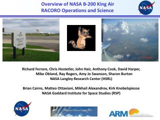
Overview of NASA B-200 King Air RACORO Operations and Science. Richard Ferrare, Chris Hostetler, John Hair, Anthony Cook, David Harper, Mike Obland, Ray Rogers, Amy Jo Swanson, Sharon Burton NASA Langley Research Center (HSRL)

E N D
Overview of NASA B-200 King Air RACORO Operations and Science • Richard Ferrare, Chris Hostetler, John Hair, Anthony Cook, David Harper, Mike Obland, Ray Rogers, Amy Jo Swanson, Sharon Burton • NASA Langley Research Center (HSRL) • Brian Cairns, Matteo Ottaviani, Mikhail Alexandrov, Kirk Knobelspiesse • NASA Goddard Institute for Space Studies (RSP)
B200/HSRL/RSP RACORO Objectives • Investigate variations in aerosol properties near clouds • Investigate variations in aerosol properties due to changes in RH • Evaluate RSP retrievals of cloud properties • Provide the vertical context for airborne in situ measurements of aerosols and clouds • Characterize the PBL height and distribution of aerosols within and above PBL • Characterize the vertical and horizontal distribution of aerosols and aerosol optical properties, including mapping aerosol by type and partitioning optical depth by type. • Develop combined active+passive retrieval algorithms relevant to “A Train” satellites and the NASA Aerosol-Clouds-Ecosystem (ACE) Decadal Survey Mission • CALIPSO Validation
Instruments High Spectral Resolution Lidar (HSRL) Research Scanning Polarimeter(RSP • Independently measures aerosol/cloud extinction and backscatter profiles at 532 nm • Profile Measurement capabilities • Extensive measurements • Backscatter at 532 and 1064 nm • Extinction at 532 nm • Intensive measurements • Color ratio (or Angstrom coeff.) for backscatter (β1064/ β532) • Extinction-to-backscatter ratio at 532 nm • Depolarization at 532 and 1064 nm • Precursor to APS on NASA Glory mission • Measures total and linearly polarized reflectance in 9 spectral bands (412 nm – 2.25 mm) • Retrieval of Stokes parameters • Columnar Aerosol retrievals • Optical depth • Size distribution • Refractive index • Cloud retrievals • Optical depth • Effective radius, variance of cloud droplet size distribution • Cloud top and base heights • Liquid water path and droplet number distribution Hair et al., 2008 Rogers et al., 2009
RACORO Operations Scorecard • B200 based in Ponca City • 19 science flights • 15 flights coordinated with Twin Otter • 4 flights included underpass of CALIPSO and A Train • 16 flights included overpass near or over DOE ARM SGP site
June 18 - Coordinated B200-Twin Otter Flight • B200 and Twin Otter flew triangular coordinated cloud pattern typical of the pattern that was conducted on several days NASA B200 CIRPAS Twin Otter
June 18 - Coordinated B200-Twin Otter Flight • Cloud locations, heights, thicknesses often varied during the flights • HSRL profile data can be used to: • Identify location of Twin Otter measurements relative to cloud and aerosol locations • Provide the vertical context for the Twin Otter in situ measurements Backscatter
June 18 - Coordinated B200-Twin Otter Flight • Suite of HSRL measurements over entire flight Backscatter Aerosol depolarization Extinction Ratio of aerosol depolarization (532/1064) Lidar Ratio Backscatter Wavelength Dependence
June 18 - Coordinated B200-Twin Otter Flight • Suite of HSRL measurements over 12 minute section (21:06-21:18 UT) Backscatter Aerosol depolarization Extinction Ratio of aerosol depolarization (532/1064) Lidar Ratio Backscatter Wavelength Dependence
June 8 - Coordinated B200-Twin Otter Flight • HSRL measurements over 30 minute portion (16:30-17:00 UT) • Vertical variability of aerosol parameters within PBL due to changes in RH Backscatter Aerosol depolarization Extinction Ratio of aerosol depolarization (532/1064) Lidar Ratio Backscatter Wavelength Dependence
June 8 – Variation of Aerosol Parameters within PBL associated with humidification • HSRL profile measurements averaged over 7 minutes (16:36-16:43 UT) • Vertical variability of aerosol parameters within PBL due to changes in RH Aerosol Depolarization Lidar Ratio Extinction RH from Raman lidar Backscatter Wavelength Dependence AOT
Raman lidar measurements of Aerosol Humidification • Aerosol humidification derived from Raman lidar measurements Relative Humidity (%) Aerosol Backscatter
June 17 – CALIPSO – “A Train” Flight • Note variability of aerosol parameters along flight path Backscatter Aerosol depolarization Extinction Ratio of aerosol depolarization Backscatter Wavelength Dependence Lidar Ratio
June 12 Backscatter Aerosol depolarization Ratio of aerosol depolarization (532/1064) Extinction Lidar Ratio Backscatter Wavelength Dependence
June 26 – Smoke over SE Oklahoma • AOT from Terra MODIS
June 26 – Smoke over SE Oklahoma Backscatter Aerosol depolarization Extinction Ratio of aerosol depolarization (532/1064) Backscatter Wavelength Dependence Lidar Ratio
ARCTAS June 30th RSP observations of a young smoke plume at two places RSP and HSRL on B200 flight coordinated with low altitude in situ observations on the P-3 White: RSP locations Red: path
RSP observations matched to radiative transfer model Dotted: model Solid: observation
HSRL Data and Image Availability • Quicklook images of HSRL data are available from RACORO wiki http://wiki.arm.gov/bin/viewauth/AAF/ • Preliminary HSRL images and data are available via ftp; contact us for username, password • A link to this ftp site will be added to the RACORO directory in the DOE IOP data archive • RSP data will be available from the GISS ftp server by the time you read this? Information will be provided to Andy Vogelmann for distribution to those interested.
Twin Otter Data Sets of Particular Interest • Aerosol size distribution (TDMA, PCASP) measurements • How does aerosol size distribution vary in relation to: • distance from clouds? • changes in RH? • CCN Measurements • How do aerosol parameters measured by HSRL (extinction * backscatter wavelength dependence) vary with CCN concentration?
Twin Otter Data Sets of Particular Interest Cloud particle size, COD (FSSP, Gerber probe, hot wire) measurements For these heterogeneous clouds fields how good are the polarimetric size distribution estimates? Are the optical depth estimates useful? • Cloud extinction (CIN, FSSP) measurements • Is the theoretical relationship between lidar depolarization and extinction robust? • If the particle sizing and extinction estimates are robust for CLOWD then lidar+polarimetry will allow Nc to be accurately estimated from space.
References • Hair, J. W., C. A. Hostetler, A. L. Cook, D. B. Harper, R. A. Ferrare, T. L. Mack, W. Welch, L. R., Izquierdo, F. E. Hovis, Airborne High Spectral Resolution Lidar for Profiling Aerosol Optical Properties, Applied Optics, 47,doi: 10.1364/AO.47.006734, 2008. • Rogers, R.R., J. W. Hair, C. A. Hostetler, R. A. Ferrare, M. D. Obland, A. L. Cook, D. B. Harper, S. P. Burton, Y. Shinozuka, C. S. McNaughton, A. D. Clarke, J. Redemann, P. B. Russell, J. M. Livingston, and L. I. Kleinman, NASA LaRC airborne high spectral resolution lidar aerosol measurements during MILAGRO: observations and validation, Atmos. Chem. Phys., 9, 4811-4826, 2009