GIS Fundamentals Seminar Introduction - Fall 2009
300 likes | 410 Views
Learn GIS basics with ArcGIS software, including spatial visualization, mapping techniques, data management, and more. Explore creating layers, shapefiles, choropleth maps, and calculating variables.

GIS Fundamentals Seminar Introduction - Fall 2009
E N D
Presentation Transcript
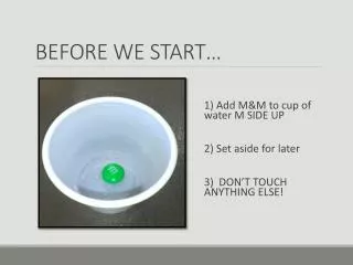
Before we start….please do the ff.: • Create your personal folder in the CSSCR Temp folder • Go to the following links and save them in your folders: • https://wagda.lib.washington.edu/data/geography/us/vector/data/cities_dtl.zip • https://wagda.lib.washington.edu/data/geography/us/vector/data/dtl_cnty.zip • https://wagda.lib.washington.edu/data/geography/us/vector/data/rail100k.zip • Extract all the saved files inside the folder you created
CSSCR Back-to-School Seminar, Fall 2009 Introduction to ArcGIS Arnisson Andre C. Ortega, Ph.C. Department of Geography University of Washington, Seattle
Introduction to ArcGIS|CONTENTS • Spatial Visualization & G.I.S. • What is ArcGIS? • Easy Mapping Techniques Using ArcGIS
Spatial Visualization & G.I.S.|Spatial Visualization ‘How to say what to whom, and is it effective?’ Source: Kraak and Brown, 2001
Spatial Visualization & G.I.S.|G.I.S. • Geographic Information System (G.I.S.) if taken as a system, involves the hardware, software, peoples and the procedure in spatial data visualization, management, representation and analysis (NCGIA Core Curriculum in GIS, 2009) Source: ESRI
Spatial Visualization & G.I.S.|Geospatial Database MAP DATABASE column row t.i.n.* vector raster Triangle Point Line Polygon Cell *T.I.N. (Triangulated Irregular Network)
What is ArcGIS?|Software Background • ArcGIS is the ‘hegemonic’ G.I.S. software program; developed & distributed by ESRI ArcGIS editions ArcView ArcEditor ArcInfo Standard Professional Enterprise Increasing product price
What is ArcGIS?|Software Background ArcGIS Interfaces ArcMap ArcToolbox ArcCatalog • Contains a set of handy tools • Analysis, Conversion & Data Mgt Tools • Create, Edit, Manipulate, Analyze & Query GIS data • Organization of GIS files • Creation, Preview, Open GIS data files
What is ArcGIS?|Exploring ArcMap • Loading, Arranging & Exploring Attributes of Layers • Zoom & Pan • Selection Features: Selecting, Identifying and Finding Features
Loading, Arranging and Exploring Layer Attributes • Add Data toolbar • Layer = map + attribute • Sorting Layers • Open Attribute table • Change Layer Properties
Zoom & Pan • Tool toolbar • Zoom, Pan and Change Map Scale Zoom & Pan
Selection Features: Selecting, Identifying and Finding Features • Select Feature Tool • Zoom to Selected Features • Statistics • Clear Selected Features • Identify Feature Tool
Finding Features • Find Toolbar
Easy Mapping Techniques Using ArcGIS|Loading A Map • With ArcMap Open, click the Add Data toolbar • Search for the shapefiles (.shp) in the folders you created earlier and click Add
Easy Mapping Techniques Using ArcGIS|Querying • With the layer, dtl_cnty checked, go to: Selection >Select By Attributes • Query the attributes (see illustration) CSSCR Back-to-School Seminar, Fall 2009 Introduction to ArcGIS
Easy Mapping Techniques Using ArcGIS|Selecting & Creating Layers Out of Selection • Selected features (counties of Washington State) are highlighted • Create a new layer out of the selected features (see illustration) CSSCR Back-to-School Seminar, Fall 2009 Introduction to ArcGIS
Easy Mapping Techniques Using ArcGIS|Creating Shapefiles • Create a new shapefile out of the layer (see illustration) & make sure to create your desired .shp filename in your folder (for easy access) • Add the new shapefile using Add Data toolbar CSSCR Back-to-School Seminar, Fall 2009 Introduction to ArcGIS
Easy Mapping Techniques Using ArcGIS|Creating A Choropleth Map • Choropleth maps are thematic maps in which areal units are shaded in proportion to measurement of variable (e.g. population density) • Right Click Layer of interest and Select Properties CSSCR Back-to-School Seminar, Fall 2009 Introduction to ArcGIS
Easy Mapping Techniques Using ArcGIS|Creating A Choropleth Map • With Layer Properties opened, go to Symbology and then select: Quantities > Field (POP05_SQMI) > OK • A choropleth map showing population density (2005) per county within Washington State is shown CSSCR Back-to-School Seminar, Fall 2009 Introduction to ArcGIS
Easy Mapping Techniques Using ArcGIS|Adding Fields and Calculating new variables • Examine Table Attributes of your created shapefile • Let us say we are interested to see the spatial distribution of proportion of blacks per county in Washington State • We can create a new attribute(variable) (say, variable name, pblack) for this by using the formula: pblack=black/pop2000 CSSCR Back-to-School Seminar, Fall 2009 Introduction to ArcGIS
Easy Mapping Techniques Using ArcGIS|Adding Fields and Calculating new variables • We first add a new field • Open attribute table • Right Click and Select ‘Add Field’ CSSCR Back-to-School Seminar, Fall 2009 Introduction to ArcGIS
Easy Mapping Techniques Using ArcGIS|Adding Fields and Calculating new variables • With the Add Field window open, fill-out variable specifics (name = pblack, type = double) • Right click the new variable, pblack, and click Field Calculator • With the Field Calculator window open, calculate the values (see illustration) CSSCR Back-to-School Seminar, Fall 2009 Introduction to ArcGIS
EXERCISE ALERT!!!1. Make a choropleth map using the new variable, pblack.2. Try exploring other map types, e.g. population dot maps
Easy Mapping Techniques Using ArcGIS|Map Layout • With our desired map made, we can proceed to create our map layout • Go to View > Layout View • In the Layout View, we can add the classic elements of maps, e.g. Title, Legend, Scale, Direction • We can save the map and convert it into image file by going to File > Export Map > CSSCR Back-to-School Seminar, Fall 2009 Introduction to ArcGIS
A FEW LAST WORDS……………………………....... • If lost….always check on the HELP Menu Bar • There is a plethora of tutorials, data and other resources relating to ArcGIS mapping • Advantages and Disadvantages of using ArcGIS • Stay tuned for future CSSCR Back-to-School Quarterly classes that will feature GIS Mapping • Geoprocessing • Spatial Statistics • Subject/Theme-related mapping techniques (demographic, housing, environmental, etc.) • I am just an email/visit/call away…….. • Andre Ortega, Geography Consultant (aaortega@u.washington.edu) CSSCR Back-to-School Seminar, Fall 2009 Introduction to ArcGIS