Download
1 / 17
200 likes | 392 Views
Storm Runoff and soil erosion processes on the Ethiopian highland. Seifu A Tilahun School of Civil & Water Resources Engineering,BDU. Introduction Field Experiments on the hydrology Field Experiments on Erosion PEER Science project at BDU. Outline.

E N D
Storm Runoff and soil erosion processes on the Ethiopian highland Seifu A Tilahun School of Civil & Water Resources Engineering,BDU
Introduction • Field Experiments on the hydrology • Field Experiments on Erosion • PEER Science project at BDU Outline
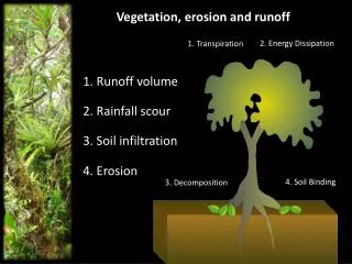
river sediment concentrations have not declined • runoff and erosion processes are not fully understood • investigating where they takes place in the landscape • used this information to model erosion Introduction
1 Automatic Rain Gauge • 4 weirs installed & measured storm runoff (40 -50 events) • 1 weir at the outlet (Adet Research Center) • 19 piezometers to measure ground Water level • 14 infiltration test • Sediment concentration from 5 weirs (40 -50 events) • Rill measurement from 10 agricultural fields • 4 gully profile measurement Introduction
Debre Mawi Infiltration Rate vs. Rainfall Intensity Bayabil et al. 2010 Ecohydrology
As = 10% Weir-1 Saturated Areas Saturation
1 2 3 4 5 Runoff
8 Aug 2010 Sediment Concentration
625m2 in 2011 321m2 in 2010 81m2 in 2005 • 120 ton ha -1 yr-1 in 2010 Rill & Gully erosion
Saturated hydraulic conductivity generally greater than rainfall intensity for well vegetated watersheds • After a precipitation threshold is exceeded, discharge at outlet of watershed is linearly related to total precipitation • soil erosion was related to wetness through landscape position • Modelling should incorporate the above processes Conclusion
To propose more effective soil and water conservation practices by identifying those parts in the landscape that contributes most of the sediment and nutrients at the outlet. Project goal
Measure stream flow and sediment concentrations • Measure shallow ground water level • Employ sediment tracers to locate sediment source areas • Focus group discussion and transect walk • Soil nutrient analysis • Modeling of runoff and sediment Activities