Download
1 / 29
290 likes | 418 Views
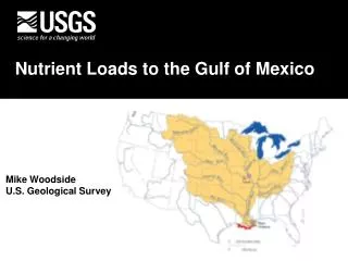
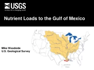
Gulf of Mexico Hypoxia and Mississippi River Basin Nutrient Losses. Herb Buxton, USGS. Rob Magnien, NOAA. Co-Chairs, Monitoring, Modeling, and Research Workgroup, Mississippi River/Gulf of Mexico Watershed Nutrient Task Force. What Causes Gulf Hypoxia?.

E N D
Gulf of Mexico Hypoxia and Mississippi River Basin Nutrient Losses Herb Buxton, USGS Rob Magnien, NOAA Co-Chairs, Monitoring, Modeling, and Research Workgroup, Mississippi River/Gulf of Mexico Watershed Nutrient Task Force
What Causes Gulf Hypoxia? “Hypoxia in the Northern Gulf of Mexico is caused primarily by excess N delivered by the MARB in combination with stratification of Gulf Waters.”– Integrated Assessment, 2000
Hypoxic Zone Extent, July 21-25, 2004 30 22 o 29 Area of Hypoxic Zone (km2 x1000) 20 Rabalais, LUMCON 18 16 94 93 92 91 90 89 o 14 12 10 o o o o o o 8 6 4 2 85 87 89 91 93 95 97 99 01 03 Gulf Hypoxia • Hypoxic Zone • Measured since 1985 • Largest extent, 2002 NOAA, Rabalais et al.
3.0 Conc. (mg/l) 2.0 1.0 0.0 NITRATE LOAD, ANNUAL STREAMFLOW AND N CONCENTRATION 1955-70 Avg. = 350,000 t/yr 1980-99 Avg. = 950,000 t/y
Nitrogen Cycling Artificially Drained Land, MRB Millions of Acres INPUTS Urban Runoff?? • N Inputs and Outputs • (Million metric Tons). • Landscape changes. OUTPUTS
MR/GM Watershed Nutrients Task Force • Federal Agencies (USEPA*, NOAA, USDA, USACE, DOI) • States (Agriculture and Environment Departments) • Tribal representatives
Task Force Organization CoordinatingCommittee (Implementation) • Finance/Budget Workgroup • Monitoring, Modeling and Research Workgroup • Management Response Workgroup • Point Sources • Non Point Sources • Restoration
CENR Science Assessment Integrated Assessment, May 2000
A Science-based Action Plan • Adaptive management. • Consider all causal and mitigating factors. • Voluntary Basis. Task Force Action Plan, January 2001
22 Area of Hypoxic Zone (km2 x1000) 20 18 16 14 12 10 8 6 4 2 85 87 89 91 93 95 97 99 01 03 Action Plan Goals 5,000 km2 • Coastal Goal: By 2015, reduce the 5-yr average zone to < 5,000 Km2. • Within Basin Goal: To restore and protect the waters of the 31 States and 77 Tribes in the Basin. • Quality of Life Goal: Improve the communities and economic conditions across the Mississippi Basin.
Reducing Nutrient Loads Reducing Point Sources and Urban Runoff Filter Strips Riparian Forest Buffers Decreasing N losses Farm N Management
Davis Pond Diversion Structure Reducing Nutrient Loads Increasing Denitification Diversions to Coastal Wetlands Restoring Wetlands Lock & Dam Management
Nitrogen Loads, 1980-96 1.6M metric tons per year Arkansas/Red 7% Lower Mississippi 7% Ohio 32% USGS Gaging Station Middle Mississippi 28% 1500 Water-Quality Measurements on 9 large sub-basins. Missouri 15% Upper Mississippi 10%
Nitrogen Yield, 1980-96 Yield on 42 small Sub-basins calculated from >4000 additional water-quality measurements.
N Input From Wet Deposition N Input From Fertilizer N Input From Point Sources Component Nitrogen Inputs
YIELD Inference Nitrogen Yield, 1980-96 Statistical extrapolation from representative basins (from 42 measured Sub-basins to 133 Sub-basins of entire Mississippi Basin).
B C Increasing yield Model Estimation of Total Nitrogen Delivered to the Gulf of Mexico(SPARROW) A - Municipal and Industrial Discharges B - Atmospheric Deposition , and C - Fertilizer and Livestock Wastes. A 6% +/- 3 18% +/- 10 64% +/-21
Fraction of In-Stream Nitrogen Delivered to Gulf Alexander et al. Nature, 2000
MMR Strategy A Science Strategy to Support Management Decisions Related to Hypoxia in the Northern Gulf of Mexico and Excess Nutrients in the Mississippi River Basin Available on the Internet: toxics.usgs.gov/hypoxia/task_force_workgroup.html
Chapters/Topical Groups (leads) • Gulf • Monitoring and Reporting (Rex Herron, NOAA) • Modeling and Research (Kenric Osgood, NOAA) • Social and Economic Issues (Rita Curtis, NOAA) • Watershed • Monitoring and Reporting (Joe Engeln, MO DNR) • Modeling and Research (Rich Alexander, USGS) • Social and Economic Issues (Marc Ribaudo, USDA) • Coordination and Information Needs • Resource Needs
Management Questions THE WATERSHED What are the major sources and causes of excess nutrients within the Mississippi River Basin?
BASIN MONITORING FRAMEWORK Nested scales to address and integrate processes from landscape to Basin-Gulf interrelationships. • MRB MOUTH • Large Sub basins • Small Sub basins • Smaller watersheds
BASIN MONITORING: Level 1 • MRB MOUTH • High Frequency data. • Nutrients, carbon and other related data. • Explain cause-effect linkages to Hypoxic zone.
USGS Gaging Station BASIN MONITORING: Level 2 • Large Sub basins • Estimate annual loads. • Monitor Sub-basin management strategies. • Explain variations in loads at the mouth.
BASIN MONITORING: Level 3 • Small Sub basins • Annual loads. • Explain load variations due to climate, sources. • Representative sites useful for model extrapolations. • Response of cumulative management actions. • Explain time lags.
BASIN MONITORING: Level 4 • Smaller watersheds • Quantify specific source contributions and evaluate specific management actions. • Useful for model extrapolations. • Explain time lags in response to management actions. • Explain processes affecting larger basins.
Priorities for Basin Monitoring and Reporting • Adopt a four-level watershed monitoring system… • Supplement existing monitoring efforts …on smaller rivers and streams… • Coordinate monitoring and reporting through leadership at the federal level… • Link watershed monitoring to management actions…
Next Step: Action Plan: short-term action 11 By December 2005, and every 5 years thereafter, the Task Force will assess the nutrient load reductions achieved and the response of the hypoxic zone, water quality throughout the Basin, and economic and social effects. Based on this assessment, the TF will determine appropriate actions to continue to implement this strategy or, if necessary, revise the strategy.
Info On the Internet USGS Hypoxia in the Gulf of Mexico: http://toxics.usgs.gov/hypoxia/ USEPA Hypoxia Task Force: http://www.epa.gov/msbasin/hyp2.htm NOAA Science Assessment: http://www.nos.noaa.gov/products/pubs_hypox.html