Understanding Earth's Magnetism Through Paleomagnetism: Accuracy and Evidence
This document explores the accuracy of Earth's magnetic field representation as utilized in paleomagnetism. It discusses the alignment of magnetic minerals in igneous rocks with Earth's magnetic field, the implications of this alignment for understanding polar wandering, and critiques the acceptance of historical hypotheses regarding the magnetic poles. The role of paleomagnetic evidence in evaluating continental drift and the concepts of spatial geology are examined, providing insights into the development and interpretation of models depicting Earth's magnetic field dynamics.

Understanding Earth's Magnetism Through Paleomagnetism: Accuracy and Evidence
E N D
Presentation Transcript
I. How can a scientist state that the representation below is accurate?
II. What is the evidence that is used to make this representation? • Using the historical reading, what are the two main hypotheses that the author describes? • What, does the author suggest, is the issue with the two hypotheses’ acceptance?
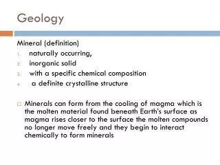
II. What is the evidence that is used to make this representation? • Earth’s core acts like a large magnet that produces a magnetic field which extends from one pole to the other. • A compass needle aligns itself with this magnetic field (points toward the magnetic poles). • When igneous rocks containing magnetic minerals crystallize, the crystals align themselves with the Earth's magnetic field. Earth’s Magnetic Field
II. What is the evidence that is used to make this representation? • Using the representation on the right as a reference, describe a magnetic field.
III. What Can The Evidence Tell Us? According to the historical reading, “new” evidence was being gathered from the emerging field of paleomagnetism. • Using what you know about Earth’s magnetic field, describe how this field could be used to develop the animation.
III. What Can The Evidence Tell Us? Using what you know about Earth’s magnetic field, describe how this field could be used to develop the representation. As evidenced by… Earth’s magnetic field could be used to develop the representation because…
IV. The Science of Paleomagnetism and Polar Wandering • When igneous rocks freeze and crystallize, the iron particles they contain align with Earth’s magnetic field. The Earth’s magnetic field is frozen in the rock. If the rock is moved, its magnetic inclination will act as a "fossil compass.”
IV. The Science of Paleomagnetism and Polar Wandering • Magnetized minerals can also be used to determine the latitude of an igneous rock at origin. • The Earth's magnetic field is curved, and the inclination of the magnetic grains gives an estimate of the paleolatitude. • Equator: horizontal • Mid-latitude: high angle • Pole: straight up
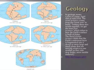
IV. The Science of Paleomagnetism and Polar Wandering • The apparent position of the North Pole was determined from the paleomagnetism of the rocks. • In looking at igneous rocks from different continents, the poles appear to be “wandering.”
IV. The Science of Paleomagnetism and Polar Wandering • Is this explainable? • Table Model
IV. The Science of Paleomagnetism and Polar Wandering • Assuming that the magnetic poles are approximately coincident with the pole of rotation, the apparent movement of the poles must be due to movement of the continents. • Curves are similar shape for North America & Europe except that they were offset by ~24° of longitude.
IV. The Science of Paleomagnetism and Polar Wandering • If the two continents are placed next to one another, according to correlation of rock features, the apparent pole wandering paths coincide. • When they directly over lap, it is thought that the continents were joined. This Apparent Polar Wandering represents a spatial component to our understanding of the geologic time scale.
IV. The Science of Paleomagnetism and Polar Wandering Example: • http://www.see.leeds.ac.uk/structure/dynamicearth/plates_move/longterm/apwp/index.htm
V. Revisit the original question, ‘How can a scientist state that the representation below is accurate?’ and describe your thoughts according to what you understand now.