Download
1 / 14
140 likes | 275 Views
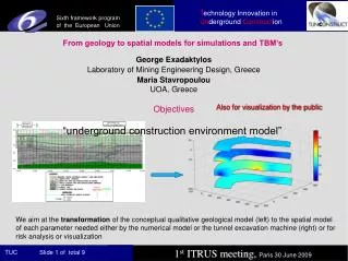
From geology to spatial models for simulations and TBM’s. George Exadaktylos Laboratory of Mining Engineering Design, Greece Maria Stavropoulou UOA, Greece. Objectives. Also for visualization by the public. “underground construction environment model”.

E N D
From geology to spatial models for simulations and TBM’s George Exadaktylos Laboratory of Mining Engineering Design, Greece Maria Stavropoulou UOA,Greece Objectives Also for visualization by the public “underground construction environment model” We aim at the transformation of the conceptual qualitative geological model (left) to the spatial model of each parameter needed either by the numerical model or the tunnel excavation machine (right) or for risk analysis or visualization
Developed concepts & IT tools for this transformation • 1. The concept and tool of the web-driven, relational rock mechanics database (RMDB) that could become an add-on database of any numerical code for rock parameters selection by modeler. Applicability of RMDB has been extended to the rock masses by using the concept of the “Damage Mechanics”. These developments should be contrasted for example with PHASES-RockLab tools developed by the Rockscience group. Extended for soil mechanics applications (standardization of rock and soil mechanical testing) • 2. The new Geostatistics package KRIGSTAT for 1D, 2D & 3D spatial analysis and interpolation through kriging (co-kriging) or simulation of geotechnical parameters inside each geological formation with evaluation of uncertainty of predictions. This software could be combined with the concept of “Discretized geological modeling” developed to feed directly numerical simulation tools, as well as Risk Analysis & Reliability Analysis software. • 3. The new CUTTING_CALC software for excavation performance analysis & optimization of TBM’s & Roadheaders. The concept of transformation of “geological model” into “machine performance model”. Exploitation • The new software KRIGSTAT may be a stand-alone application or add-on of a commercial numerical code or risk analysis software. • CUTTING_CALC code may be add-on of tunneling machines or for work nearly real-time in the office. • The RMDB could be also exploited to become a useful tool for selecting rock mechanical parameters at the pre-design & design stages of an underground excavation (combined with numerical software).
Case study: Mas-Blau EPB tunnel in soft soil formations Screenshot of KRIGSTAT code 2) Ordinary Kriging 4) Prediction error or uncertainty 3) Annealing (stochastic simulation) 1) Indicator Kriging
EPB head design Traces of knives, calculate S=10 cm Knives design 1) Specific Energy of soil cutting SE2 (MPa) calculation
Plasticity slip-line analytical model for soil cutting • - Undrained conditions during cutting • - Undrained pore pressure drop • pb-p0 is very large • SE independent of p0; only function of pm
Model calibration procedures in the RMDB Damage Failure criterion Upscaling
main items for modern tunneling are risk reduction for workers and neighbourhood in urban areas, better production rates and less stops due to unexpected events or wear is also of interest, lowering costs and offering the infrastructures earlier to public (reduces social cost). Ideas on the development of industrial systems for forecasting subsidence and visualisation. - Define and improve types of data adquisition, use of sensor networks, create homogeneous protocols, provide decision making tools.
On the development of the “Cutting Efficiency Mapping System (CEMS)” for Roadheaders (RH) George Exadaktylos & George Xiroudakis TUC Laboratory of Mining Engineering Design Greece Maria Stavropoulou UOA Greece
Objectives • Develop a “Cutting Efficiency Mapping System (CEMS)” using RH • logged data and fast analytical algorithms (TUC). • - Testing CEMS with the new roadheader prototype (Sandvik-TUC). Benefits • Further exploitation of new RH automations such as “Guidance System”, • Sandvik – Geodata for continuous monitoring of the position of RH. • Shift by shift monitoring of RH’s performance and ground strength. • Prediction of RH’s performance (energy consumption-advance rate) from • geological and rock mechanics test data already at the design phase. Exploitation • The new software may be added on the RH for the continuous monitoring • of its performance or for rock mass characterization. • - Also, the software maybe used for the optimization of excavation efficiency • of a RH by selecting the best operational parameters or head design under • given geological conditions.
Example case study: Montreal, Quebec, Canada metro tunnel Left: Transformed geological model in kWh/m3 of the Montreal metro case (Simulation Annealing Module of KRIGSTAT software). Comparison of lithology (left), SE estimation from geostatistical analysis with KRIGSTAT & from the analytical formula (middle),and from registered machine data(right) (SE=Specific Energy in kWh/m3).
Developed modeling framework • Geostatistical code KRIGSTAT • New analytical performance model for RH (calculation of cutting • geometry, cutting forces and specific energy of cutting considering the “size effect”) • Implementation of analytical relations and part of the geostatistical • model in the form of RH’s add-on software Left fig.: KRIGSTAT Right fig.: Cutting_calc algorithm