Download
1 / 30
300 likes | 304 Views
This workshop aims to enhance emergency response readiness for seismic and tsunami threats in Southern California. Topics include plate tectonics, fault lines, seismic waves, earthquake effects, and tsunami risks.

E N D
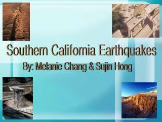
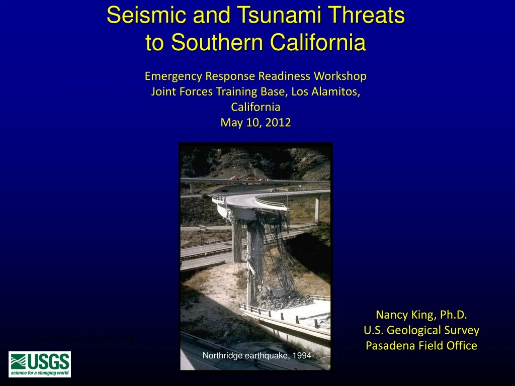
Seismic and Tsunami Threats to Southern California Emergency Response Readiness Workshop Joint Forces Training Base, Los Alamitos, California May 10, 2012 Nancy King, Ph.D. U.S. Geological Survey Pasadena Field Office Northridge earthquake 1994 Northridge earthquake, 1994
Faults and Plate Tectonics Plate motion occurs on faults.
What Faults Look Like After Earthquakes 1906 San Francisco earthquake Scarp of 1971 San Fernando earthquake Photo from Finding Fault in California: An Earthquake Tourists’ Guide, by Susan Elizabeth Hough Landers earthquake, 1992 1979 Imperial Valley earthquake
Faults and Shaking An earthquake is sudden slip on a fault. This slip triggers seismic waves. These waves cause shaking and most of the damage.
What the San Andreas Fault Looks Like Stream offset: 420 feet in 3800 years
Faults of Southern California Over 300 faults in Southern California But other faults can produce damaging earthquakes Only the San Andreas can have the “Big One” (M 7.8+) But earthquakes on other faults can be disasters, e.g. 1994 Northridge M 6.7
Magnitude and Intensity Magnitude is the maximum amplitude on a seismogram. The magnitude scale is logarithmic. Each whole number increase is: 10 times more ground motion 32 times more energy Worldwide Intensity is the earthquake’s effects, on scale of I to XII.Depends on: • Distance from earthquake • Geology • Type of structure • Observer! Varies from place to place. Doug Given, USGS neic.usgs.gov/neis/eqlists/eqstats.html
Earthquakes in California On average in southern California: Over 30 per day, mostly not felt Magnitude 6 every 5 years Magnitude 7 every 30 years Magnitude 7.7 every 150 years 50,000 We CANNOT predict these earthquakes! Good seismic network begins here. 1930 2007
Earthquake Effects – Aftershocks March 11, 2011 Tohoku M 9.0 earthquake and its aftershocks in the first day
Earthquake Effects - Structure Failure Life-safe Northridge, CA, M 6.7 1994 NOT life-safe Ferndale, CA, M 7.1 1992 Performance depends on • Material • Construction Columbia, M 6.2, 1999
Earthquake Effects - Falling Objects Stanford University, 1906 earthquake
Earthquake Effects - Utility Line Rupture Northridge earthquake,1994 USGS Open File Report 96-263
Earthquake Effects - Lifelines Highways, railways, power lines, phone lines, pipelines, and water aqueducts and pipelines all cross the San Andreas fault L A
Earthquake Effects - Interior Damage Dr. Cindy Stern
Earthquake Effects – Landslidesand Liquefaction Liquefaction – Niigata, Japan, 1964 Steinbrugge Collection of the UC Berkeley Earthquake Engineering Research Center Landslides – Northridge, 1994
Earthquake Effects - Tsunamis • One or more intense waves, usually caused by an earthquake or undersea landslide. • First wave may NOT be the largest. Timing between waves may vary from • minutes to several hours apart. The danger lasts hours after the first wave. • Tsunami waves can come ashore in different ways: • Wall of water – rapidly rising tide – series of surf-like breakers • Tsunamis can carry boats, debris and heavy rocks. • Types: Local – earthquakes near the coast where first wave can be within 10 • minutes and may not be time for a tsunami warning • Pacific-wide – caused by earthquakes far away from our coast which • allows time for an tsunami warning • Vulnerable areas in so. California include: LA and Long Beach Harbor, • Venice and West Los Angeles beaches. • TSUNAMI WARNING BROADCAST: Pack up your family and pets • and move inland
Earthquake Effects – Tsunami in Hawaii, 1946 Hilo, Hawaii, 1946
Earthquake Effects - Community • Death and injury • Structure damage • No power/gas • Fire • No water • Road/rail closures • Phones out • No emergency services • Stranded commuters • Separated families • Destroyed homes • Stores closed • Business losses • Loss of jobs
The Big One The last Big One in southern California was the Fort Tejon Earthquake of 1857, which killed 2 people. No one remembers this earthquake. The next Big One will be different, causing casualties and damage in now heavily populated southern California. There will be up to 2 minutes of ground shaking. Preparation and response are local. It’s up to us.
Earthquake Deaths Japan 2011 Roger Bilham, University of Colorado
Earthquake Preparedness and Response Before • Retrofit buildings • Secure fixtures/contents • Emergency plan • Emergency supplies During – Drop, cover, and hold on! After • Check for damage and injuries • Follow your emergency plan • Expect aftershocks • Contact insurance agent • Restore documents • Begin repairs • Contact FEMA
USGS Products CISN Display – Real time earthquake alert and notification California-Nevada Earthquake Map ShakeCast – Situational awareness tool for emergency responders and critical facility operators Earthquake Notification System
USGS Products ShakeMap Did You Feel It?
The Take-Home Message We live in earthquake country! It’s up to each of us to prepare.
Thank you! Questions?