Download
1 / 27
290 likes | 566 Views
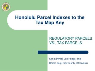
Honolulu Parcel Indexes to the Tax Map Key. REGULATORY PARCELS VS. TAX PARCELS. Ken Schmidt, Jon Hodge, and Bertha Yagi, City/County of Honolulu. Cadastre, Cadastral Maps, and the Parcel Fabric.

E N D
Honolulu Parcel Indexes to the Tax Map Key REGULATORY PARCELS VS. TAX PARCELS Ken Schmidt, Jon Hodge, and Bertha Yagi, City/County of Honolulu
Cadastre, Cadastral Maps, and the Parcel Fabric • Cadastre – A records of interests in land, encompassing both the nature and extent of the interests (maps and other descriptions). • Cadastral Maps – Graphical portrayals of the legal descriptions of land parcels. Typically maintained for tax assessment purposes. • Parcel – Physical Area of land with legally defined boundaries, usually recorded in a Land Title Recordation System. • Parcel Fabric - A parcel fabric is a representation of the record of survey/title for an area of land.
Regulatory vs. Tax • Subdivision – A division of land into 2 or more lots, parcels, or other divisions (e.g. easements), for purposes such as sales, lease, rental, or transfer of title or interest. (also Consolidations). • Regulatory subdivision – Permitted for development purposes, to comply with Land Use Ordinances, e.g. R-5. • Taxable Subdivision – Performed for tax assessment and collection purposes.
Reasons for Differences: • Tax office consolidates two parcels with the same owner for tax assessment purposes. • Condominium Property Regime CPR formerly HPR • Lease Lots • Land Titles • DPP has done updates to the parcels but new TMK's have not been assigned yet. There are many reasons why Regulatory (approved subdivision) parcels may differ from the Tax Office parcels. Some examples are...
Different Parcel Types • Tax and Regulatory Parcels - parcels that have the same geometry for both Dpp and Tax office. • Regulatory Only Parcels - parcels that are DPP approved parcels. • Tax Only Parcels - parcels that are approved by the Tax office for Tax Assessment purposes. GIS parcel layer has 3 different parcel Types: Tax and Regulatory, Regulatory Only and Tax Only.
Parcel Object Ids (POI), TaxPIN, and TMKs • Parcel Object Identifier (POI or POID) are used to identify Regulatory Parcels which are approved by DPP. • TAXPIN are TAX ID numbers assigned by GIS to give Tax Parcels a unique ID. • TMKs that are 8 digit numbers are assigned by the Real Property Tax office for tax assessment purposes. • A Regulatory and Tax parcel will have a POI that is equal to the Tax Pin and it will have a TMK (most common occurrence). • A Regulatory Only parcel will have a POI but no Tax pin or TMK. • A Tax Only parcel will have a Tax Pin and TMK but no POI.
TAX AND REGULATORY PARCELSMatching Boundaries: Tax and Regulatory parcels will have TMK, TaxPin and a POI ( 85%) BOLD GREY LINES ARE THE TAX PARCEL BOUNDARY THIN RED LINES ARE THE REGULATORY BOUNDARY
REGULATORY ONLY and TAX ONLY PARCELS Regulatory and Tax parcels match, so each has POI, TaxPIN, and TMK. Tax only parcel with TMK 59001016 has tax pin 478153 which occupies the same spatial area as 2 regulatory only parcels POIs 456643 and 456641 BOLD GREY LINES ARE THE TAX PARCEL BOUNDARY, THIN RED LINES ARE THE REGULATORY BOUNDARY
TAX ASSESSMENT CONSOLIDATIONS: BOLD GREY LINES ARE THE TAX PARCEL BOUNDARY, THIN RED LINES ARE THE REGULATORY BOUNDARY
DPP Permitted Subdivisions RPA has not assigned separate TMK's BOLD GREY LINES ARE THE TAX PARCEL BOUNDARY, THIN RED LINES ARE THE REGULATORY BOUNDARY
Tax Assessment Subdivision RPA has assigned 2 separate TMK's BOLD GREY LINES ARE THE TAX PARCEL BOUNDARY THIN RED LINES ARE THE REGULATORY BOUNDARY
How this affects permitting. Look up by TMK or Taxpin object The Display Format of the Tax Map Key window displays the TMK, POID and TAXPIN The grid at the bottom displays the overlapping parcels of Tax-Only or Reg-Only parcels. (Tax-Only parcels display overlapping Reg-Only parcels; Reg-Only Parcels show the overlapping Tax-Only parcels) You can double click on any of the overlapping parcels to open the Tax Map Key window of that TMK object. This detail displays the type of parcel (Tax & Reg, Tax Only, or Reg Only)
Why you need to know the “*POI” Look up by Poi The Display Format of the Tax Map Key window displays the TMK, POID and TAXPIN The grid at the bottom displays the overlapping parcels of Tax-Only or Reg-Only parcels. (Tax-Only parcels display overlapping Reg-Only parcels; Reg-Only Parcels show the overlapping Tax-Only parcels) You can double click on any of the overlapping parcels to open the Tax Map Key window of that TMK object. This detail displays the type of parcel (Tax & Reg, Tax Only, or Reg Only) Regulatory parcels will display an *poi in the TMK field
How it looks “HONLine” – Matched Parcels This parcel is both tax and reg so it shows a POI and TaxPin that are the same number.
How it looks “HONLine” – Tax Only This is a Tax only so it only has a Tax Pin and NO POI.
Using the *POI in HONLine When you are searching for a parcel in HONLine you will not be able to find the retired TMK. You will need to know the POI or the address. If you know the POI then you can enter an * POI in the TMK field. Or you can use the address.
Viewing Tax Parcels and Regulatory Parcels on the Honolulu GIS Web SiteUsing the Advanced Map
Public GIS website The city has our GIS website available to the public Go to:http://gis.hicentral.com/ We have several maps available. In the ADVANCED MAP you can search by TMK or POI. Search by TMK to get the Tax parcel view.
GIS website: Tax Parcel View Table of Contents show all the layers available To view parcels you need to check on main group “Cadastral” then check on the parcels type that you want to view.
GIS website: Regulatory Parcel View We have several maps available. In the ADVANCED MAP you can search by TMK or POI. Search by POI to get the Regulatory parcel view.
GIS website: Regulatory Parcel View To view parcels you need to check on main group “Cadastral” then check on the parcels type that you want to view.
Parcel History Historic View of Tax Parcels In box you can decide if you want to view Tax Parcels or Regulatory Parcels. Historic View of Parcels are available to City GIS users. Under Cityview Tools click on Roll back parcels to prior date. Then you will determine the date that you want to view
Parcel History Historic View of Tax Parcels Parcels can be rolled back to 12/2005. Parcel History will show the edits from that date.
Special Thanks • Rod Low – ESRI Honolulu • BFS Real Property Division • DPP • Site Development Division • Building Division • Customer Services Office • Computronix • Jon, Bertha, Cynthia, Lynn
SAVE THE DATE! – JULY 1, 2010TEJUINOFoster Garden Summer Concert Series