Download
1 / 25
250 likes | 374 Views
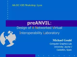
6th EC-GIS Workshop, Lyon. preANVIL : Design of A N etworked V irtual I nteroperability L aboratory. Michael Gould Computer Graphics Lab University Jaume I Castellón, Spain. preANVIL. Interoperability in Europe Overview and possible scenarios Partners and Work packages

E N D
6th EC-GIS Workshop, Lyon preANVIL:Design of ANetworked Virtual Interoperability Laboratory Michael Gould Computer Graphics Lab University Jaume I Castellón, Spain
preANVIL • Interoperability in Europe • Overview and possible scenarios • Partners and Work packages • Key questions, issues • Expected results • Invitation to participate
Interoperability in Europe • Many international initiatives, OGC • Europe just beginning to take part • GIPSIE, ELADIS, GETIS, ETeMII, OGC Europe • integration, not competition, with international work • primary need: information dissemination • Interop: key to growth and competitiveness in the European GI market • Key research topic: AGILE Interop WG
The preANVIL project • February 1999 workshop at JRC: Virtual Interoperability Laboratory (VIL) • in collaboration with DG III • a brainstorming session • Among the conclusions: “Europe could benefit from a laboratory conducting practical tests and making recommendations oriented to improving interoperability of relevant information systems and data.”
preANVIL • September 1999: JRC’s call for tender • “To assess the technology progress in the area of interoperability of information systems in general and GIS in particular... • To set up a showcase for the demonstration of project results with potential to contribute to the interoperability of GI and GIS systems, • To assess the feasibility and define a sustainability policy for the establishment of a GIS Interoperability laboratory in Europe, • To catalyse technical discussions regarding GI/GIS interoperability and harmonising the interoperability strategy through discussion at technicalforums, concertation meetings and a Workshop.”
preANVIL • Official project title: • “PreANVIL: An Accompanying Measure for the Interoperability of Geographic Information Systems in Europe – A Technology Perspective” • Duration: Feb-June and July-Nov 2000 • Funding: 100+100 kEuro • We believe ANVIL will be built in Europe, the question is how and by whom...
Scenarios: composition • ANVIL as a simple web portal • dissemination of information • ANVIL as a full-time, staffed operation • central server, offices, researchers/sys ops • secondary nodes at various European sites • Component model of funding and creation • Single centralised laboratory (AVIL) • Others (your ideas here)
Scenarios: roles, tasks • ANVIL as communication mechanism • workshops, website, discussion forum(s) • builds, maintains a virtual interop community • ANVIL as geo-interop R+TD centre • conformance testing of software • create new standards/recommendations • liasion with other global initiatives • Other tasks...
preANVIL partners • Gere S.A. (L), coordinator • Geobase Consultants Ltd. • OpenGIS Consortium (Europe) Ltd. • Technical University Vienna • University Jaume I, tech. coordinator • University of Münster • Idelux
Work Packages • WP1: Project coordination and QA • WP2: Technology observatory • WP3: GIS interoperability showcase • WP4: Technical forum, meetings/workshops • WP5: GIS Interop Information Service (IIS)
WP2: Technology observatory • Desk study • EC project review, website survey • state of the art in the interoperability field • technology trends studied...incl webmapping, mobile technologies, external forces shaping GI interop • from >500 projects to 290 GI-related projects to 27 (4%) focusing on interoperability topics • interop matters: on-going projects (few results) • synthesis, results analysis currently under way
Interop project categorisation 3 main focuses
Interop Technology Graph Client technologies Middleware technologies, DCPs, etc. Server technologies
Technology observatory • Close attention is being paid to mobile technologies (WAP, 3G phone technology, etc.) and their possible roles in geospatial interoperability issues • Location based mobile services (OGC) • Must think 12 months ahead... ...but the window of opportunity is closing
Technology observatory • Interviews • Approximately 10 key people to be interviewed • within and beyond the GI field • being conducted in June (Agile, EC-GIS, etc.) • Topics/protocol to be based on desk study results and feedback from technical forum • Beta (test) interviews conducted at various meetings i.e. OGC TC
Technology observatory • ANVIL Rough Idea • Design of a possible ANVIL • example tasks to be carried out by the lab • possible players / contributors • sustainability • Business plan • Concept / vision statement • Under way: call for contributions to appear in OJEC and in public forums
WP3: GIS Interop. Showcase • Internet based demonstrations of key interop-related projects • Clearly showing the value of GIS interoperability to Europe • Based on scenarios: travel from airport to hotel; environmental disaster... • Multimedia demonstrations for public use
WP4: Tech. Forum, meetings • Actions aimed at gaining the input of key players: How should ANVIL work? • Technical Forum: mail list (preanvil@jrc.it) • moderated (not filtered) • 110+ subscribers at present (20 countries) • Position papers published each month, to spark debate • more active discussions sought! • we need your opinions and suggestions
Tech Forum (cont.) • Position papers thus far (4) • introduction to preANVIL and problematic of interoperability • WAP and associated mobile technologies • data quality/pricing (quick and dirty data for mobileGIS) • location based mobile services: competing standards...
Meetings • Concertation meeting of 15-20 selected experts • Probably in Ispra (JRC) • Date: t.b.d. • Final workshop with printed proceedings • November 2000, jointly with IST Conference (Nice)
WP5: GIS-Interop Info System • GIS-IIS • website, portal covering all project issues • links to “everything” • www.ec-gis.org/preanvil • “public” since June 1
Expected Results • Compilation of interop-related projects • Website (GIS-IIS), links to resources • Publicly available interop showcase • Final workshop, meeting(s) • ANVIL rough idea, business plan • Synergy with other relevant projects • Emphasis on public participation, feedback
Key questions • Does Europe need ANVIL? • What should it’s role be? • Who (orgs, people) should run it? • How distributed (networked) should it be? • Can it be self-sustained? • Financing model? • Role of emerging mobile technologies?
Invitation to Participate • preANVIL is an open process • depends on feedback from key players in the GI (and other related) fields • academics as well as practicioners/vendors/users • subscribe to preanvil@jrc.it • participate in workshops/meetings
Further Information • Many consortium members present at 6 EC-GIS workshop • PO: rui.meneses@jrc.it • Consortium: yves.reginster@gere.lu • Web site: www.ec-gis.org/preanvil/ 6th EC-GIS, Lyon