Download
1 / 54
540 likes | 868 Views
Mass Movements: Flows. Semester Schedule. 28-Oct Creep Processes 31-Oct No Class 4-Nov Style/Activity/Distribution 7-Nov Type: Slides 9-Nov FIELD TRIP 11-Nov Type: Flow 14-Nov Type: Topple and Rockfall 18-Nov Causes: Earthquakes and Overloading

E N D
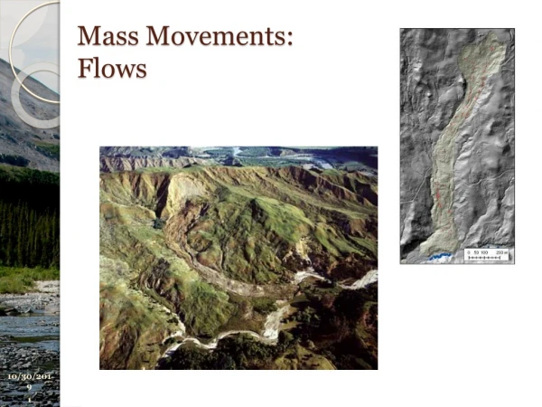
Mass Movements: Flows
Semester Schedule • 28-Oct Creep Processes • 31-Oct No Class • 4-Nov Style/Activity/Distribution • 7-Nov Type: Slides • 9-Nov FIELD TRIP • 11-Nov Type: Flow • 14-Nov Type: Topple and Rockfall • 18-Nov Causes: Earthquakes and Overloading • 21-Nov Causes: Water, Slope Angle and Glacier Thinning • 25-Nov Hazard Assessment • 28-Nov Landslide Risk • 2-Dec Landslide Risk • 5-Dec (Away?)
Classification Schemes Guthrie, 2012
For each category we will discuss • Definition • Occurrence • Relative Size/Range • Velocity of Travel • Triggering Mechanism • Effects (direct/indirect) • Mitigation Measures • Predictability • (Today we focus on definition only) Much of this information comes from: Highland, 2008
Flow Guthrie, 2012
Flow • Flows: slow to rapid movements of saturated or dry materials which advance by flowing like a viscous fluid, usually following an initial sliding movement. Some flows may be bounded by basal and marginal shear surfaces but dominant movement of the displaced material is by flowage. • Important Factors: • Degree of turbulence • Depth effects on shear/comminution/erosion • Flow Types: • Fluid Flow: distributed internal deformation • Granular Flow: • nonlinear response to grain concentration, size, boundary conds. • Grain in Fluid Flow
Flow Fluid Dry Grains Grain-in-fluid --Pulses developed Davies, et al., 2013
Flows: General Definition • A flow is a spatially continuous movement in which the surfaces of shear are short-lived, closely spaced, and usually not preserved. The component velocities in the displacing mass of a flow resemble those in a viscous liquid. Often, there is a gradation of change from slides to flows, depending on the water content, mobility, and evolution of the movement.
Debris Flows • A form of rapid mass movement in which loose soil, rock and sometimes organic matter combine with water to form a slurry that flows downslope. They have been informally and inappropriately called “mudslides” due to the large quantity of fine material that may be present in the flow. Occasionally, as a rotational or translational slide gains velocity and the internal mass loses cohesion or gains water, it may evolve into a debris flow. Dry flows can sometimes occur in cohesionless sand (sand flows). Debris flows can be deadly as they can be extremely rapid and may occur without any warning.
Debris Flows • Long runout supported by self-formed levees. David Mogk, Debris Flow, cirque wall, Sacagawea Trail
Videos: Debris Flow • Collection: list • USGS Classic: Part1, Part2, Part3 • Austria, surging df: video • Chile, Maipu, video • India, coarse snout • Experimental: • Field, full scale: video from Korea • Rotating Drum: Hsu Videos • Small Scale: video
Debris Flows • Occurrence • Debris flows occur around the world and are prevalent in steep gullies and canyons; they can be intensified when occurring on slopes or in gullies that have been denuded of vegetation due to wildfires or forest logging. They are common in volcanic areas with weak soil. • Relative size/range • These types of flows can be thin and watery or thick with sediment and debris and are usually confined to the dimensions of the steep gullies that facilitate their downward movement. Generally the movement is relatively shallow and the runout is both long and narrow, sometimes extending for kilometers in steep terrain. The debris and mud usually terminate at the base of the slopes and create fanlike, triangular deposits called debris fans, which may also be unstable.
Debris Flows • Velocity of travel • Can be rapid to extremely rapid (35 miles per hour or 56 km per hour) depending on consistency and slope angle. • Triggering mechanisms • Debris flows are commonly caused by intense surface-water flow, due to heavy precipitation or rapid snowmelt, that erodes and mobilizes loose soil or rock on steep slopes. Debris flows also commonly mobilize from other types of landslides that occur on steep slopes, are nearly saturated, and consist of a large proportion of silt- and sand-sized material. • Effects (direct/indirect) • Debris flows can be lethal because of their rapid onset, high speed of movement, and the fact that they can incorporate large boulders and other pieces of debris. They can move objects as large as houses in their downslope flow or can fill structures with a rapid accumulation of sediment and organic matter. They can affect the quality of water by depositing large amounts of silt and debris.
Debris Flows • Mitigation measures • Flows usually cannot be prevented; thus, homes should not be built in steep-walled gullies that have a history of debris flows or are otherwise susceptible due to wildfires, soil type, or other related factors. New flows can be directed away from structures by means of deflection, debris-flow basins can be built to contain flow, and warning systems can be put in place in areas where it is known at what rainfall thresholds debris flows are triggered. Evacuation, avoidance, and (or) relocation are the best methods to prevent injury and life loss. • Predictability • Maps of potential debris-flow hazards exist for some areas. Debris flows can be frequent in any area of steep slopes and heavy rainfall, either seasonally or intermittently, and especially in areas that have been recently burned or the vegetation removed by other means. Figures 13 and 14 show a schematic and an image of a debris flow.
Vargas Debris Flow Disaster, Venezuela: December 1999 Wieczorek, USGS, 2001
Wieczorek, USGS, 2001
Debris-flow damage to the city of Caraballeda, located at the base of the Cordillera de la Costan, on the north coast of Venezuela. In December 1999, this area was hit by Venezuela’s worst natural disaster of the 20th century; several days of torrential rain triggered flows of mud, boulders, water, and trees that killed as many as 30,000 people. (Photograph by L.M. Smith, Waterways Experiment Station, U.S. Army Corps of Engineers.) Wieczorek, USGS, 2001
Debris Flows Aerial view of the Magnesia Spring Canyon alluvial fan flood of July 1979, which caused over $7 million in damage, and one death
Debris Flows Joel Sternfeld’ After a Flash Flood, Rancho Mirage, California’ 1979
Lahars (Volcanic Debris Flows) • The word “lahar” is an Indonesian term. Lahars are also known as volcanic mudflows. These are flows that originate on the slopes of volcanoes and are a type of debris flow. A lahar mobilizes the loose accumulations of tephra (the airborne solids erupted from the volcano) and related debris.
Lahars (Volcanic Debris Flows) • Occurrence • Found in nearly all volcanic areas of the world. • Relative size/range • Lahars can be hundreds of square kilometers or miles in area and can become larger as they gain speed and accumulate debris as they travel downslope; or, they can be small in volume and affect limited areas of the volcano and then dissipate downslope. • Velocity of travel • Lahars can be very rapid (more than 35 miles per hour or 50 kilometers per hour) especially if they mix with a source of water such as melting snowfields or glaciers. If they are viscous and thick with debris and less water, the movement will be slow to moderately slow.
Lahars (Volcanic Debris Flows) • Triggering mechanism • Water is the primary triggering mechanism, and it can originate from crater lakes, condensation of erupted steam on volcano particles, or the melting of snow and ice at the top of high volcanoes. Some of the largest and most deadly lahars have originated from eruptions or volcanic venting which suddenly melts surrounding snow and ice and causes rapid liquefaction and flow down steep volcanic slopes at catastrophic speeds. • Effects (direct/indirect) • Effects can be extremely large and devastating, especially when triggered by a volcanic eruption and consequent rapid melting of any snow and ice—the flow can bury human settlements located on the volcano slopes. Some large flows can also dam rivers, causing flooding upstream. Subsequent breaching of these weakly cemented dams can cause catastrophic flooding downstream. This type of landslide often results in large numbers of human casualties.
Lahars (Volcanic Debris Flows) • Mitigation measures • No corrective measures are known that can be taken to prevent damage from lahars except for avoidance by not building or locating in their paths or on the slopes of volcanoes. Warning systems and subsequent evacuation work in some instances may save lives. However, warning systems require active monitoring, and a reliable evacuation method is essential. • Predictability • Susceptibility maps based on past occurrences of lahars can be constructed, as well as runout estimations of potential flows. Such maps are not readily available for most hazardous areas. Figures 15 and 16 show a schematic and an image of a lahar
Debris Avalanche • Debris avalanches are essentially large, extremely rapid, often open-slope flows formed when an unstable slope collapses and the resulting fragmented debris is rapidly transported away from the slope. In some cases, snow and ice will contribute to the movement if sufficient water is present, and the flow may become a debris flow and (or) a lahar.
Debris Avalanche • Occurrence • Occur worldwide in steep terrain environments. Also common on very steep volcanoes where they may follow drainage courses. • Relative size/range • Some large avalanches have been known to transport material blocks as large as 3 kilometers in size, several kilometers from their source. • Velocity of travel • Rapid to extremely rapid; such debris avalanches can travel close to 100 meters/sec.
Debris Avalanche • Triggering mechanism • In general, the two types of debris avalanches are those that are “cold” and those that are “hot.” A cold debris avalanche usually results from a slope becoming unstable, such as during collapse of weathered slopes in steep terrain or through the disintegration of bedrock during a slide-type landslide as it moves downslope at high velocity. At that point, the mass can then transform into a debris avalanche. A hot debris avalanche is one that results from volcanic activity including volcanic earthquakes or the injection of magma, which causes slope instability. • Effects (direct/indirect) • Debris avalanches may travel several kilometers before stopping, or they may transform into more water-rich lahars or debris flows that travel many tens of kilometers farther downstream. Such failures may inundate towns and villages and impair stream quality. They move very fast and thus may prove deadly because there is little chance for warning and response.
Debris Avalanche • Corrective measures/mitigation • Avoidance of construction in valleys on volcanoes or steep mountain slopes and real-time warning systems may lessen damages. However, warning systems may prove difficult due to the speed at which debris avalanches occur—there may not be enough time after the initiation of the event for people to evacuate. Debris avalanches cannot be stopped or prevented by engineering means because the associated triggering mechanisms are not preventable. • Predictability • If evidence of prior debris avalanches exists in an area, and if such evidence can be dated, a probabilistic recurrence period might be established. During volcanic eruptions, chances are greater for a debris avalanche to occur, so appropriate cautionary actions could be adopted. Figures 17 and 18 show a schematic and an image of a debris avalanche
Earthflow • Earthflows can occur on gentle to moderate slopes, generally in fine-grained soil, commonly clay or silt, but also in very weathered, clay-bearing bedrock. The mass in an earthflow moves as a plastic or viscous flow with strong internal deformation. Susceptible marine clay (quick clay) when disturbed is very vulnerable and may lose all shear strength with a change in its natural moisture content and suddenly liquefy, potentially destroying large areas and flowing for several kilometers. Size commonly increases through headscarp retrogression. Slides or lateral spreads may also evolve downslope into earthflows. Earthflows can range from very slow (creep) to rapid and catastrophic. Very slow flows and specialized forms of earthflow restricted to northern permafrost environments are discussed elsewhere. Wyoming DOT Timelapse movie
Earthflow • Occurrence • Earthflows occur worldwide in regions underlain by fine-grained soil or very weathered bedrock. Catastrophic rapid earthflows are common in the susceptible marine clays of the St. Lawrence Lowlands of North America, coastal Alaska and British Columbia, and in Scandinavia. • Relative (size/range) • Flows can range from small events of 100 square meters in size to large events encompassing several square kilometers in area. Earthflows in susceptible marine clays may runout for several kilometers. Depth of the failure ranges from shallow to many tens of meters. • Velocity of travel • Slow to very rapid.
Earthflow • Triggering mechanisms • Triggers include saturation of soil due to prolonged or intense rainfall or snowmelt, sudden lowering of adjacent water surfaces causing rapid drawdown of the ground-water table, stream erosion at the bottom of a slope, excavation and construction activities, excessive loading on a slope, earthquakes, or human-induced vibration. • Effects (direct/indirect) • Rapid, retrogressive earthflows in susceptible marine clay may devastate large areas of flat land lying above the slope and also may runout for considerable distances, potentially resulting in human fatalities, destruction of buildings and linear infrastructure, and damming of rivers with resultant flooding upstream and water siltation problems downstream. Slower earthflows may damage properties and sever linear infrastructure.
Earthflow • Corrective measures/mitigation • Improved drainage is an important corrective measure, as is grading of slopes and protecting the base of the slope from erosion or excavation. Shear strength of clay can be measured, and potential pressure can be monitored in suspect slopes. However, the best mitigation is to avoid development activities near such slopes. • Predictability • Evidence of past earthflows is the best indication of vulnerability. Distribution of clay likely to liquefy can in some cases be mapped and has been mapped in many parts of eastern North America. Cracks opening near the top of the slope may indicate potential failure. Figures 19 and 20 show a schematic and an image of an earthflow.
Slow Earthflow (Creep) • Creep is the informal name for a slow earthflow and consists of the imperceptibly slow, steady downward movement of slope-forming soil or rock. Movement is caused by internal shear stress sufficient to cause deformation but insufficient to cause failure. Generally, the three types of creep are: (1) seasonal, where movement is within the depth of soil affected by seasonal changes in soil moisture and temperature; (2) continuous, where shear stress continuously exceeds the strength of the material; and (3) progressive, where slopes are reaching the point of failure for other types of mass movements.
Slow Earthflow (Creep) • Occurrence • Creep is widespread around the world and is probably the most common type of landslide, often preceding more rapid and damaging types of landslides. Solifluction, a specialized form of creep common to permafrost environments, occurs in the upper layer of ice-rich, fine-grained soils during the annual thaw of this layer. • Relative size/range • Creep can be very regional in nature (tens of square kilometers) or simply confined to small areas. It is difficult to discern the boundaries of creep since the event itself is so slow and surface features representing perceptible deformation may be lacking. • Velocity of travel • Very slow to extremely slow. Usually less than 1 meter (0.3 foot) per decade.
Slow Earthflow (Creep) • Triggering mechanism • For seasonal creep, rainfall and snowmelt are typical triggers, whereas for other types of creep there could be numerous causes, such as chemical or physical weathering, leaking pipes, poor drainage, destabilizing types of construction, and so on. • Effects • Because it is hard to detect in some places because of the slowness of movement, creep is sometimes not recognized when assessing the suitability of a building site. Creep can slowly pull apart pipelines, buildings, highways, fences, and so forth, and can lead to more drastic ground failures that are more destructive and faster moving.
Slow Earthflow (Creep) • Corrective measures/mitigation • The most common mitigation for creep is to ensure proper drainage of water, especially for the seasonal type of creep. Slope modification such as flattening or removing all or part of the landslide mass, can be attempted, as well as the construction of retaining walls. • Predictability • Indicated by curved tree trunks, bent fences and (or) retaining walls, tilted poles or fences, and small soil ripples or ridges on the surface. Rates of creep can be measured by inclinometers installed in boreholes or by detailed surface measurements. Figures 21 and 22 show a schematic and an image of creep.
Flows in Permafrost • Failures in permafrost conditions involve the movement of fine-grained, previously ice-rich soil and can occur on gentle slopes. Seasonal thaw of the upper meter of frozen ground melts ground ice and results in oversaturation of the soil, which in turn loses shear strength and initiates flows. Solifluction, a form of cold environment creep, involves very slow deformation of the surface and forms shallow lobes elongated downslope. Active layer detachments, also known as skinflows, involve rapid flow of a shallow layer of saturated soil and vegetation, forming long, narrow flows moving on the surface but over the underlying permanently frozen soil. This type of movement may expose buried ice lenses, which when thawed may develop into retrogressive thaw flows or possibly debris flows. Retrogressive thaw flows are larger features with a bimodal shape of a steep headwall and low-angle tongue of saturated soil. This type of feature will continue to expand through headscarp retrogression until displaced vegetation buries and insulates the ice-rich scarp.


