Funding
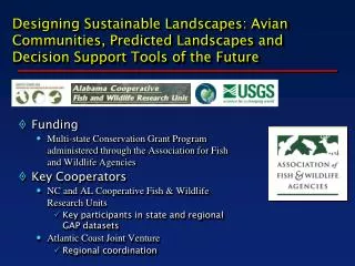
Designing Sustainable Landscapes: Avian Communities, Predicted Landscapes and Decision Support Tools of the Future. Funding Multi-state Conservation Grant Program administered through the Association for Fish and Wildlife Agencies Key Cooperators

Funding
E N D
Presentation Transcript
Designing Sustainable Landscapes: Avian Communities, Predicted Landscapes and Decision Support Tools of the Future • Funding • Multi-state Conservation Grant Program administered through the Association for Fish and Wildlife Agencies • Key Cooperators • NC and AL Cooperative Fish & Wildlife Research Units • Key participants in state and regional GAP datasets • Atlantic Coast Joint Venture • Regional coordination
Project Objectives • Assess the current capability of habitats in ecoregions in the eastern United States to sustain bird populations • Predict the impacts of landscape-level changes (e.g., from urban growth, conservation programs, climate change) on the future capability of these habitats to support bird populations • Target conservation programs to effectively and efficiently achieve objectives in State Wildlife Action Plans and bird conservation plans and evaluate progress under these plans • Enhance coordination among partners during the planning, implementation and evaluation of habitat conservation through conservation design
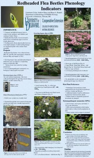
Project extended to summer 2011 Land Cover maps updated for SAMBI 42 species modeled Models run on 3 climate projections up to year 2100 Models sent to Auburn to develop priority surfaces for each habitat type Updates
Multiple habitats 12 major habitats w/surrogate species Develop models for conflict resolution Complex, dynamic landscape Urban growth Climate change Succession Product(s) Map of highest priority areas for each habitat type in each scenario (GCM model, conservation action) Combined priorities across all habitat types Vision for Final Product(s)
Northern Bobwhite 2000 – a2 2050 – a2
Open Pine 2000 – a2 2050 – a2
Forested WetlandHabitat 2000 – a2 2050 – a2
Funding from SALCC Expanded to Piedmont Identify policies for analysis (May) Build in Occupancy Next steps