Download

1 / 43
440 likes | 582 Views
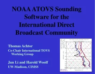
NOAA ATOVS Sounding Software for the International Direct Broadcast Community. Thomas Achtor Co-Chair International TOVS Working Group Jun Li and Harold Woolf UW-Madison, CIMSS. International TOVS Working Group (ITWG) Activities. ITWG

E N D
NOAA ATOVS Sounding Software for the International Direct Broadcast Community Thomas Achtor Co-Chair International TOVS Working Group Jun Li and Harold Woolf UW-Madison, CIMSS
International TOVS Working Group (ITWG) Activities • ITWG • Is a sub group of the Radiation Commission within the International Association of Meteorology and Atmospheric Physics (IAMAP) • Serves as an International Forum for Operational and Research users of (A)TOVS and other Sounder data to exchange information and ideas and optimal use of satellite sounder data
International TOVS Working Group (ITWG) Activities • ITWG (continued) • Holds the International (A)TOVS Study Conferences every 18 months • Provides recommendations to guide the directions of future research and to influence relevant programs of WMO and other agencies (NOAA/NESDIS, NASA, EUMETSAT, JMA, CMA)
International TOVS Working Group (ITWG) Activities • ITWG (continued) • Through collaborations, develops and distributes software packages for use with Direct Broadcast radiance data • ITPP • 3I • AAPP • IAPP • ICI
IAPPInternational ATOVSProcessing Packagev2.01 Atmospheric Variable Retrieval Software for Direct Readout from the UW-CIMSS
IAPP Retrieval • Developed for Direct Readout and 1-B data • AAPP Pre-processing (from Eumetsat) • Uses HIRS/3 and AMSU-A and -B radiances as input • AMSU is remapped to HIRS/3 FOV • 3 x 3, 2 x 2, or 1 x 1 fov can be used for retrieval • NetCDF output file
IAPP Retrieval • Cloud Detection and Removal • Bias Adjustment • Regression Retrieval • Non-linear, Iterative, Physical Retrieval (Li, et al, 1999, 2000)
IAPP Retrieval Output • Atmospheric temperature and water vapor mixing ratio profiles • O3, TPWV, BLVW • Tsk, MW sfc emissivity • HIRS/3 clear column radiances • NESDIS AMSU-A climate products
IAPP ATOVS 500 hPa Temperature Retrievals with Radiosondes
AMSU-A 55.5 GHz Channel Hurricane Bonnie, August 25, 1998
AMSU Temperature Retrieval Anomaly Cross Section at 29 latitude, August 28, 1998
IAPP Contacts • Tom Achtor (acquisition, questions) • tom.achtor@ssec.wisc.edu • Jun Li (retrieval science) • jun.li@ssec.wisc.edu • Hal Woolf (IAPP design, setup) • hal.woolf@ssec.wisc.edu • http://cimss.ssec.wisc.edu/iapp
Software Packages for Direct Broadcast Data Processing: IMAPP and Future Packages for NPP/NPOESS H-L Allen Huang CIMSS/SSEC, University of Wisconsin-Madison Satellite Direct Readout Conference for the Americas Miami, Florida 9-13 December 2002 Topics: X-band System Receiving Capability International MODIS & AIRS Processing Package - IMAPP MODIS/AIRS Level 1 & 2 Products Level 2 Processing Algorithms Processing Packages for NPP & NPOESS
UW-Madison X-band Receiving Capability Terra Aqua X-band Antenna MODIS Coverage AIRS
0.66-Red 0.87-Green 11.0-Blue 0.66-Red 0.55-Green 0.45-Blue
Cloud Mask Product: December 12, 2000 Snow Cirrus 1.38 m reflectance White: Cloud, Green: Clear 0.66 m reflectance This complex scene over the US plains states includes snow cover at the top of the image and a mix of high and low clouds elsewhere in the image. Note the thin cirrus cloud detected only in the 1.38 m channel. The cloud mask successfully discriminates clear sky from snow in this challenging case.
Total Precipitable Water Product: June 2, 2001 MODIS 0.87 m MODIS TPW
Hurricane Lili, 2 October 2002 Terra MODIS direct broadcast MODIS true color image MODIS total precipitable water vapor TPW (mm):
Pressure (hPa) oK Temperature Isobaric Surfaces/Profiles of Temperature 13 October 2002 Terra MODIS direct broadcast 300 hPa 500 hPa 850 hPa true color image
Pressure (hPa) Mixing Ratio (g/kg) Isobaric Surfaces/Profiles of Moisture 13 October 2002 Terra MODIS direct broadcast 300 hPa 500 hPa 850 hPa true color image
IMAPP MODIS Products MODIS L1B True Color (R: .67 m, G: .55 m , B: .46 m ) Cloud Mask Cloud Top Pressure Low Mid High Cloud Phase Total Precipitable Water (mm)
Global Community IMAPP Applications Real-time IMAPP products placed on the web and used by the USA National Weather Service as a forecasting tool. (http://wwwghcc.msfc.nasa.gov/sport/modis_products.html)
Global Community IMAPP Applications Scientists at the Plymouth Marine Laboratory in the UK are using IMAPP to provide cloud information as part of the CLOUDMAP 2 project (18 September 2002)
Global AIRS Spectra: July 20, 2002 20-July-2002 Ascending LW_Window
Global AIRS Spectral Day/Night & Boundary Layer Temperature Inversion Land-inversion;clear CR1 Sunglint-desert; clear CR4 Water-inversion;clear CR2 Sunglint-desert; clear CR5 CR3 Sunglint-desert; clear CR6 Land-inversion;clear
Global AIRS Spectral Cloud, Cold Surface, & Upper Level/Boundary Layer Temperature Inversion Cloud;Day - Desert Cloud;Day - Water CD4 CD1 Snow/Ice- Inversion/South Pole Cloud;Day - Land CD2 CD5 Cloud-Inversion/South Pole Cloud;Night - Inversion CD6 CD3
Global AIRS Spectral Cloud & Upper Level Temperature Inversion CD10 Cloud;Night - Inversion Cloud;Night - Inversion CD7 Cloud;Day - Inversion CD11 Cloud;Night - Inversion CD8 CD12 CD9
IMAPP software was created with these requirements: • Portability - IMAPP software has been ported and tested on the following UNIX/PC platforms: • SGI MIPS, IRIX 6.5, Sun Ultra, SunOS 5.7, • IBM RS/6000, AIX 4.3, HP PA-RISC, HP-UX B.10.20, • Intel Pentium Linux 2.2.12-20, Solarisx86 2.5.1 • Easy to install and use: • NCSA HDF4 is the only required toolkit • Required ancillary data available from anonymous ftp site: ftp://terra.ssec.wisc.edu/pub/terra/ancillary • Overpasses of arbitrary size can be processed • MODIS science data products must work using both DAAC • L1B radiances and direct broadcast L1B radiances as input • Compatibility with DAAC operational versions
MODIS IMAPP • Funded by NASA (Dr. Jim Dodge) • Fosters international compatibility and ease of use of the data • Consists of software to turn direct broadcast MODIS and • eventually AIRS data into useful science products. The current • suite of MODIS products consists of: • Calibrated, navigated 36 channel radiances (L1B) • Cloud Mask (MOD35) • Cloud Top Properties (MOD06) • Cloud top temperature/ height/emissivity/fraction • Cloud Phase (MOD06) • Atmospheric Profiles (MOD07): • Vertical profiles of temperature and moisture at 20 levels • Total precipitable water, Precipitable water low/high • Total column ozone • Stability parameters (Lifted Index, K-Index, Total totals) • Software is freely distributed and available via download from: • http://cimss.ssec.wisc.edu/~gumley/IMAPP/
IMAPP has been successful in providing a portable software package for converting direct broadcast MODIS data into valuable science products • CIMSS IMAPP automated processing applications: • MODIS L1B and science product validation • Testing of MODIS algorithm product changes • Quick look display for identifying regions of spectral or meteorological interest • Real-time support for field experiments • Known global community MODIS IMAPP applications: • MODIS calibration validation over Lake Tahoe, USA • Providing USA Weather Service forecasters with real-time high spatial resolution imagery and products • Aiding the Canadian Ice Service in monitoring the amount of ice on Hudson Bay for shipping concerns • Supplying cloud information from IMAPP as part of the European CLOUDMAP 2 project
Aqua AIRS & MODIS Retrieval Examples July 20, 2002, 19:15-19:20 UTC AIRS @ ~14 km (Nadir) MODIS @ ~1km (Nadir)
AIRS/MODIS Co-location Example Scan Angle = 49 Nadir Scan Angle = 23.7
Past, Current and Future International Polar Orbiting Satellite Processing Package MODIS AIRS AMSU NPP/NPOESS CrIS VIIRS ATMS CMIS OMPS Others IMAPP INPP IAPP ITPP ATOVS TOVS ITPP-International TOVS PP IAPP-International ATOVS PP IMAPP-International MODIS/AIRS PP INPP-International NPP/NPOESS PP
Current and Future International Polar Orbiting Satellite Processing Package - Summary • CIMSS/UW will continue to work with government, academic, & industry partners to support package development: • Leveraging with past & current research & operational data processing and algorithm development capability • Adopting/adapting algorithms for efficient and accurate level 0 to level 1 data and level 1 to level 2 products demonstration • Provide synergistic data & products processing options • Provide regional products to support real-time applications • Provide students, teachers, & researchers with hand-on data processing, algorithm development, and product application educational opportunity
Countries using MODIS IMAPP Let us know if you are using IMAPP but we don’t know yet! http://cimss.ssec.wisc.edu/~gumley/IMAPP/