Coastal Hazards Collaboratory: River/Watershed Flood Modeling Strategies
Explore cutting-edge river and watershed flood modeling strategies in this collaborative research project focusing on Northern Gulf coastal hazards. Discover shared, distributed reference models, data, and tools aimed at enhancing coastal hazard management. The project also aims to establish a regional-scale collaboratory with access to common tools and services for effective environmental management.

Coastal Hazards Collaboratory: River/Watershed Flood Modeling Strategies
E N D
Presentation Transcript
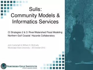
Sulis:Community Models & Informatics Services CI Strategies 2 & 3: River/Watershed Flood Modeling Northern Gulf Coastal Hazards Collaboratory John Cartwright & William H. McAnally Mississippi State University – 25 October 2012
Atmospheric Tools • Data • Weather Radar • Topo/Bathymetry • Land Use/Cover • River Discharge • NEON DB • NDDC/BASINS • Resource Mgmt Hydrologic Models Landscape Tools Surge Models Stream & Estuary Models Ecosystem Models
River/Watershed Flood Modeling Goals: • Shared, distributed, reference models, data & tools for coastal hazards (CI2) • Data network - catchment to the coast flooding hazards. (CI2) • Regional-scale collaboratory with access to common tools and services (CI3 & 4) • Support E&O (CI5) Approach: • Existing Sulis Models Catalog (CI2) • Sulis Informatics Services (CI3)
Sulis Components CI Strategy 2 CI Strategy 3
Sulis Informatics Services Metadata: • Metadata Creator (Beta) • Sulis Data Portal • Registered Users • Register a Network Resource • MERMAiD (NOAA) • All provide XML format • Uploaded to Sulis Portal or NGCHC Portal
Block diagram of Mobile Bay use case ADCIRC data sets LSU Data storage Inference 2D GIS 3D vis Sulis Informatics Flood Modeling E&O DISL & JSU MSU Rainfall & ET data sets UAT/NEON Rainfall/runoff (HSPF) Model Connectivity Flooding (EFDC) Surge (ADCIRC)
Sulis Informatics Services Inference Engine: Connecting & Filling Model Gaps • Methods • Support Vector Regression • Multivariate Spline Regression • Linear Regression • Tested On: • EFDC model data from Mobile Bay. • ADCIRC model data from eastern U.S. coast. • EFDC model data from Fish River, Mobile Bay
Sulis Informatics Services – Weeks Bay Flood Flood Tide Tide
Sulis Informatics Services Data Discovery: • ESRI Geoportal • OpenSource • Customized for complex model data sets • NetCDF • Quickly search and review data details • Visualize static and dynamic data layers • EnVis