Download
1 / 15
180 likes | 332 Views
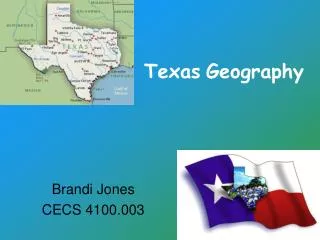
Texas Geography. So how big is Texas. Second largest state New York, Pennsylvania, Ohio, Illinois, Connecticut, Rhode Island, Massachusetts, Vermont, New Hampshire, New Jersey, and Maine Can all fit inside Texas combined El Paso is closer to the Pacific Ocean than it is to Houston.

E N D
So how big is Texas • Second largest state • New York, Pennsylvania, Ohio, Illinois, Connecticut, Rhode Island, Massachusetts, Vermont, New Hampshire, New Jersey, and Maine • Can all fit inside Texas combined • El Paso is closer to the Pacific Ocean than it is to Houston
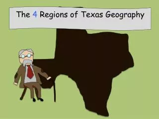
Four Regions of Texas • Great Plains • Panhandle and central • Central Plains • North central • Coastal Plains • Eastern to Southern • Mountains and Basins • Extreme western
Viewing Texas • Southern Texas is plains • Gentle rolling hills • Padre Island; barrier island for the state • Central Texas is the “Hill Country” • Balcones Escarpment-long cliff • Northwest Texas is the “High Plains” • Caprock Escarpment • West Texas is a mountain range • Guadalupe peak
Southern Texas Plains Galveston Texas
Texas Hill Country • Splendora Texas
Northwest Texas “High Plains” • Amarillo Texas
West Texas Mountain Range • Guadalupe Peak
Texas Water Resources • Gulf of Mexico • Nurseries for fish, shrimp, oysters, crabs, birds
Texas Water Resources • Rio Grande River • Forms most of Texas southern boundary • 2,000 miles long
Texas Water Resources • All 200 lakes in Texas are dammed rivers • Only Caddo Lake began as a natural lake • Most lakes are built for flood control and water conservation • Some used for irrigation, manufacturing, and cities
Texas Water Resources • Edwards Aquifer • Located in the hill country • Fills up with rain and turns into springs • Most of central Texas’ water supply • Ogallala Aquifer (oh-gah-LAH-lah) • Located in the panhandle • Irrigates more than 5 million acres
Different Types of Vegetation • Texas has 3 types of vegetation regions • forests, savannas, and grasslands • Allows for different types of farming • Cotton, watermelons, spinach, wheat, rice, corn, soybeans, and peanuts • Land not used for farming is used for ranching • We lead the nation in cattle, sheep, and goats ranching
Energy Production • Main minerals • Petroleum, gas, coal, sand, and gravel • Also a big producer of: • Limestone, granite, salt, and coal
Climate • The middle latitudes are a meeting place for cool air moving from the north and moist warm air from the Gulf of Mexico • Makes Texas weather unpredictable • Mild winters, with an occasional norther • A norther is a sudden blast of Canadian air • Thunderstorms, lightening, hail • Also allows for hurricanes to hit occasionally • Mountain ranges allow for snowfall