Download

1 / 11
151 likes | 403 Views
INTRODUCTION TO REMOTE SENSING. Remote sensing is the science and art of obtaining information about an object, area, or phenomenon through the analysis of data acquired by a device that is not in contact with the object, area or phenomenon under investigation. . Electro Magnetic Radiation.

E N D
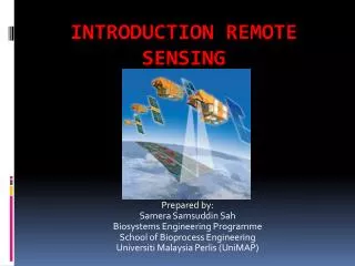
INTRODUCTION TO REMOTE SENSING
Remote sensingis the science and art of obtaining information about an object, area, or phenomenon through the analysis of data acquired by a device that is not in contact with the object, area or phenomenon under investigation.
Electro Magnetic Radiation Q = h f = h c/ (The energy of a quantum) M = T4 (Stefan-Boltzman law) m = A/T (Wien’s displacement law )
Atmospheric Influences Absorption Scattering Rayleigh scatter Mie scatter Nonselective scatter
Image Acquisition Photographic Sensors Digital Data Earth Resource Satellites
Image Resolution Spatial resolution Spectral resolution Radiometric resolution Temporal resolution
Image Interpretation Shape Size Pattern Tone (Hue) Texture Shadows Site Association
Applications Land Use/Land Cover Mapping Geologic and Soil Mapping Agricultural Applications Forestry Applications Rangeland Applications Urban and Regional Planning Applications Wetland Mapping Wildlife Ecology Applications Archaeological applications Environmental Assessment Oil Exploration Mineral Exploration Landforms Identification and Evaluation Water Resource Applications etc.
Conclusions A picture is worth a thousand words, because pictures concisely convey information about positions, size, and interrelationships between objects. The basic advantages of images over the ground observation are i) Improved vantage point, ii) Capability to stop action, iii) Permanent recording, iv) Broadened spectral sensitivity, v) Increased spatial resolution and geometric fidelity, vi) providing data for inaccessible regions etc. Remote sensing will continue to play an increasingly broad and important role in natural resources management. The technical capabilities of sensors, space platforms, data communication systems, GPSs, digital image processing systems, and GISs are improving on almost a daily basis. At the same time, we are witnessing an evolution of various remote sensing procedures from being purely research activities to being commercially available services. Most importantly, we are becoming increasingly aware of how interrelated and fragile the elements of our global resource base really are and of the role remote sensing can play in inventorying, monitoring, and managing earth resources and in modeling and helping us understand the global ecosystem.