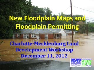
Understanding Flood Zones and Insurance in Osceola County: A Comprehensive Guide
The Osceola County Floodplain Program emphasizes the importance of understanding flood zones and the necessity of flood insurance. Over 48% of the county is within high-risk flood zones (A, AE, Floodway), affecting homeowners and real estate transactions. Homeowners insurance typically does not cover floods, making flood insurance essential, particularly in high-risk areas. This guide provides insights on flood zone designations, risk assessments, and tips for homeowners, with resources to navigate flood insurance requirements and mapping updates.

Understanding Flood Zones and Insurance in Osceola County: A Comprehensive Guide
E N D
Presentation Transcript
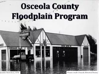
Osceola CountyFloodplain Program Picture credit: Osceola Historical Society Jennifer Nicholson, CFM
National Flood Insurance Program (NFIP) through FEMA • Act of 1968 • Federal program to purchase flood insurance • Over 20,000 communities participate nationwide
Flood Insurance Facts: • Home owners insurance does not cover flood • Flood Insurance is Federal • Available to participating jurisdictions • FEMA does not drop policy's • Rates are set by FEMA • Can be purchased through FEMA or FEMA agreements with private companies (WYO’s) • Can be Mandatory
Flood Zones: A Flood Zone is an area established on the Flood Hazard Maps with a designated risk attached to it Everyone lives in a flood zone Flood zones in Osceola: A, AE, Floodway X and X shaded
How to read a Flood Map? Low – and moderaterisk zones are represented on the maps by the letter “X” or an “X” that is shaded. The high-riskzones will be labeled with designations such as “A” or “AE”.
Flood Map: Low Risk Area – X zone High Risk Area – A zone High Risk Area – AE Zone
Flood Zone Definition The low- and moderate-riskhas the potential for flooding and flood insurance is recommended but not required . The high-riskzones has high potential of flooding and flood insurance may be required.
A , AE and Floodway: High risk and requires flood policy's with a mortgage. • A – High risk no base flood elevation • AE – High risk with a base flood elevation • Floodway – Federally protected, highvelocity of water and has a base flood elevation
Floodway: Considered to be a rather dangerous and no construction or fill is allowed in this area unless a variance is submitted . If a home is mapped in a floodway; residents can continue to live there. Restrictions in the floodway…
Helpful Documents: Floodplain Determination Letter Aerial with floodplain overlay Elevation Certificates Letter of Map Revisions
48% of Osceola County is zoned in a High Risk Flood Zone. All of the Orange is High Risk!
How is the Risk Determined? A Flood study and maps made by FEMA determine each areas risk percentage, which places homes in a flood zone. Current maps were created in 2001. Changes are here!
Why new flood hazard maps? Important tools in the effort to protect lives and properties. Current maps out of date. New technology will provide more detailed and reliable information. Digital maps.
Timeline: 2001 - Current maps 2009 - FEMA began studying for new maps August 2011 - preliminary maps are released 2011- Outreach May 2011 - 40 protests are 1 appeal submitted to FEMA ??- Map adoption
Osceola County’s Changes: Over 10,000 properties affected Flood zones changed Base flood elevations determined and revised
New Maps = New Challenges Building regulations New floodway’s Mandatory flood insurance Flood elevation changes Flood Damage Prevention Ordinance and Building Code Real Estate
FOR SALE IN FLOOD ZONE ? What flood zone is this? LOW RISK Affect on home sales? How do we find out what flood zone a property is in and what flood zone a property is proposed to be in? www.osceola.org/go/floodplain GIS Maps – FEMA Floodplain OR call the County
Grandfathering Policy: Available if a property is going from low-risk to high-risk. $aving$ Purchase flood voluntary pre-map adoption: Preferred Risk Policy = additional savings for the first 2 years Does not apply to all changes www.floodsmart.org
#1 call we get~ “I am closing on my house today and I was told the house in the floodplain; can you help me, asap? “ Do not wait till closing to find out the property is in a floodplain and insurance will be required. This may end up costing the client a lot more money $$$.
#2 call we get ~ “Is my property in the floodplain and how can you help me” Good! We are happy to help any way we can although there is usually a fee for this. The County is the only repository for certain documents. We want to help.
Message: Stay informed and keep clients informed. Never use an inadequate data base. Use City, County or FEMA. There is usually more to the story. Find out flood info pre-closing date. Osceola floods, the risk is real.
FEMA RATES US • Community Rating = • Reduces flood insurance premiums by 15% • Flood policy direct savings $350,000 annually
How to get covered. Calling an insurance agent Or Calling FEMA to obtain a policy. # 1-888-379-9531
Resources Osceola County Floodplain Coordinator: Jennifer Nicholson , CFM 407-742-8653 City of Kissimmee Floodplain Coordinator: Larry Clough, P.E. , CFM 407-518-2385 City of St. Cloud Floodplain Coordinator: Kevin Felblinger, P.E., CFM 407-957-7283 For more information on the Floodplain Program, please visit: www.osceola.org www.FEMA.gov www.floodsmart.gov