Borders and Powers
Borders and Powers. Vocabulary. Complete the circle maps on the front page of your notes packet. The dictionary definition of the words are on the following slide. . Political power – power to control or force behavior. Political region – area that a government controls.

Borders and Powers
E N D
Presentation Transcript
Vocabulary • Complete the circle maps on the front page of your notes packet. The dictionary definition of the words are on the following slide.
Political power – power to control or force behavior. • Political region – area that a government controls. • Borders – boundaries between the countries.
Levels of Government • Each country usually has several levels of government such as cities, counties, states (provinces). • This creates overlapping governments. • For example…In Houston, Texas citizens belong to • The city government • The county government – Harris County • The state government • The national government • Which government trumps all the others? • National Government
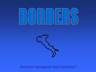
BORDERS • Sovereign government – is not subject to any higher governmental authority. • Who decides where the borders are for each country? • Physical features are the first step • But boundaries are often the product of historical circumstances or political agreements.
United States Boundaries • Eastern border – set by geography…the Atlantic Ocean. • Western border continually shifted . • On your map in your notes color it the following way. • • Color the Original 13 States – RED • • Color the United States addition due to the Treaty of Paris in 1783 – Blue • • Color the Louisiana Purchase in which they bought Louisiana from France – Yellow • • Color the Florida Cession in which the United States bought Florida from Spain –Green • • Color the territory ceded by Great Britain – Orange • • Color the Annexation of Texas – PURPLE • • Color the Oregon Territory – Brown • • Color the territories gained in the Mexican Cession – Pink • Color the territories gained in the Webster- Ashburton Treaty – Black • Color the Gadsden Purchase of 1853 - Teal
MEXICO • Between 1800 and 300 BCE Mexico was home to several Mesoamerican civilizations • Olmecs • Teotihuacans • Mayas • Toltecs • Aztecs • In the early 1500s Hernan Cortes, a Spanish explorer, led a small army of conquistadors to conquer the ruling Aztec civilization. • The territory was named New Spain. • It was colonized and became a part of the Spanish Empire.
MEXICO • 1821 – Mexico received its independence from Spain • Texas broke free from Mexico in 1836. • 1846 – Border dispute between the United States and Mexico led to war and Mexico surrendered nearly half of its land to the United States, including California and New Mexico. • 1854 – United States purchased parts of Arizona and New Mexico, known as the Gadsden Purchase.
Europe • Some countries lack good natural borders. • Historical events have changed the borders and names of some countries. • World War I and II • Franco-Prussian War