Introduction to GPS Data Communications-- NMEA and RTCM
270 likes | 948 Views
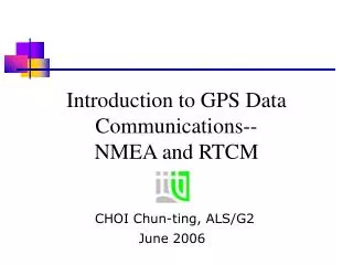
Introduction to GPS Data Communications-- NMEA and RTCM . CHOI Chun-ting, ALS/G2. June 2006. Overview . RINEX Raw GPS static data format for data processing and archive NMEA Standard related to data communication between marine electronics devices.

Introduction to GPS Data Communications-- NMEA and RTCM
E N D
Presentation Transcript
Introduction to GPS Data Communications-- NMEA and RTCM CHOI Chun-ting, ALS/G2 June2006
Overview • RINEX • Raw GPS static data format for data processing and archive • NMEA • Standard related to data communication between marine electronics devices. • Transmission of GPS position from GPS receiver to other devices (e.g. GPS receiver to PDA) • For real time positioning • RTCM SC-104 • Transmission of GPS correction from GPS reference station to GPS Rover • For DGPS/RTK surveys
(National Marine Electronics Association) NMEA Data Format
Outline • Example of using NMEA Data Format • About NMEA • Message Format and Sentence Structure • Common NMEA Messages
NMEA using in real-time navigation Real-time positioning Surveyed position NMEA data format GPS receiver ArcPAD software
National Marine Electronics Association • Developed by National Marine Electronics Association • Standard related to the marine electronics devices (GPS, echosounder, …) • Standard specifies the message formats for data transmission between marine electronics devices
What is NMEA ? • NMEA data format contains many various message types • Not all messages related to GPS application. • Even GPS-related messages, there are over 20 various types. • For a GPS survey, only some messages are selected.
Standard Message Format • $aaaaa, df1,df2………[Carriage Return][Line Feed] • Each message start with $ • Five characters after $ are address field • Multiple data fields delimited by commas • Up to 82 characters per each sentence
Sentence structure • There are three sentence structures • Talker: data from GPS receiver to other devices. • Query: “receive” device (e.g. notebook) send query sentence to GPS receiver for specified messages. • Proprietary: non-standard sentence developed by GPS manufacturers for special purposes.
Talker sentence • Format: $ttsss, df1, df2…[CR][LF] • tt: defines device (GPS receivers the prefix is GP) • sss: message type Example $GPGGA,031956,2218.2035,N,11410.7595,E,1,04,3,9,005.9,M,-001.3,M,,*51 • The GPS receiver sends the data in GGA sentence format.
Common NMEA Messages Position Data Messages $GPGGA: Global positioning system fixed data $GPGLL: Geographic position - latitude / longitude $GPRMC: Recommended minimum specific GPS data Associated Data Messages $GPGSA: GNSS DOP and active satellites $GPGSV: GNSS satellites in view $GPVTG: Course over ground and ground speed .
GGA Message Format $GPGGA,092204.999,4250.5589,S,14718.5084,E,1,04,24.4,19.7,M,,,,0000*1F Field Example Comments Message ID $GPGGA UTC Time 092204.999 hhmmss.sss Latitude 4250.5589 ddmm.mmmm N/S Indicator S N = North, S = South Longitude 14718.5084 dddmm.mmmm E/W Indicator E E = East, W = West Position Fix 1 0 = Invalid, 1 = Valid SPS, 2 = Valid DGPS, 3 = Valid PPS Satellites Used 04 Satellites being used HDOP 24.4 Horizontal dilution of precision Altitude 19.7 Altitude (WGS-84 ellipsoid) Altitude Units M M= Meters Geoid Separation Geoid separation Separation Units M= Meters Time since DGPS in seconds DGPS Station ID Checksum *1F always begin with *
GSV Message Format(satellite in view) $GPGSV,3,1,10,20,78,331,45,01,59,235,47,22,41,069,,13,32,252,45*70 Field Example Comments Sentence ID $GPGSV No. of sentence 3 No. of messages in complete (1-3) Sequence no. 1 Sequence no. of this entry (1-3) Satellites in view 10 Satellite ID 1 20 Range is 1-32 Elevation 1 78 Elevation in degrees Azimuth 1 331 Azimuth in degrees SNR 1 45 Signal to noise ratio dBHZ (0-99) Satellite ID 2 01 Range is 1-32 Elevation 2 59 Elevation in degrees Azimuth 2 235 Azimuth in degrees . . Checksum *70
First epoch Second epoch Sample NMEA data file(output GGA, GSA, GSV and RMC messages)
References • The National Marine Electronics Association http://www.nmea.org/ • Common NMEA Sentence types http://www.commlinx.com.au/NMEA_sentences.htm • NMEA Data Format http://www.gpsinformation.org/dale/nmea.htm