Global Positioning Systems
Global Positioning Systems. Glen T. Huettl Agricultural Education Garrison High School. Global Positioning System (GPS). Navigation and Positioning System Determines Exact Location Establishes Longitude, Latitude, Altitude. GPS Components. Satellites in Space Send Signals


Global Positioning Systems
E N D
Presentation Transcript
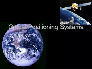
Global Positioning Systems Glen T. Huettl Agricultural Education Garrison High School
Global Positioning System (GPS) • Navigation and Positioning System • Determines Exact Location • Establishes Longitude, Latitude, Altitude
GPS Components • Satellites in Space Send Signals • Receivers on the earth Receive the Signals • Software Converts Satellite Signals • Position Monitoring Equipment Validate Satellite Location
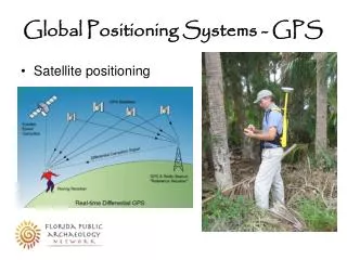
How GPS Works • Receivers calculate position by reading 3 or more satellite signals • Called “Triangulation” • Theory used before GPS to locate earthquakes
GPS Developed By: • U.S. Department of Defense • Available for both Civilian and Military Uses • Available 365 days a year
Commerical Applications • Emergency Vehicles • Electronic Maps in Cars • Aircraft Landing Systems • Delivery Vehicles • Sea Navigation
History of GPS • Developed by Department of Defense for Security Purposes • Previous navigational and positional methods were not exact • GPS is answer to age-old problem
Satellites • NAVSTAR (Navigation Satellite Timing and Ranging) • 24 Satellites • Circle the earth every 12 hours • 4 - 10 Satellites visible from any location in the earth at any time • Send radio signals
Satellites (cont’d) • Act as Reference Points • Position known and precisely measured • Control Segment continually monitor accuracy of signal • Atomic Clocks provide timing accuracy
The Satellite Signal • Information sent is 1) Time stamp of when signal sent and 2) Satellite position • Complicated digital codes referred to as “Pseudo-Random” Code • Radio signals transmit two L-Band frequencies: L1 and L2
Receiver • Small hand-held computers • Attach to an Antenna that receives satellite signals • Uses integrated circuit technology • Costs vary from $200 to several $1000’s • Affordable to a wide audience
The Receiver Calculates Position • Travel time of signals plus high powered math calculates position • Speed of Light X Time = Distance • Converts signals sent from 3 to 4 satellites • Intersecting point of three measurements gives positional reading (“Triangulation”)
Control Segment • Monitor Satellite Signal for Accuracy • Located around the world • Satellites pass over monitors every 12 hours • Measure signals and correct positional errors
Error Sources • Selective Availability • Particles in the Ionosphere • Atomic Clocks • Speed of Light Calculations • Multipath Errors • Receiver Errors
Error Correction Methods • Control Segment Error Correction • Differential Global Positioning System (DGPS)
DGPS • More advanced form of GPS • Offers more Accuracy • DGPS adds correctional signal to GPS signals • Uses a reference station to broadcast corrections to receivers
DGPS (cont’d) • Cancels out natural and man-made errors • Makes GPS positioning very precise • Broadens GPS applications because of accuracy of Differential signal.
DGPS Uses • Coast Guard • Natural Resource Management • Forest Service • Offshore Exploration • Agricultural Uses
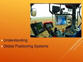
Commercial USES • Yield Monitors • Variable Rate Technology • Field Mapping and Acreage Management • Noting Underground Locations
WAAS Wide Area Augmentation System • Government supplied correction • Approx 25 land based stations