SECOND VIVEKANANDA BRIDGE TOLLWAY
20 likes | 199 Views
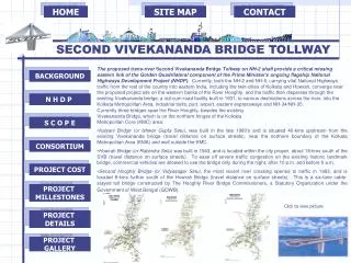
HOME. SITE MAP. CONTACT. BACKGROUND. N H D P. S C O P E. CONSORTIUM. PROJECT COST. PROJECT MILLESTONES. PROJECT DETAILS. PROJECT GALLERY. SECOND VIVEKANANDA BRIDGE TOLLWAY.

SECOND VIVEKANANDA BRIDGE TOLLWAY
E N D
Presentation Transcript
HOME SITE MAP CONTACT BACKGROUND N H D P S C O P E CONSORTIUM PROJECT COST PROJECT MILLESTONES PROJECT DETAILS PROJECT GALLERY SECOND VIVEKANANDA BRIDGE TOLLWAY • The proposed trans-river Second Vivekananda Bridge Tollway on NH-2 shall provide a critical missing eastern link of the Golden Quadrilateral component of the Prime Minister's ongoing flagship National Highways Development Project (NHDP).Currently, both the NH-2 and NH-6, carrying vital National Highways traffic from the rest of the country into eastern India, including the twin-cities of Kolkata and Howrah, converge near the proposed project site on the western banks of the River Hooghly, and the traffic then disperses through the existing Vivekananda bridge, a rail-cum-road facility built in 1931, to various destinations across the river, into the Kolkata Metropolitan Area, industrial belts, port, airport, eastern expressways and NH-34/NH-35. • Currently three bridges span the River Hooghly, besides the existing • Vivekananda Bridge, which is on the northern fringes of the Kolkata • Metropolitan Core (KMC) area: • Kalyani Bridge (or Ishwar Gupta Setu), was built in the late 1980's and is situated 40-kms upstream from the existing Vivekananda bridge (travel distance on surface streets), near the northern boundary of the Kolkata Metropolitan Area (KMA) and well outside the KMC. • Howrah Bridge (or Rabindra Setu) was built in 1943, and is located within the city proper, about 18-kms south of the SVB (travel distance on surface streets). To ease off severe traffic congestion on the existing historic landmark bridge, commercial vehicles are allowed to use the bridge only during the night, after 10 p.m. and before 8 a.m. • Second Hooghly Bridge (or Vidyasagar Setu), the most recent river crossing opened to traffic in 1993, and is located 8-kms further south of the Howrah Bridge (travel distance on surface streets). This is a six-lane cable-stayed toll bridge constructed by The Hooghly River Bridge Commissioners, a Statutory Organization under the Government of West Bengal (GOWB). Click to view picture
HOME SITE MAP CONTACT BACKGROUND N H D P S C O P E CONSORTIUM PROJECT COST PROJECT MILLESTONES PROJECT DETAILS PROJECT GALLERY SECOND VIVEKANANDA BRIDGE TOLLWAY PROJECT GALLERY ODAWARA BLUEWAYBRIDGE


![Swami VivekananDa 150 Womens Initiative [sv150wi]](https://cdn2.slideserve.com/5136877/slide1-dt.jpg)