Download
1 / 25
250 likes | 322 Views
Explore the identification of boundaries and terrains along with the ice flow history of the Kamb Ice Stream in the Antarctic region. Discover the presence of syncline features, flat-ice terrains, and potential causes of layer downwarping. Investigate the impact of localized basal melting, grounding line melt, and potential geothermal sources on the ice stream. Gain insights into the history of the Kamb Ice Stream, including regrinding events and potential shifts in flow direction. Unravel the mystery of past floatation events and their influence on the subglacial drainage network. The research delves into syncline features, flat-ice terrains, and the overall ice flow history of the Kamb Ice Stream, shedding light on its complex geological past.

E N D
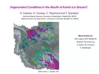
Ungrounded Conditions in the Mouth of Kamb Ice Stream? G. Catania, H. Conway, C. Raymond and T. Scambos* Earth and Space Sciences, University of Washington, Seattle WA, 98195 *National Snow & Ice Data Center, University of Colorado, Boulder CO, 80309 Many thanks to: NSF support (OPP #9909518) Raytheon Polar Services A. Gades, M. Conway & E. Waddington Data source: I. Joughin, JPL
Whillans Stream Ice Kamb Ice Stream Identification of boundaries and terrains Engelhardt Ridge Siple Dome
Whillans Stream Ice Kamb Ice Stream Identification of boundaries and terrains Engelhardt Ridge Siple Dome
Whillans Stream Ice Kamb Ice Stream Identification of boundaries and terrains Engelhardt Ridge Siple Dome
Whillans Stream Ice Kamb Ice Stream Identification of boundaries and terrains Engelhardt Ridge Siple Dome
Whillans Stream Ice Kamb Ice Stream Identification of boundaries and terrains Engelhardt Ridge Siple Dome
Whillans Stream Ice Kamb Ice Stream Identification of boundaries and terrains Engelhardt Ridge Siple Dome
Whillans Stream Ice Kamb Ice Stream Identification of boundaries and terrains Engelhardt Ridge Siple Dome
Syncline feature Ice Stream Terrain Flat-ice terrain Identification of other features • Terrain on both sides of KIS • Diffractors have uniform depth • Diffractors are line-type • No near-surface diffractors
Flat-ice Terrain Ice Stream Terrain Identification of other features Syncline feature Syncline amplitude grows with depth. Deep layers are truncated by the bed. Synclines are narrow in width. No change in layer thickness across dip.
Causes of layer downwarping Localized Basal Melt
Causes of layer downwarping How long did it melt for? Localized Basal Melt
Causes of layer downwarping How long did it melt for? Localized Basal Melt Melting lasted for ~10-130 years
Causes of layer downwarping How long did it melt for? Localized Basal Melt Melting lasted for ~10-130 years Short-lived melting Spatially focussed melting Deep diffractors Syncline features wrap around ridges
Localized Basal Melting Ice Stream Margin? • Pros: • melting is spatially focussed • melting is short-lived • Cons: • no explanation of deep line-diffractors • synclines wrap around ridges
Localized Basal Melting Ice Stream Margin? • Pros: • melting is spatially focussed • melting is short-lived • Cons: • no explanation of deep line-diffractors • synclines wrap around ridges Geothermal Source? • Pros: • synclines wrap around ridges • Cons: • no explanation of deep line-diffractors • source must be extremely shallow • melting is short-lived
Grounding Line Melt? • Pros: • explains deep line-diffractors • melting is short-lived • synclines wrap around ridges • Cons: • not currently floating • melting is spatially focussed Localized Basal Melting Ice Stream Margin? • Pros: • melting is spatially focussed • melting is short-lived • Cons: • no explanation of deep line-diffractors • synclines wrap around ridges Geothermal Source? • Pros: • synclines wrap around ridges • Cons: • no explanation of deep line-diffractors • source must be extremely shallow • melting is short-lived
Whillans Stream Ice Kamb Ice Stream Relict Grounding Line Positions When did it float? • not floating now (50-100 m above) • sea level is steady so floatation due to thickness changes • thickness changes indicate it could have grounded ~350 years ago • Accumulation • Compression • became floating ~480 years ago Engelhardt Ridge Siple Dome BEDMAP
Flow history of Kamb Ice Stream ~700 y.b.p Engelhardt Ridge CIR Siple Dome Wide trunk, fast flow permits thinning
Flow history of Kamb Ice Stream ~500 y.b.p Engelhardt Ridge CIR Siple Dome Thinning floatation Shift in flow direction of WIS
Flow history of Kamb Ice Stream ~450 y.b.p Engelhardt Ridge CIR Siple Dome Ice/water piracy shutdown of SIS
Flow history of Kamb Ice Stream ~350 y.b.p Engelhardt Ridge CIR Siple Dome Re-advance (b/c of WIS?) Narrowing of KIS Destruction of water system? SIR
Flow history of Kamb Ice Stream ~250 y.b.p Engelhardt Ridge CIR Siple Dome Ice/water piracy shutdown of KIS0 SIR
Flow history of Kamb Ice Stream ~150 y.b.p Engelhardt Ridge CIR Siple Dome Stagnation of KIS Continued flow in tributaries SIR
SUMMARY: Flow history of Kamb Ice Stream Syncline features/flat-ice terrain identified: • Strongly downwarped isochrones bound flat-ice terrains • Likely caused by basal melting for 130 years • Melting is a result of grounding line melt? • Associated deep diffractors caused by past floatation events • Floating occurred between 500 years ago and ended ~350 years ago Ice flow history of KIS: • Grounding line retreat in the mouth of KIS prior to stoppage • Sudden floatation and regrounding could destroy the subglacial drainage network • This might permit freezing to occur as upstream water is unable to reach the trunk