Download
1 / 27
330 likes | 537 Views
How can we describe Earth ’ s Landscape and its landforms?. What attributes define - landscape?. Natural Landscapes can be divided into 4 main attributes Biomes– plants and animals (humans) Abiotic – earth – rocks & soil Relief– shape, form, height Climate – average weather patterns.

E N D
What attributes define - landscape? • Natural Landscapes can be divided into 4 main attributes • Biomes– plants and animals (humans) • Abiotic – earth – rocks & soil • Relief– shape, form, height • Climate – average weather patterns
What are landforms? • Landforms are the natural shapes or features on the Earth’s surface. • Landforms are created or altered through weathering, erosion or geological processes.
1) Mountain A mountain is a place on Earth’s surface that is much higher than the land around it. It usually rises to a summit, and is higher than 610 meters (2000 feet).
2) Hill Smaller than a mountain; less than 610 metres
3) Valley A valley is a low area between higher lands such as mountains.
4) Gorge or Canyon A Gorge (Canyon) is deep valley with high, steep sides.
5) Cliff A cliff is high land with a very steep, vertical, or overhanging face of rock, earth, or ice.
6) Plain A plain is an extensive area of level or rolling area on the Earth’s surface. It is usually treeless and covered in grasslands.
7) Plateau (tableland) A relatively level surface higher than the adjacent land on at least one side.
8) Desert Arid land with usually sparse vegetation; land having a very warm climate and receiving less than 25 centimetres of sporadic rainfall annually.
9) Beach a shoreline of a body of water covered by sand, gravel, or larger rock fragments.
10) Dune a hill or ridge of sand piled up by the wind
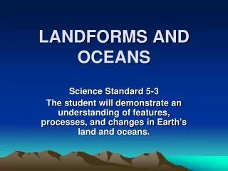
1) Ocean The body of salt water that covers nearly three fourths of the Earth’s surface.
2) Coast Land adjacent to the ocean; where a body of water meets land (usually a continent/country).
3) Tributary Astream that flows into a larger stream, or river, or into a lake.
4) River Alarge natural flow of water that crosses an area of land and goes into an ocean or a lake.
5) Lake An inland body of standing water; A body of water surrounded by land.
6) Waterfall A perpendicular or very steep descent of water from a stream or river; A natural stream of water falling from a high place.
7) Estuary Where river water and ocean water meet; a water passage where the tide meets a river current.
8) Delta Apiece of land shaped like a triangle that is formed when a river splits into smaller rivers before it flows into an ocean.
9) Inlet Anarrow area of water that goes into the land from a sea or lake.
Student Task Complete Task.3 – Landform worksheet. This can be found on the smccsose8 website
Images are from: Slides 1, 2, 3, 4, 5, 8, 9, 10, 11, 12, 14, 15, 16, 17, 19 Microsoft Office Clip Art Slide 6, 7, 13, 18 The Print Shop 22