Mapping Our World
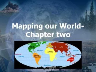
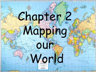
Mapping Our World. California Standards 1h, 9d, . Cartography – The science of map making. A grid of the imaginary parallel and vertical lines are used to locate points on the earth, Equator is a encircles the earth half way between the north and south poles.


Mapping Our World
E N D
Presentation Transcript
Mapping Our World California Standards 1h, 9d,
Cartography – The science of map making. • A grid of the imaginary parallel and vertical lines are used to locate points on the earth, Equator is a encircles the earth half way between the north and south poles. This imaginary lines separates the earth in to the northern and southern Hemispheres. Latitude and Longitude
Run parallel to the equator • Distance in degrees north or south of the equator. Reference point is O degree latitude. Poles are at 90 degrees. N. Of the equator is referred to North Latitude S. Of the equator is referred to South Latitude. Latitude
1 degree of latitude= 111 km on earth’s surface Why? Circumference of the earth is 40,000 km, Earth is a sphere, divided into 360 degrees. 40,000/360 = degrees Degrees latitudes/60 = minutes ‘ symbol 1 minute =1.85 km on earth (111/60’) 1 second = 1.85km/60 “ symbol Latitude and Longitude
Used to locate position in the east and west positions • Called Meridians Reference point is 0* Longitude- Prime Meridian It runs through Greenwich, England Points west from 0* to 180* W Points East from 0* to 180* E Longitude
Large semicircles that are vertically from pole to pole. • East Lines meet the West lines at Greenwich England at 180* meridian. Known as the International Date line. Longitude
Distances vary by locations • All lines converge at the poles • 1 degree longitude varies from 111 km to a point at the poles. Latitude and Longitude are used to locate a location. Use of Longitude for location by 1 700’s Use of Latitude for locations by 150 AD Example: Diamond Bar is at Degrees of Longitude
Earth has 24 time zones Constant Spinning, time changes all the time. Each zone is 15 degree wide. The size of the zone has been adjusted at a local level to avoid confusions. Countries such as the U.S. has six time zones. Time Zones
Midnight a day ends and another begins. • As a person passes through a time zone, time is lost. • International Date Line 180* meridian serves as a transition line for calendar days; Calendar Dates
If it is 2 p.m. in New York, New York, what time is It in Quito, Peru? • Why is time zone boundaries do not strictly follow lines longitude? Problem
Parallel lines of both longitude and Latitudes Landmasses areas are distorted but their locations are correct Used for navigation of planes and ship Mercator Projections
Made by projecting points and lines from the globe onto a cone. The cone touches the globe at a certain point. • Distortion exist near the top and bottom of the projection. • High degree of accuracy • Use to make road maps and weather maps Conic Projections
Made to projecting points and lines from a globe onto a piece of paper that touches the globe at a single point. • Direction and distance between landmasses are distorted. • Great Circles are used to divide the earth into halves. Shortest distance between two points are located on the equator. • Useful for mapping long distances by air and sea Gnomonic Projections
Maps that showing hills and valleys of an area • Shows changes in Elevations, mountains, rivers and bridges. • Uses lines and symbols and colors to represent changes and features of the surface. • Contour Lines: Connects points of equal elevations. Never cross • Elevation is the distance above or below sea level. Topographic Maps
Two side by side contour lines • Dependent on the terrain Contour Intervals
Contour line that are marked by numbers their elevations Index Contours
Used for the location of volcanos and mines. • The contour lines have hachures or short lines that are at right angles to the contour lines. The hachures point downward to lower elevations. Depression Contour Lines
Explains the meaning of symbols on the map. Map Legends
Ratio between distances on a map and actual distances on the surface of the earth’ • Three types of scales • Verbal scale- A statement expressing distance. • Graphic scale- consist of a line that represent a certain distance • Fractional Scale – A broken line each section equals a certain distance. Map Scale
Electromagnetic Spectrum • Satellites detect different wavelengths of energy (electric/magnetic) reflected or emitted from the Earth’s surface. Electromagnetic Radiation • Light travels at 300,000 km/s in a vaccum. Speed of light. • Electromagnetic waves have definite wavelengths Remote Sensing
Wavelength, frequency and speeds of electromagnetic waves help determine how the energy help is used by a satellite.
Receives reflected wavelengths of energy emitted by Earth surface, includes visible light and infrared radiation. • Bodies of water and forests show up in different colors in images. • Mirrors scan the earth picking up the intensity of the energy. This information is picked up and converted to digital images. • Used to study tectonics, rivers, earthquakes and pollution, Landsat Satellites
Use radar to map the bottom of the ocean • Name stands for Topography Experiment • Radar used high frequency signals that are from the satellite to the surface of the ocean. • A receiving device then picks up the returning echoes as it is reflected off the water. Distance to the water’s surface is calculated with the speed of light and time it take to return. • Used to map topography, tidal changes and ocean currents. Topix/ Poseidon Satellite
Radio Navigation system of 24 satellites • Satellites orbits the earth and transmits high frequency microwaves the contain information of its location. Several satellites are doing this at once. The devices on earth processes all the data using latitude and longitude and tells your location. Global Positioning System {GPS}