Download
1 / 16
160 likes | 318 Views
Graphic systems in Fire Safety and Rescue DIRECORATE GENERAL. 1. GIS in FSR Directorate General. FSRDG works with 3 types of GIS software. MapInfo Professional 7.8. Autodesk 3D Map 2005. ESRI ArcGIS 9.2. 2. GIS in FSR Directorate General.

E N D
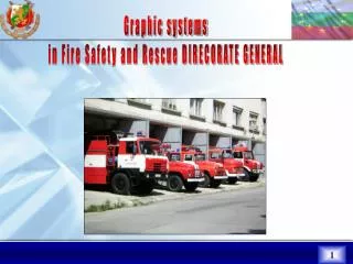
Graphic systems in Fire Safety and Rescue DIRECORATE GENERAL 1
GIS in FSR Directorate General FSRDG works with 3 types of GIS software MapInfo Professional 7.8 Autodesk 3D Map 2005 ESRI ArcGIS 9.2 2
GIS in FSR Directorate General FSRDG uses Digital Map of Bulgaria in scale 1:200 000 with the following structure: Administrative divisionRoads BG_bor - borders BG_railways BG_obl - regions BG_auto - Motorways BG_obs- municipalities BG_T1 - Primary roads BG_sity - towns BG_T2 - Secondary roads BG_selo- villagesBG_T3 - Third class roads City_str - Street network in 40 towns Hydrography Black_sea BG_ezera- lakes BG_reki -rivers Relief Isolinesfrom 0 to 2800 metersat intervals of200 meters 3
GIS in FSR Directorate General The electronic map is used for development of plans in conducting exercises with international participation. 4
National operational graphical information system(NOGIS) Under the Regulations the Fire Safety and Rescue Units elaborate “Operational action plans in case of fires and terrorist acts”. They are drawn with the AutoCAD software program and the special graphic library. More than 1000 operational plans have been created in FRSDG. 5
GIS in FSR Directorate General By means of MapInfo Professional 7.8 an electronic map of the most important critical sites on the territory of Bulgaria has been created in FSRDG. 6
GIS in FSR Directorate General FSRDG used GIS to create different thematic maps with analysis purpose. 7
GIS in MoI Geographic Information System “Crisis management” was developed in 2009 for the needs of the Ministry of Interior. 8
GIS in MoI FSRDG is among the first users of this system. 9
GIS in MoI The system has many useful “tools” for working in critical situations, such as finding the optimal route and route recalculation in case of occurrence of an obstacle. 10
GIS in FSR Directorate General • Some new layers, specific for the fire activity have been created in ESRI ArcGIS environmentsuch as: • FRS Units and District services; • Areas of responsibility of the FRS Units; • Technical equipment of FSR Units and District Services. 11
GIS in FSR Directorate General In 2009 the layer “CORINE Land cover” was added and a map of the exact forest fires location was created. 12
GIS in FSR Directorate General In the field of Risk Prevention activity FSRDG works together with the National Institute of Meteorology and Hydrology at The Bulgarian Academy of Sciences on the so called “Forest fires danger index” /Canadian Fire Weather Index- CFI/ Canadian Fire Weather Indexand actual forest fires Forest Fire Index – AUGUST2009 13
GIS in FSR Directorate General The metrological data are integrated into GIS environment. In case of “extreme” values of the Index, thematic maps of the threatened areas are prepared and published on the FSRDG website:http://www.nspbzn.mvr.bg/Operativna_obstanovka/default.htm 14
GIS in MoI • In the FUTURE: • Implementation of numerical model for forest fires development assessment together with the National Institute of Meteorology and Hydrology at The Bulgarian Academy of Sciences ; • Integration of “Tetra AVL” and “GIS –crisis management”; • Receiving actual basic geographical information of a high quality /Digital dynamic maps/ from the future Spatial Data Geo-portal of the Republic of Bulgaria. 15
GIS in FSR Directorate General THANK YOU 16