Download
1 / 22
220 likes | 360 Views
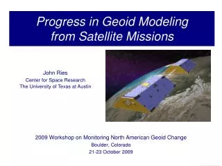
Geoid Modeling at NOAA. Dru A. Smith, Ph.D. National Geodetic Survey National Ocean Service, NOAA November 13, 2000. Topics of Discussion. The many definitions of “height” Why does anyone need a geoid model? NOAA resources and partnerships Geoid modeling 101

E N D
Geoid Modeling at NOAA Dru A. Smith, Ph.D. National Geodetic Survey National Ocean Service, NOAA November 13, 2000
Topics of Discussion • The many definitions of “height” • Why does anyone need a geoid model? • NOAA resources and partnerships • Geoid modeling 101 • Current status and future directions Geoid Modeling at NOAA Dr. Dru A. Smith
The many definitions of “height” • Orthometric Height (H) • Height from the geoid to the Earth’s surface • Frequently (informally) called “height above mean sea level” • On most topographic maps • e.g. “The Height of Mount Everest is 8848 meters” Geoid Modeling at NOAA Dr. Dru A. Smith
Geoid Modeling at NOAA Dr. Dru A. Smith
The many definitions of “height” • Ellipsoidal Height (h) • Height from the ellipsoid to the Earth’s surface • Usually derived from GPS measurements • Easy to obtain through GPS • Has few physical applications • e.g. water does not necessarily run ‘downhill’ in ellipsoid heights Geoid Modeling at NOAA Dr. Dru A. Smith
The many definitions of “height” • Geoid Height (N) • Height from ellipsoid up to geoid • Also called “geoid undulation” • N = h - H • “N” determined from gravity measurements Geoid Modeling at NOAA Dr. Dru A. Smith
Geoid Modeling at NOAA Dr. Dru A. Smith
Why do we need a geoid model? • It saves money • It saves time (but time = money) • Additional scientific and economic uses: • Geophysical: Oil and other subsurface features • Oceanographic: Sea level rise and current modeling Geoid Modeling at NOAA Dr. Dru A. Smith
Saving money with a geoid model • The geographic community needs orthometric heights, H • Old way: H = H0 + DH (spirit leveling) • Time consuming, 4 person team. Expensive! • New way: H = h - N (GPS & geoid) • Fast, accurate, 1 person team. Cheap! • Part of NOAA’s “Height Modernization” program Geoid Modeling at NOAA Dr. Dru A. Smith
Saving money with a geoid model • Baltimore County GPS project, Phase III • Installed new vertical control benchmarks • 290 square miles (1/3 of Baltimore county) • Traditional leveling: 7 1/2 months / $174,000 • GPS and geoid: 3 weeks / $ 49,000 • Savings: $125,000 = 72% !! Geoid Modeling at NOAA Dr. Dru A. Smith
Saving money with a geoid model • Baltimore county GPS project, Phase III • 1/3 of 1 county out of 3142 counties • Informal extrapolation: • The geoid could save 150-1500 million dollars for this application alone • Depends on achieving an accurate geoid not just in Baltimore, but everywhere Geoid Modeling at NOAA Dr. Dru A. Smith
NOAA resources / partnerships NOAA is uniquely qualified to undertake this research Geoid research is cross-disciplinary Geoid Modeling at NOAA Dr. Dru A. Smith
NOAA resources Within NOAA: NOS : NGS -- gravity database, GPS on leveled benchmarks and research on high resolution geoid modeling NESDIS : NGDC -- Gravity and topography data NESDIS : ORA : ORAD -- Satellite altimetry and oceanic gravity Geoid Modeling at NOAA Dr. Dru A. Smith
NOAA partnerships Partner groups: NIMA -- Significant gravity and DEM data USGS -- DEM data NASA -- Global gravity field with NIMA NTIA -- DEM data Universities -- Data and research States -- GPS cooperative surveys Other countries (Canada, Mexico, Caribbean, Denmark) -- Data and tech transfers Geoid Modeling at NOAA Dr. Dru A. Smith
Geoid modeling 101 • Gravity measurements every 5-10 km • Digital elevation models (30-100 m) • Global gravity field models • GPS heights on leveled benchmarks Geoid Modeling at NOAA Dr. Dru A. Smith
Geoid Modeling at NOAA Dr. Dru A. Smith
Geoid Modeling at NOAA Dr. Dru A. Smith
Current Status GEOID99 accuracy: Absolute +/- 2.5 cm about North American Vertical Datum of 1988 (NAVD 88) Differential +/- 0.2 to 3.5 cm between points 1 to 40+ km apart Geoid Modeling at NOAA Dr. Dru A. Smith
Positioning for the Future Today: Surveyors can do sub-cm spirit leveling over lines up to 10 km long Tomorrow: Surveyors expect to do 100+ km lines at similar accuracy with GPS and geoid (“GPS leveling”) Geoid Modeling at NOAA Dr. Dru A. Smith
Achieving Higher Accuracies 1 cm error budget (absolute and differential) Better theory More data (Terabytes, USA; Petabytes, Globe) More computational power Supercomputers? Occasional, one shot, massive computations Maui supercomputer: Fall 2000 (UNM/USAFRL) Geoid Modeling at NOAA Dr. Dru A. Smith
Conclusions The geoid is the bridge between historical data sets and new cost-saving GPS technology Geoid modeling is an integral part of Height Modernization The “1 cm geoid” is achievable in the USA within 10 years Geoid Modeling at NOAA Dr. Dru A. Smith
Contact Information • Dr. Dru A. Smith • 301-713-3202 x 149 • Fax: 301-713-4172 • Dru.Smith@noaa.gov • www.ngs.noaa.gov/GEOID Geoid Modeling at NOAA Dr. Dru A. Smith