Download
1 / 27
270 likes | 289 Views
This overview discusses the use of imputed tree lists in running FVS simulations for large landscapes when plot data is only available for some stands. It explores different imputation techniques, with a focus on Nearest Neighbor Imputation (NN), and highlights the benefits and challenges of using imputed data for landscape projections.

E N D
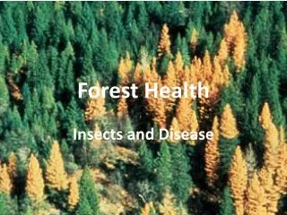
Use of imputed tree lists for FVS landscape projections:An overview of some issues and opportunities. Eric L. Smith Forest Health Technology Enterprise Team U.S. Forest Service Fort Collins, CO
Problem: We would like to run FVS simulations for large landscapes, but we only have plot data for some of the stands One solution: For each uninventoried stand, use imputation techniques to find plot data taken from a similar site and use that data as if it were taken from the un-inventoried stand.
Imputation “Imputation” is a generic term for methods which can be used to estimate missing data. There are many ways to do this. For example, in FVS, you can provide a tree height but, if you don’t, FVS can impute it: estimate it from a height as fn(dbh) model.
Nearest Neighbor Imputation “Nearest Neighbor” (NN) imputation is a statistical technique which substitutes many values from another sample plot which is like the plot with the missing data, based on what information you do have about the plot with the missing values. The kind of information we do have (or can get) includes the kind of mapped data in GIS coverages and satellite data.
Why NN Imputation? • In general, use of an entire plot sample insures the group of data elements represents a realistic combination of conditions • For use in FVS, we need the whole tree list and sometimes addition plot data
Process example Gradient Nearest Neighbor from Ohmann and Gregory, 2002
Example mapped data Adapted from Ohmann and Gregory
Mapped data information • Physiographic variables relates to “potential vegetation” or successional pathway • Satellite data relates to current tree sizes and density (pathway state) • If management (or fire) has created variation in understory conditions which is hidden from the satellite by the overstory, this could be a problem.
The status of NN for FVS • The NN technique most associated with FVS, Most Similar Neighbor (MSN), has been around for over 10 years, additional techniques are being added to the software by Crookston and others. • There is a increased recognition for the need for landscape simulations for fire and other applications. • FIA annual data increasing available for all forested lands, while recent stand exam data is decreasing. • Adequate computer storage, processing power, software, and GIS-based mapped data are now widely available to perform large imputation projects.
Some current Major NN Efforts • Crookston et al, RMRS, Moscow • MSN support, new YAImpute package • Ohmann et al, PNWRS, Corvallis • Gradient NN (GNN), mapping in CA, OR, WA • McRoberts & Finley, NRS, St. Paul • Faster processing (ANN), variance estimation • Twombly, NRIS, have Informs, will travel • MSN inside INFORMS, creates Nat’l Forest maps • LeMay et al, UBC, Vancouver • Various application in Canada
Large NN imputations are here PNW, Ohmann Mn, McRoberts Pa, Lister NFs, Twombly
Scale: Compartments to States The application of NN imputation to fill in a (small?) number of uninventoried stands in a small landscape takes place in a very different information context than the NN allocation of large scale inventory plots to a large area (sub-states to multi-states).
Small area application • Can know conditions and history • Can gather more ground information • Can relate imputation results to the on the ground reality • Inventory often linked to purpose and reasonably intensive • Homogeneous areas (stands) can be predefined and be a sampled unit • Data and relationships between data are likely to be consistent
Large area application • Too large to have direct knowledge about • Sampling intensity is generally low • Homogeneous areas not pre-defined but can be done so (using image analysis and GIS tools) • Data and relationships between data are often inconsistent across area • Can gather more information- but through existing sources of remote sensing and other mapped data • Inventories may not be linked to the desired applications of the users • However, inventory design may provide statistically reliable population estimates
Scale shifts focus to map data Fine scale details are less reliable as sample intensity decreases and the imputation geographic range increase; But, from the stand point of the inventory estimates, imputation allows: (1) the more precise estimation of inventory data for small areas; (2) the estimation of additional types of summary variables for post stratified conditions; (3) the FVS projection of inventory subpopulations using associated tree lists by area and adjusted for a range of site conditions.
Error and Variance • Need goodness of fit measures to evaluate the relative quality of procedures • Understanding sources of errors which contribute to variance needed to know if and how they can be reduced • Variance estimates for NN results are complex and difficult, and under active investigation • There are different approaches used by different disciplines
FIA Plot Design Trees 5 inch and over are measured on 4 subplots, each 1/24th acre Trees 1 to 5 inch are measured on 4 microplots, each 1/300th acre Eventually, there should be at least one plot per 6000 forested acres, nationwide
Spatial scale: FIA vs. Landsat • Landsat pixels are 30x30 meters (900 m2) • Each FIA subplot (>5 in.) is 167 m2 (19% of the pixel) • Each FIA microplot (1 to 5 in.) is 13.7 m2 (1.5% of the pixel) • This difference in scale may result in an underestimate the accuracy of the imputation if the sample estimates are assumed to be “true” • In addition, there is positional error and other sampling and measurement error associated with FIA plot data, Landsat data, and other map data Image from McRoberts, 2006 1/300th Acre small tree plot 30m x 30m pixel
k Nearest Neighbor • k Nearest Neighbor technique allows the selection of more than one reference data set, usually averaged to estimate target conditions. (using 3 closest neighbors would be “k=3”) • In FVS, the kNN approach could treat the multiple near neighbors as imputed sub-plots. • This may be desirable in the case of a scale mismatch between the intensive plot and the map data. It also creates more variation across the landscape, perhaps better representing transitions between conditions. • kNN option is included in YAImpute
Questions: • Would k > 1 be a good tradeoff between real mixes of plot conditions and the sample uncertainty of plots smaller than pixels? • Could additional pixel-sized information be gathered at sample point locations (e.g. photo-interpreted crown cover or cover type) and included in the multivariate data analysis?
How much does it matter? • The issues of goodness of the imputation need to be considered in the context of the simulation: the use of the results and the models’ sensitivity to the lack of accuracy. • Model applications have a range of sensitivity • Analysis projrcts have a range of sensitivity • Sensitivity tests can be performed
Envision project using imputed data This imputation application has a low sensitivity to error Crystal Lakes Fuel Trt Project Arapaho-Roosevelt NF as seen from road intersection
A fire-beetle project using MSN This FFE WWPB application has catastrophic and contagion behaviors, and may be sensitive to imputation errors Five Buttes Analysis Area Deschutes Nat’l Forest
Imputation Sensitivity Analysis In this analysis, two landscapes were imputed, high and a low pine beetle risk, based on risked rating stands which fell in each of many stand classifications. These maps represent the no action, “after beetle outbreak” BA for each Red River pine beetle analysis, Nez Perce National Forest 2011 HIGH 2011 LOW
Sensitivity: High minus Low The difference in the two extremes show how much the results may have changed if better data were available, and where the uncertainty is manifested on the landscape. This is the “no action” alternative; so a comparison can also be made as to the sensitivity of the action-no action difference to these 2 extreme landscape ranges. 2011 H-L 1986 H-L
An additional challenge What is “most similar” depends on what aspects are considered in the analysis. If these products are used in decision making, we face the challenge to produce understandable, useful products which can be integrated with other corporate resource data systems and analyses. (Its not so good to have several, different estimates of where something important might be. It drives the boss crazy, but the appellants’ lawyers love it)
Acknowledgements • Nick Crookston • Andrew McMahan • Ron McRoberts • Ken Pierce • Al Stage • and to all of you from out of town, who are here on Valentine’s Day, away from those you hold dear