Download
1 / 38
380 likes | 589 Views
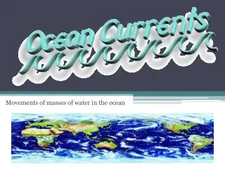
Movements of masses of water in the ocean. Formation of Surface Currents. The forces that move water to produce ocean currents are caused by: Rotation of the earth Winds Water density Differences. Effect of a Rotating Earth. Turns from west to east .

E N D
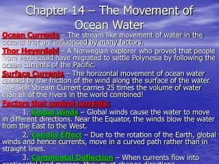
Formation of Surface Currents • The forces that move water to produce ocean currents are caused by: • Rotation of the earth • Winds • Water density Differences
Effect of a Rotating Earth • Turns from west to east. • Velocity of rotation at its surface is greatest at the equator and least at the poles. • This is called the Coriolis effect.
Effect of Rotating Earth • Find city of Quito, capital of Ecuador • Put a sticker on it • Find Buffalo, NY • Put a sticker on it • Use a string to measure the distance around the earth beginning and ending at the same city (do not cut the string, just mark with your finger) • Speed = distance/time (24 hrs)
Understanding the Coriolis Effect • Read pp. 164 to first paragraph on pp. 167 under “The Coriolis Effect” • Discuss with your partner until you both understand. • Read pp. 189 (Western Boundary Currents) to pp. 191 and look at Figure 9.8. • On a piece of paper, describe the coriolis effect and draw a picture • Which direction does it turn in N. Hemisphere? • Which direction does it turn in the S. Hemisphere?
Coriolis Effect • Earth spins counterclockwise • Deflection will always be to the right (looking south from N. Pole) • Air turns to the right in the Northern Hemisphere • Air turns to the left in the Southern Hemisphere
Circulation • Global circulation of air • Uneven solar heating • Rotation of the Earth (Coriolis effect) • Areas near equator where wind converges is known as intertropical convergence zone (ITCZ) • Doldrums
Wind Patterns • Trade Winds • Surface winds that move from latitudes where dry air sinks toward latitudes at the equator • ****Winds are named by the direction from which they blow • In the N. Hemisphere they are the northeast trades • In the S. Hemisphere they are the southeast trades • Westerlies • Surface winds that flow between areas where dry air sinks toward the latitudes at polar cells • In N. Hemisphere they approach from the southwest • In the S. Hemisphere they approach from the northwest
Monsoons • A monsoon is a pattern of wind circulation that changes with the season • Areas that experience monsoons typically have wet summers and dry winters • Land changes temperature more rapidly than the ocean • In spring, land heats faster than the ocean • Air above the land becomes warmer and rises • Relatively cool air flows from over the ocean to the land to take the place of the warm air, which then heats, rises, and forms clouds and rain
July January
Breezes • Breezes are small, daily “mini-monsoons” • Sea breezes • Morning sunlight warms the land, which then warms the air above it • Warm air expands and rises • Cooler air from over the sea moves toward land • Land breezes • After sunset, the land loses heat quickly. • The air over the still-warm ocean will be warmer than air over the cooling land • The air over the ocean will rise and cooler air from the land will move over the ocean
Review • Differentiate between trade winds and westerlies. (i.e. Where are they located and in what direction do they flow...from _____to _____?) • Diagram and label sea and land breezes.
STOP • Begin and Finish Storm Powerpoint • Then continue
Ocean Circulation • Primary forces start water moving and determine velocity (speed and direction). • Thermal expansion and contraction • Stress of wind blowing over the water • Density differences • Secondary forces influence the direction and nature of the flow. • Coriolis effect • Gravity • Friction • Shape of the ocean basins (floor)
Surface Currents – Solar heating • Solar (sun) heating causes water to expand slightly. • Sea level near equator is about 8 cm higher than sea level moving toward poles. • This global difference creates a very slight slope, and warm equatorial water flows “downhill”toward poles.
Surface Currents • Because the earth is turning west to east, the water is deflected to the west • Water’s travel is influenced by the Coriolis effect which starts a circular flow
Surface Currents - Wind • Primary force responsible for surface currents • Trade winds and Westerlies “tug” on the surface of the water • Water is deflected to the right of the wind direction (Coriolis Effect) • As a rule, the friction of wind blowing for at least 10 hours will cause surface water to flow at about 2% of wind speed – a surface current
Ekman Transport • Coriolis effect – spinning of the earth • Water flows to the right of the direction of the wind • Water in each layer flows a little more to the right as you go down • A down flowing spiral occurs • Eventually water in one layer will flow in the opposite direction of the surface water
Gyres – circular flow of water • Coriolis effect deflects water to the right of wind direction • Clockwise in the northern hemisphere • Counterclockwise in the southern hemisphere • 5 Major Gyres • North Atlantic • South Atlantic • South Pacific • North Pacific • Indian
Western and EasternBoundary Currents • 5 major ocean gyres flow in relation to the spin of the earth – geostrophic currents. • Currents on the western boundary of the ocean flow from the equator to the poles • Currents on the eastern boundary of the ocean flow from the poles to the equator
Western Boundary Currents • Fastest and deepest currents • Move warm water poleward in each hemisphere • Examples: • Gulf Stream (largest) • Japan or Kuroshio Current • Brazil Current • Aqulhas Current • East Australian Current
Eastern Boundary Currents • Carry cold water toward equator • Shallow, broad, and slower than western boundary currents • Examples: • Canary Current • Benguela Current • California Current • West Australian Current • Peru or Humboldt Current
Countercurrents and Undercurrents • Countercurrent - Surface water at the equator where lack of wind allows it to flow in the opposite direction of the main current. • Without the wind driving the water to the west, some backward flow of water occurs here • Undercurrent – water flows beneath and opposite of the current over it. • Undercurrents are why the Galapagos islands are in cold water even though they are in the tropics near Equator
Upwellings • Form when winds parallel to shore force water away from shore; west coast of continents. • Water from the bottom is brought up to replace the moved water • Water brings with it nutrients from the ocean bottom • Cooler water brought upward can create fog banks and cool summers (San Francisco)
Downwellings • Form when winds parallel to shore force water into shore; east coast of continents • Extra water is forced down towards the bottom • Helps supply deeper ocean with dissolved gases and nutrients
Heat transport and Climate • Currents redistribute heat throughout the globe • Without these, Earth would have more extreme weather. • Cold water from the poles keeps the Galapogos Islands cool even though they are in the tropics • Warm water from Gulf Stream, warms the air above and keeps much of Europe warmer than other places at similar latitudes.
Galapagos Islands FROM: serc.carleton.edu
El Niño Southern Oscillation (ENSO) • ENSO is a reoccurring natural phenomenon in which the Eastern Pacific is warmer than usual causing global weather changes. • Trade winds weaken and warm equatorial water that would normally flow west-ward “backs up” to flow east • Upwellings in California and Peru decrease or stop • Increases Pacific tropical cyclone activity • Occurs every 3-8 years
La Niña • La Nina is a intense return to the “normal” conditions following strong ENSO • Colder than normal conditions in California and Peru
Gravitational Currents • Two forces that explain vertical movement in the ocean: • Gravitational Force (G) • Buoyant Force (B) • G > B – downward movement = sinking • B >G – upward movement = rising • G = B – no movement = floating at surface • G = B – no movement = floating neutrally bouyant
Thermohaline Circulation • Water movement caused by differences in temperature and salinity. • Processes that decrease salinity: • Precipitation • Freshwater run-off • Processes that increase salinity: • Evaporation • Freezing