Download
1 / 7
110 likes | 1.12k Views
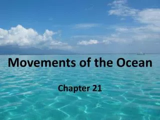
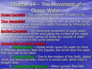
Chapter 14 – The Movement of Ocean Water. Ocean Currents – The stream like movement of water in the oceans that are influenced by many factors.

E N D
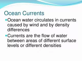
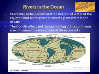
Chapter 14 – The Movement of Ocean Water Ocean Currents – The stream like movement of water in the oceans that are influenced by many factors. Thor Heyerdahl – A Norwegian explorer who proved that people from Peru could have migrated to settle Polynesia by following the ocean currents of the Pacific. Surface Currents – The horizontal movement of ocean water caused by the friction of the wind along the surface of the water. The Gulf Stream Current carries 25 times the volume of water than all of the rivers in the world combined! Factors that control currents: 1. Global winds – Global winds cause the water to move in different directions. Near the Equator, the winds blow the water from the East to the West. 2. Coriolis Effect – Due to the rotation of the Earth, global winds and hence currents, move in a curved path rather than in straight lines. 3. Continental Deflection – When currents flow into continental land masses, they must change directions.
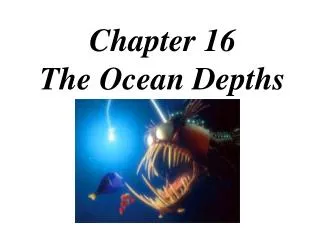
Deep Currents – The movement of waters below the surface that are NOT influenced by the wind but rather by density of the water. Cold temperatures and high salinity produce denser water. As water increases in density, it will sink due to gravity. Usually, these currents will flow along the bottom of the oceans however, when meeting denser waters, they will flow above them. Currents & Climates – Surface currents greatly affect the climate in many parts of the world. Warm-water currents create warmer climates along the coastal regions of many continents which would normally be colder. The Gulf Stream carries warm water from the tropics and warms the British Isles. Conversely, the California current is a cold water current and cools our west coast!
Upwelling – The process in which cold, nutrient-rich, deep ocean waters rise up to replace warmer surface waters moved away by local winds. These nutrients include iron and nitrates essential to the life process of phytoplankton that form the base of the marine ecosystem food web. El Nino - A change in the water temperature of the Pacific that produces warmer currents. Responsible for disasters such as heavy rains producing floods and mudslides in normally arid regions and droughts in areas normally humid climates. This also prevents the upwelling of nutrients in the coastal waters of South America. The N.O.A.A. set buoys in the ocean to help predict when El Nino will occur. La Nina – A change in the Pacific waters where there are colder than normal water temperatures. This also affects weather patterns and usually follows an El Nino event.
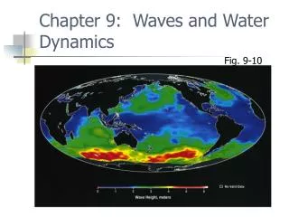
Waves – Created by the wind and move in a circular pattern with only the energy of the wave being directed towards the shore. Wave Measurements: 1. Wavelength – The distance between two successive wave crests. 2. Wave Height – The distance between the trough and crest of a wave. 3. Wave Period – The time between two successive wave crests. As a wave approaches the shore, the energy of the wave interacts with the ocean floor and begins to rise upwards. Gravity will eventually pull it over to form a breaker. Undertow – A subsurface current that forms when the waves washes up onto the shore and carries sand, debris, swimmers, etc. back out to the sea.
Longshore Current – A current that runs parallel to the shoreline. Whitecaps – White, foaming waves with steep crests that usually form during storms. Swells – Long ocean waves that forms a high wave and can travel long distances. Tsunamis – Huge waves that are formed when a large volume of water is suddenly moved up or down usually by seismic or volcanic events. Storm Surge – A rise in sea level caused by strong winds usually associated with a hurricane.
Tides – The daily change in the ocean level caused by the gravitational pull of the sun and especially the moon. Although the sun is larger and we do orbit it, the moon is much closer and has a greater gravitational influence. The Earth rotates once every 24 hours. Tidal Range – The difference in the level of the ocean between high and low tides. High Tide – The bulge in the ocean when the Earth is facing the moon or opposite of. Low Tide – The ocean water is drawn away from the shore by the gravitational pull of the moon.
Spring Tide – Occurs when the Earth, moon and sun are in alignment to create the largest tidal range, longest time between, and occurs twice a month during the new and full moons. Neap Tide – When the Earth, moon and sun form a 90° angle resulting in the smallest tidal range. Occurs twice every 28 days during the first and the third quarter moons. Tidal Bore – A body of water that rushes into a narrow bay and causes a very sudden tidal rise. The Bay of Fundy in Canada, has the greatest tidal range due to its long, narrow, inlet.