Download
1 / 23
230 likes | 363 Views
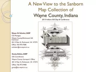
A New View to the Sanborn Map Collection of Wayne County, Indiana. 2013 Indiana GIS Day & Conference. Shaun N. Scholer, GISP GIS Manager, Wayne County/Richmond GIS Interlocal 401 E Main St. Richmond , IN 47374 Office: 765-973-9385 sscholer@co.wayne.in.us. Gunty Atkins, GISP

E N D
A New View to the Sanborn Map Collection of Wayne County, Indiana 2013 Indiana GIS Day & Conference Shaun N. Scholer, GISP GIS Manager, Wayne County/Richmond GIS Interlocal 401 E Main St. Richmond , IN 47374 Office: 765-973-9385 sscholer@co.wayne.in.us Gunty Atkins, GISP GIS Coordinator, Wayne County Surveyor’s Office 401 E Main St. Richmond , IN 47374 Office: 765-973-9483 gunty@co.wayne.in.us
MAP DETAILS 2013 Indiana GIS Day & Conference
IndianaView Funding Beneficiaries What is the Sanborn Map Collection? Confined to Books Indiana’s Digital Archiving Project Old Maps with a Modern View 2013 Indiana GIS Day & Conference
IndianaView Internal Grant Program Administrator: Larry Biehl, Purdue University Funding Source: Grant from the U.S. Geological Survey AmericaView: Nationwide partnership of remote sensing scientists supporting remote sensing research, K-12 and higher education. Partnerships: IGIC and Indiana Spatial Data Portal 2013 Indiana GIS Day & Conference
Beneficiaries • Inside Government • Assessor • Planning and Zoning • Surveyor • Environmental compliance/regulatory • Outside Government • Lawyers • Environmental Assessments Firms • Historians • Archeologists • Agriculture • Utilities 1909 2013 1886 2013 Indiana GIS Day & Conference
Sanborn Map • What is the Collection 2013 Indiana GIS Day & Conference
Sanborn Map • Confined to Books
Sanborn Map • Indiana’s Digital Archiving Project • Over 10,000 public domain maps • Download without restriction • 305 cities and towns • 20 TB storage 2013 Indiana GIS Day & Conference
Sanborn Map • Old Maps with a Modern View 2013 Indiana GIS Day & Conference
Creating Image Layers • Software used: • GIMP (manipulating images) • ArcGIS Desktop (Rectification and clipping) • Open source • Best of all it is FREE! • http://www.gimp.org • Most GIS systems already use ArcGIS 2013 Indiana GIS Day & Conference
Creating Image Layers Tools used: • Add Alpha Channel • Erase/Cut • Rotate 90 deg. • Rotate Tool • Scale Tool • Perspective Tool • Merge Tool 2013 Indiana GIS Day & Conference
Creating Image Layers Two Methods: • Rectangular Clipped Images • Custom Shape Clipped Images • Method Wayne Co used • Works well with various software- Map Guide, AutoCad, Microstation Etc • Complex in creating • Works well within the ArcGIS world of raster mosaic datasets 2013 Indiana GIS Day & Conference
Rectangular Clipped Images • Preplanning • Would like to keep clipped edges in road right of ways • Determine which map pages to merge to create good North South break lines 2013 Indiana GIS Day & Conference
Rectangular Clipped Images Create Base Map in ArcGIS • Use Features found on the Sanborn Map • Road R/W • Parcel Lines • Set scale to equal Sanborn Map • Most maps 1”=50’ • Export base map for use in GIMP • Tiff or Jpg 2013 Indiana GIS Day & Conference
Rectangular Clipped Images • Add map pages and base map to GIMP • Rectify against base map • Rotate, Stretch, Erase • Cut and paste data that might get lost in the clipping process 2013 Indiana GIS Day & Conference
Rectangular Clipped Images Ready for Georeferencing 2013 Indiana GIS Day & Conference
Rectangular Clipped Image Georeferencing Images 2013 Indiana GIS Day & Conference
Rectangular Clipped Image Clipping Images 2013 Indiana GIS Day & Conference
Custom Shape Clipped Images Hit the Easy Button 2013 Indiana GIS Day & Conference
Custom Shaped Clipped Images • Results 2013 Indiana GIS Day & Conference
Sanborn Map • Conclusion • Geo-referenced Mosaic for Each Map Set in Wayne County Indiana Spatial Data Portal 2013 Indiana GIS Day & Conference
Sanborn Map Shaun N. Scholer & Gunty Atkins Wayne County/Richmond GIS Interlocal 401 E Main St. Richmond , IN 47374 Office: 765-973-9201 sscholer@co.wayne.in.us gunty@co.wayne.in.us Grant Provided by: IndianaView Consortium Larry Biehl Purdue University Information Technology at Purdue (ITaP) biehl@purdue.edu Partnerships: IGIC Philip S. Worrall Executive Director Indiana Geographic Information Council, Inc. pworrall@igic.org 317.504.4389 Indiana Spatial Data Portal Anna Radue Indiana University aradue@iu.edu 2013 Indiana GIS Day & Conference