Download
1 / 22
220 likes | 248 Views
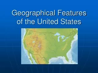
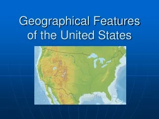
Discover the diverse geographical features of the United States, from the lowlands of the Atlantic Coastal Plain to the vast prairies of the Great Plains and the majestic Continental Divide. Learn about the arid Great Basin, scorching Death Valley, and the importance of the St. Lawrence River and Great Lakes. Explore iconic cities like New York City, Boston, and Philadelphia, and the historic Erie Canal.

E N D
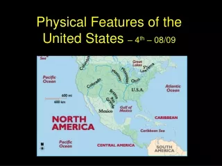
Atlantic Coastal Plain The Atlantic Coastal Plain is a lowland in North America that stretches along the Atlantic coast of the United States from New York to the tip of the Florida Peninsula.
The Great Plains The Great Plains is a vast prairie region extending from Alberta and Saskatchewan and Manitoba in Canada south through the west central United States into Texas; formerly inhabited by Native Americans.
The Continental Divide The Continental Divide is a series of mountain ridges extending from Alaska to Mexico that forms the watershed of North America. Most of it runs along peaks of the Rocky Mountains and is often called the Great Divide in the United States.
Great Basin The Great Basin is an arid region in the western US between the Sierra Nevada and the Rocky Mountains that includes most of Nevada and parts of the adjacent states (Utah, California, Idaho, Wyoming, and Oregon).
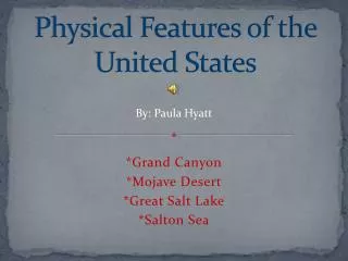
Death Valley Death Valley is a desert valley in Eastern California and Western Nevada. It is the lowest, hottest, and driest area of the United States.
Gulf of Mexico The Gulf of Mexico is an arm of the Atlantic to the south of the United States and to the east of Mexico.
St. Lawrence River The St. Lawrence River is a North American river which flows into the Gulf of Saint Lawrence and the North Atlantic.
The Great Lakes The Great Lakes are a group of five freshwater lakes of central North America between the United States and Canada, including Lakes Superior, Huron, Erie, Ontario, and Michigan. French traders first sighted the lakes in the early 17th century. Today the Great Lakes connect Midwestern ports with the Atlantic Ocean via the St. Lawrence Seaway.
New York City New York City is the largest city in New York State and in the United States. It is located in southeastern New York at the mouth of the Hudson river. It is a major financial and cultural center.
Boston, Massachusetts Boston is the capital and largest city of Massachusetts, in the eastern part of the state on Boston Bay, an arm of Massachusetts Bay.
Erie Canal The Erie Canal is an artificial waterway extending about 360 miles across central New York from Albany to Buffalo. Constructed from 1817 to 1825 and enlarged numerous times after 1835. It is now part of the New York State Barge Canal.
The Erie Canal
Philadelphia, Pennsylvania Philadelphiais the largest city in Pennsylvania. It is located in the southeastern part of the state on the Delaware river. It is site of Independence Hall where the Declaration of Independence and the Constitution were signed.