Maurya & Gupta India. Chandragupta : 321 BCE-298 BCE. Unified northern India. Defeated the Persian general Seleucus . Divided his empire into provinces, then districts for tax assessments and law enforcement.
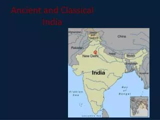
By saniAncient and Classical India. India’s Geography Indus River flows across northwest edge of Indian subcontinent —large landmass, part of a continent Home of one of ancient world’s great river valley civilizations Indian subcontinent includes three major geographic zones:
By donaghMaurya & Gupta India. Indian Monsoons. Chandragupta: 321-298 BCE. Unified northern India. Defeated the Persian general Seleucus . Divided his empire into provinces, then districts for tax assessments and law enforcement.
By shandiMaurya & Gupta India. Ms. Susan M. Pojer Horace Greeley HS Chappaqua, NY. Chandragupta : 321 BCE-298 BCE. Unified northern India. Defeated the Persian general Seleucus . Divided his empire into provinces, then districts for tax assessments and law enforcement.
By lokiView International trade routes PowerPoint (PPT) presentations online in SlideServe. SlideServe has a very huge collection of International trade routes PowerPoint presentations. You can view or download International trade routes presentations for your school assignment or business presentation. Browse for the presentations on every topic that you want.

Trade Routes. Silk Road Trade Indian Ocean Trade Trans Saharan Trade. What you need to know:. Climate and location of the routes typical goods and products being traded ethnicity of people involved technology and domesticated animals making it possible
Trade Routes. Foundations – 600 CE. Silk Road. Originally as interregional trade, trade route grew during Han dynasty: 1 st -2 nd Century CE to forge alliances with non-Chinese nomads. Silk Road. Trade with China, Roman Empire, India, Middle East, Egypt
Trade Routes. Major Trade Patterns in the Eastern Hemisphere from 1000 to 1500 AD. Silk Road Trading. Where did the Silk Roads start? Where did they end? What goods came from China?. compass—used by travelers to figure out what direction they were going.
Trade Routes. Silk Road Trade Route. http://www.youtube.com/watch?v=vfe-eNq-Qyg&list=PLBDA2E52FB1EF80C9&index=9&feature=plpp_video. Sea Trade Routes. http://www.youtube.com/watch?v=a6XtBLDmPA0&feature=edu&list=PLBDA2E52FB1EF80C9. Triangular Trade. Linked Europe, Africa and the Americas
Trade Routes. Silk Road Trade Indian Ocean Trade Trans Saharan Trade. What you need to know:. Climate and location of the routes typical goods and products being traded ethnicity of people involved technology and domesticated animals making it possible
Transregional Trade Routes. The Silk Road. Silk Road. Silk Road: Connection between East and West Overland Route Named after most sought after item. Origin. Series of Roads beginning around 200 BCE Created for caravan paths in the Han Empire to exact tribute from conquests and trade.
Phoenician Trade Routes. Traders of the Mediterranean. Background on the Phoenicians. Located on the eastern coast of the Mediterranean Sea, (Lebanon) Phoenicia was not a unified state Self-rule by ~1200 BCE Most notable traders and sailors of the ancient world. Where did they go?.
Trade routes assignment. Daniel Schollie . Abbasid dynasty circa 786 – 1194 CE(Map). Abbasid Dynasty. Used Baghdad, Cairo and Cordoba to stimulate trade and industry throughout the Islamic world Created paper using Chinese methods
Ancient trade routes. The Silk road. Italy (I) after Lodi’s peace ( left ) . Treaty of Tordesillas. World map about XVI century. Africa’s map about XVII-XVIII centuries. Europe and the other world areas after middle XVIII century . 7. Europe after congress of Vienna.