Download

1 / 62
620 likes | 639 Views
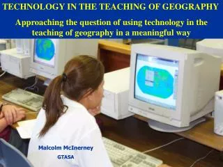
TECHNOLOGY IN THE TEACHING OF GEOGRAPHY Approaching t he question o f using technology in the teaching of geography in a meaningful way. Malcolm McInerney GTASA. Malcolm McInerney GTASA. WHAT IS TECHNOLOGY? DIFFICULT TO CLARIFY DEPENDING ON FIELD OF ENDEAVOUR!.

E N D
TECHNOLOGY IN THE TEACHING OF GEOGRAPHY Approaching the question of using technology in the teaching of geography in a meaningful way Malcolm McInerney GTASA Malcolm McInerney GTASA
WHAT IS TECHNOLOGY?DIFFICULT TO CLARIFY DEPENDING ON FIELD OF ENDEAVOUR! • Technology is often referred to a body of knowledge used to create tools, develop skills, and extract or collect materials. It is also referred to as an application to meet an objective or solve a problem.
MORE THAN JUST ARTEFACTS • 1. Response to a need and/or problem and at the centre of technology lies the design to meet the need. • 2. Technology is informed by values at every point - in relation to the rightness or wrongness of a particular solution in ethical terms. • 3. Technology is socially shaped and shaping. In this way technology is shaped by society, by consumer choice, yet it could also be argued that technology shapes society. It has become appallingly obvious that our technology has exceeded our humanity - Albert Einstein
COMPONENTS OF TECHNOLOGY • 1. Technology as objects or artefacts in the form of tools, machines, instruments, weapons, appliances. • 2. Technology as Knowledge: The know-how behind technological innovation • 3. Technology as Activities: What people do - their skills, methods, procedures, routines? • 4. Technology as a Process: Begins with a need and ends with a solution Any sufficiently advanced technology is indistinguishable from magic. - Arthur C. Clarke
CLASSROOM TECHNOLOGY: MORE THAN GIS! • Spatial Information Systems (GIS/GPS etc) • Internet interfaces and databases • Internet sites for information, views and activities • Podcasts for student use (http://www.nationalgeographic.com/podcasts/) • CD/DVD’s for student use • Electronic communication (blogging, Wiki’s)
The recent change • In recent years many geography classes have moved away from the traditional textbook approach towards the use of technology in the classroom.
Technology for the classroom “The use if ICT can profoundly alter teaching and learning, and can likewise raise new opportunities and issues” Bednarz, Rich and Robinson: 1999 • Increasingly, instead of working from a textbook, teachers are using technology in the classroom via computer use. • In the case of a computer room not being available, teachers are going to the laptop-data projector instruction approach. • Students are being set technology based tasks for homework and assignments. • Teachers are increasingly sourcing their teaching materials for lessons from the Internet and other technology resources rather than textbooks.
TECHNOLOGY AND GEOGRAPHY BEWARE OF CHANGE FOR CHANGE SAKE! Many say “If it ain’t broke why fix it!” but “Technology in geography is just what happened to the geographer, while we were busy making other plans!” Apologies to John Lennon
REASONS WHY CHANGE IS NOW POSSIBLE • Increased availability of computer technology in classrooms and at home. • Improved quality and accessibility of technological resources. • Cost of textbooks. • Sustainability of technological resources. • Difficulty to find a textbook to cover all aspects of courses. • Creative enquiry approach does not need a textbook • Data projectors and computers can be used for whole class activity • In a rapidly changing world, textbooks are often out of date before they get to the classroom
TOYS DO NOT MEAN ENGAGEMENT! If the human race wants to go to hell in a basket, technology can help it get there by jet. Charles M. Allen If it's green, it's biology, If it stinks, it's chemistry, If it has numbers it's math, If it doesn't work, it's technology - Unknown
TAKING ON THE TECHNOLOGY LEARNING CURVE AS A GEOGRAPHY TEACHER CAN BE OVERWHELMING • Curriculum support. • Academic training. • Vocational relevance. • Empowerment of learning. • Student relevance. • Achievability of the process. • Technological use. • Usefulness. • Motivational value. • Community potential. • Out of school learning. • Fun. IT MUST BE FOR MORE THAN JUST FOR THE GLAT FACTOR!!
Academic training Technologies such as GIS provide tools to develop elaborate problem solving and technical skills that are useful to Senior School and Tertiary Geography Studies. Skills that are developed in a GIS course • Develop maps of a high cartographic standard. • Discuss interdependency when exploring a geographical problem • Understand the nature of a spatial problem • Understand and apply the GIS concepts of buffering, proximity, adjacency, containment and overlayering. • Develop a strategy to investigate a spatial problem. • Create analysis of a spatial problem. • Work in groups. • Prepare and present a report associated with the problem created. • Understand the geographical concepts associated with the investigation of the spatial problem. An ability to:
Vocational relevance GIS skills are in demand in the public and private sector. The shortage is real!! • “69% of the Spatial Education Industry surveyed indicated that they had vacancies in spatial science related occupations and that these were ‘difficult’ to fill” • “…..the broader spatial information workforce numbers approximately 250,000” • “It is the recognition of the strategic importance of the industry that is driving governments around the world to invest in the skilling of the workforce.” • From the SEAC report on The Spatial Information Industry in Australia, May 2007 • Current Australian shortage of I.T. professionals – 300,000: of this number, spatial 25 percent.are not just in people who are technically skilled in GIS but it is mainly in people who can effectively apply it. • DISR, 2001. Positioning for Growth: Spatial Information Action Agenda, Canberra, AGPS.
Usefulness and community potential Technologies such as GIS encourages the use of the community for the collection of data for the purpose of addressing “real” problems in the local environment. Findon High School 2000 Recycling GIS project Winner of the 2000 University of New South Wales, Sustainable Living Competition
Empowerment of learning • Students take to technology like “ducks to water”. Needless to say that student computer literacy skills and lateral thinking are often better than teachers. • During the use of technology students begin to turn to other members of their project group for advice when they become stuck before requestingassistance. • This autonomous and independent learning is a very positive outcome for the students, preparing them well for the problem solving demands of Senior School Geography.
Motivational value Students can be motivated by: • Real and relevant projects using a technology they understand and appreciate. • Practical fieldwork out of school. • Aerial photographs of their area. • Recognition from community groups and the school for their meaningful work.
Factors of greatest impediment rating • Insufficient funds at school. • Access to school computers. • Software too expensive. • Limited IT support at school. • Factors of moderate impediment rating • Insufficient computing capacity at school. • School release and access to training. • Cost of data. • Factors of low impediment rating • No support at school. • Limited computers at school. • Training too expensive. • Other impediments to the introduction of ICT into schools placed in order of frequency of response: • Timetabling so as to access rooms • Time • Lack of general IT skills amongst teachers • Geographical and spatial understandings and skills do not always have priority WHAT IS STOPPING US? IMPEDIMENTS TO IMPLEMENTATION: A TEACHER PERSPECTIVE
Approaching the question of methodology using technology in the classroom • The need to create a philosophical and intellectual framework around the use of GIS in the curriculum. • To shift the emphasis from discussing GIS as a thing to do, to a focus on an awareness of spatial learning and the role of GIS in enhancing our efforts to develop student spatial cognition and perceptions.
Issues associated with GIS • Equity Issues: Who has access to the technology? • Vocational Issues: How does the technology vocational option or pathway? • Curriculum Issues: The place of technology in the geography curriculum and beyond? • Future Issues: How can the System resource and support the implementation of technology in the future?
An integrated approach to the model • Components: • Skills • Context • Application • Understandings Core business: Spatial literacy • Related outcomes: • Lifeskills • Fieldwork • ICT • Group skills • Community • Vocational • Fun Spatial literacy
Spatial Literacy: Everything is somewhere! • Spatial thinking is the ability to understand spatial relationships, the knowledge of how geographic space is represented, and the ability to reason and make key decisions about spatial concepts. • Words are only one way of symbolizing ideas. Numbers, pictures, graphs, maps, diagrams, photographs, and other means are also used to convey information. Researchers refer to notational systems such as graphs, diagrams, and maps as "inscriptions." Inscriptions are tools that help people to perceive and to talk about spatial worlds. Spatial literacy is embedded in nearly every discipline in the school curriculum, including mathematics, social studies, science, and the arts.
The proliferation of 3D games, flight simulators and use of Google Earth are just some examples of how our young people are growing up using tools and environments that challenge them to think spatially. SPATIAL LITERACY: WHEREVER YOU GO, THERE YOU ARE!
Spatial thinking, defined by US educators as the knowledge, skills, and habits of mind to use concepts of space, tools of representation, and processes of reasoning to structure problems, find answers, and express solutions to these problems, is coalescing across disciplines as a significant area of research, advocacy, and outreach.
Core business: Spatial Literacy Perceptions involving: • Location of features. • Identification and location of environments. • Distance and depth of features and environments. • Distance between features and environments. • Vertical and horizontal interactions at localities and between localities. • Distribution patterns and trends within identified localities and across environments. • Interdependencies of features and environments and the multiplicity of cultural and human features at a particular location interplaying and interacting with each other. • Appreciation of: • Changes across space that occur over time. • The diversity of environments across space. • The relationships between places and landscape features. • The transition and changes in environments across space. • The reasons for the relative location of features and environments.
Spatial literacy involves the ability to: • Describe the relative location of features and environments. • Estimate distance and depth. • Analyse interdependencies between places and environments. • Discuss and analyse the reasons for the relative location of features and environments. • Identify and describe spatial trends, patterns, correlations and overall relationships betweenplaces and places, places and environments and between environments. • Spatial literacy understandings • Distance and depth • Location of features and environments • Vertical and horizontal spatialinteractions • Relative location • Distribution patterns • Locational reasoning • Change over space and time • Interdependencies • Spatial correlation
http://blog.core-ed.net/derek/2006/04/thinking_spatially.htmlhttp://blog.core-ed.net/derek/2006/04/thinking_spatially.html A geographic information system mirrors many of the functions and operations of spatial thinking. A GIS can serve as one means of support for spatial thinking and as a model for exemplifying the challenges and ways of incorporating spatial thinking into K–12 education.
To enhance the development of spatial literacy there is a need to create a philosophical and intellectual framework around the use of the technology advocated as the tools for the classroom i.e. GIS. • To shift the emphasis from discussing the use of technology in subjects such as geography as a thing to do, to a focus on an awareness of the type of learning and the role of technology in enhancing our efforts to develop student spatial cognition and perceptions (spatial literacy). • . Approaching the question of methodology using technology in the classroom
There is a need to ensure any use of technology in the classroom is used to broaden experience, communicate, develop resources access skills, to acquire knowledge and to create informed discussion. The updated technology does not mean the teaching will be better! AVOIDING THE COPY AND PASTE SYNDROME!!
Technology can be used for knowledge consolidation and creative enquiry • There is a danger that the use of technology in the classroom could just become another “busy tool” to occupy students for the purpose of “crowd control”. • To avoid the mis-use of technology we need to have a debate about the reason why we have introduced technology into the classroom.
The “Creative enquiry” approach using technology. • Is the application of technology in the classroom about the consolidation of knowledge or is it about creative enquiry? Both are quite valid but the great variety of resources available via technology is particular conducive to the creative enquiry approach. • The use of technology in the classroom can provide the means and medium to explore, discuss and possibly resolve societal issues and problems .
A problematic approach During the application of such an approach students will have the opportunity to: • Develop a problem/issue to explore. • Collect primary and secondary data via technology. • Decide on the type of presentation. • Conduct analysis, identifying trends and patterns. • Draw conclusions and future recommendations.
AN EXAMPLE OF USING TECHNOLOGY FOR CREATIVE ENQUIRY • For the purpose of this presentation we will focus on the use of spatial technology to demonstrate the creative enquiry approach. Appeasement CarYards Virtual Tourism Suburban heritage Explorers Heritage Heritage World population Human Rights Urban morphology Local demographics Earthquakes
SOME CREATIVE ENQUIRIES • Where in the local area would the Environmental Health be the best? • Where would be the best location in the local area for a family (mother, father, two boys and a girl) with the following requirements to build their house? To be near a primary and high school, public transport to the city, park for jogging, gym and football club and shopping facilities. • Would the facilities provided be better in a high socio-economic area than those offered in a lower socio-economic. • Are the rubbish bins appropriately placed around the school? Are they placed to optimise collection? • What are the Football team allegiances across the local Council area? • How do streetscapes differ between Socio-economic areas and what can be done to improve the aesthetic appeal of a suburban area? Maps to be developed that show ratings of aesthetic appeal in buffer zones across the region.
LET’S CHECK OUT THE TECH SCENEWHAT’S AVAILABLE? CD provided at the GTANSW conference for individual teacher use. Available (see paperwork) as school license for network installation and copying.
Issues associated with GIS • Equity Issues: Who has access to the technology? • Vocational Issues: How does the technology provide a vocational option or pathway? • Curriculum Issues: The place of technology in the geography curriculum and beyond? • Future Issues: How can the System resource and support the implementation of technology in the future?
TOP TEN TIPS: OVERCOMING TECH ANXIETYTO INTRODUCE 2007 TECHNOLOGY INTO YOUR CLASSROOM
TIP 1: TRUST THE STUDENTS Don’t be afraid to let your students work with the technology and take you with them.
TIP 2: TAKE SMALL STEPS AT A TIME A step by step skill development process avoids technological indigestion! The GIS skill development process
TIP 3: EXPLORE KEY WEBSITES For example the site http://edcommunity.esri.com/ just keeps going and growing the more you look.
TIP 4: REGISTER ON TECHNOLOGY INFORMATION SITES www.gtasa.asn.au StOzEd Spatial Technology on-line community via StOzEd (Spatial Technologies OZ Educators) teacher network which aims to. create email information and a chat facility on GIS for Australian teachers.
TIP 6: ATTEND TRAINING OPPORTUNITIES There are plenty of training opportunities provided by ESRI Australia which helps you to negotiate the technological learning curve.
Concluding statements Generally it is now recognised that technologies such as the Internet and GIS are wonderful tools for teachers in schools to use to create and deliver new and exciting learning experiences and pathways for students. However we must now go beyond the “wow” or GLAT stage of implementing technology into the classroom and honestly and realistically examine why we want to use such technology and how we will use it in the future. Such methodology and pedagogical discussions are imperative if tecnology is to be more than just classroom entertainment.