Download
1 / 31
310 likes | 458 Views
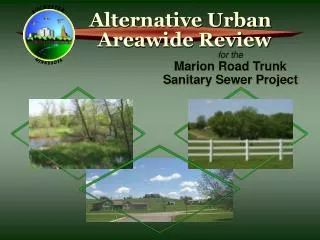
for the Marion Road Trunk Sanitary Sewer Project. ROCHESTER,. MINNESOTA. Alternative Urban Areawide Review. Welcome!. The information presented here is also provided in more detail in your fact sheet packets, and at the five information stations where you can inspect more detailed maps.

E N D
for theMarion Road TrunkSanitary Sewer Project ROCHESTER, MINNESOTA Alternative Urban Areawide Review
Welcome! The information presented here is also provided in more detail in your fact sheet packets, and at the five information stations where you can inspect more detailed maps. Staff will be present to answer questions and receive comments.
You Are Invited • Visit the information stations provided at this meeting and review the large-scale maps • Discuss your ideas and concerns with staff and TAC members present tonight • Leave your comments on the sign-in table OR • Review your fact sheets, absorb tonight’s information, and return your comment card by mail • Monitor the AUAR web site for updates • Contact Barb Huberty (see the fact sheets)
Introduction • The Minnesota Pollution Control Agency (MPCA) asked the City to conduct a type of environmental review known as an Alternative Urban Areawide Review, or AUAR. Accordingly, the City is the Responsible Governmental Unit for this AUAR. • The AUAR will identify potential environmental impacts from future development that may occur as a result of the Marion Road Trunk Sanitary Sewer extensions to serve the City’s Urban Service and Urban Reserve Areas.
The Purpose of This Open House • Share results of the natural and cultural resource inventories • Describe how these features may restrict future development • Describe the proposed development scenario and project area boundary before submittal to the City Council • Obtain public input on work completed to date
Opportunities for Public Input Interested parties are encouraged to share their environmental concerns; input from many perspectives is needed. PUBLIC INPUT OPPORTUNITIES • Technical Advisory Committee (TAC) meetings • Public open houses (11/1/01 and when the draft AUAR and Mitigation Plan are ready) • 30-day public comment period to provide input on the submitted draft AUAR and Mitigation Plan* • Call, write or e-mail Barb Huberty * This is the only time the rules require public input.
What Is An AUAR? Station 1 • A type of environmental review that assesses potential cumulative environmental impacts over broad geographic area. • It will include a Mitigation Plan that identifies methods to avoid, minimize, and/or mitigate unacceptable environmental impacts as future development occurs. • The AUAR is independent of annexation or utility connection issues.
Proposed Project Boundary The project area is based on the theoretical maximum capacity of the sewer lines and the expected development densities.
Advantages of an AUAR • Evaluates environmental impacts for larger areas instead of on a project-by-project basis. • Increases awareness of environmental issues prior to development. • Provides more consistency in addressing environmental issues during the development process. • Potentially eliminates the need for some types of environmental reviews if future developments are consistent with AUAR.
Steps In AUAR Process • Identify the project boundary and describe the expected development densities (“development scenario”) that are consistent with adopted land use plans. • Prepare the draft AUAR, assessing potential environmental impacts based on the development scenario. • Prepare the draft Mitigation Plan, describing ways to avoid, minimize, and/or mitigate potential unacceptable environmental impacts. (continued)
Steps In AUAR Process (continued) • Obtain public comments. • Prepare and distribute the final AUAR and Mitigation Plan that addresses public comments. • City adopts AUAR and Mitigation Plan if no objections are filed by any state agency. • On-going oversight by responsible agencies to assure conformance with the AUAR and Mitigation Plan. • Regular (minimum 5-year) AUAR updates.
Projected AUAR Timeline • Early November 2001 - Open House • Early January 2002 - “Order for Review” presented to City Council for adoption • Early January 2002 - TAC review of draft AUAR and Mitigation Plan • Late January 2002 - Draft AUAR and Mitigation Plan public open house (continued)
Projected AUAR Timeline (continued) • Mid-February 2002 - Draft AUAR and Mitigation Plan distributed (30-day public comment period) • Late March 2002 - Final AUAR and Mitigation Plan) distributed • Mid-April 2002 - City Council Adopts AUAR and Mitigation Plan • October 2006 - Start 5-year AUAR review cycle
Traffic Station 2 • Roads and intersections are being analyzed to assess existing traffic flows and predict future traffic constraints so that appropriate roadway improvements are planned for and implemented as development occurs. • Air quality impacts related to traffic will also be assessed as the AUAR report is developed.
Sanitary Sewer Station 2 Existing and planned sanitary sewer extensions for Sewer Service Area 16.
Natural and Cultural Resource Inventory Station 3 Identify natural and cultural resources in the project area, including: • Watershed boundaries • Natural communities • State listed plants and animals • Biologically significant sites • NWI wetlands and wetland indicator soils • 100- and 500-year floodplains, floodways (continued
Natural and Cultural Resource Inventory (continued) • Springs and seeps • Sinkholes • Slopes • Uppermost bedrock unit • Aggregate (sand and gravel) mines and resources • Recorded cultural sites • Areas of moderate and high archaeological potential • Potential historic/architectural sites/areas
Constraint Mapping Station 4 • After inventorying the natural and cultural features, they were evaluated to see how they might “constrain” or limit future development. • The following ranking system was used:
Levels of Constraint • Level 1 (High) • Areas with the highest level of constraint, due to very restrictive regulatory criteria: • Will likely preclude residential and commercial development • Level 2 (Moderate) • Areas with a moderate level of constraint, due to less restrictive regulatory criteria: • Will likely affect the density of residential and commercial • development • Mitigation is frequently required for impacting many of these • features • Level 3 (Low) • Areas with a low level of constraint, due to the absence of regulatory criteria: • Are not likely to preclude residential and commercial development • These areas could be more densely developed
Features with High Level of Constraint on Development • Existing Roads • Water Features (rivers, streams, lakes) • Existing Parkland • Floodways • Slopes >18% in shoreland zoning area • Slopes > 26% in all areas • “Endangered” plant or animal sites • Developed parcels
Features with Moderate Level of Constraint on Development • 100-year floodplain (other than floodways) • Flood-prone areas (as indicated by floodplain soils) • NWI mapped wetlands and wetland indicator soils • Slopes 18 to 25% • Transitional lands adjacent to existing large lot development • Spring/seep locations • “Threatened” plant or animal locations • Sinkholes
Features with Low Level ofConstraint on Development • 500-year floodplain • Lowland hardwood forest • Oak forest • Oak savanna or woodland • Known or likely prairie remnants • Grassland/old pasture with possible prairie remnants • Shrub land with possible prairie remnants • Depth to bedrock • Lands where it is economically not feasible to extend infrastructure (roads, sewers, etc.)
“Flagged” Features Some environmental features that had a low level of constraint were “flagged” so the City can consider alternative measures to protect or enhance these features that are currently unregulated. These “stewardship opportunities” may be non-regulatory measures or recommendations for future controls.
Flagged Features forStewardship Consideration • Areas of outstanding, high, and moderate biodiversity significance • “Special concern” plant and animal locations • Areas with high or moderate archaeological potential • Potential historic/architectural sites/areas • Aggregate (sand and gravel) resources • Decorah shale and Decorah edge areas
Sample “Stewardship Opportunities” • Establish buffers around unique features or habitat remnants • Promote cluster development • Control invasive species to preserve remaining habitats • Improve or expand native communities or habitat • Obtain conservation easements to permanently preserve tracts of land • Maintain connectivity via potential “greenway” development
The Development Scenario Station 5 Once the development constraints are known, the required hypothetical development scenario for the project area can be determined so that cumulative environmental impacts can be evaluated. • The anticipated types and density of allowable residential and other development are described. • The potential future development is quantified in terms of housing units and non-residential square footage. (continued)
The Development Scenario (continued) • Must be consistent with existing land use plans. • Considers the highest reasonable and feasible density that could occur in an area.
Drafting the Development Scenario • Inventory natural and cultural features • Map existing land use patterns • Rank features to reflect the level of constraint to development • Map a composite of the high and moderate constraints • Assign development types and densities to developable areas to calculate an overall development scenario
The Development Scenario The draft hypothetical development scenario proposed for the project area is primarily low-density residential with an overall average of three residential units per gross acre.
What’s Next? • Begin preparation of the draft AUAR report and Mitigation Plan • Further discussions regarding stewardship opportunities • Bring development scenario and project area to City Council for adoption
THANK YOU FOR YOUR INTEREST AND PARTICIPATION At this time, we will break so you can leave to visit the information stations or you may stay here to ask questions and provide comments. Attached to the fact sheet packet, you will find responses to “Commonly Asked Questions.”