Download
1 / 20
200 likes | 224 Views
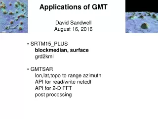
Applications of GMT David Sandwell August 16, 2016. SRTM15_PLUS blockmedian, surface grd2kml GMTSAR lon,lat,topo to range azimuth API for read/write netcdf API for 2-D FFT post processing. Soundings used in SRTM15/30_PLUS multibeam, singlebeam, grids,. Data Sources. multi-beam

E N D
Applications of GMT David Sandwell August 16, 2016 • SRTM15_PLUS • blockmedian, surface • grd2kml • GMTSAR • lon,lat,topo to range azimuth • API for read/write netcdf • API for 2-D FFT • post processing
Soundings used in SRTM15/30_PLUS multibeam, singlebeam, grids, . . .
Data Sources multi-beam soundings predicted from satellite gravity single-beam soundings
JJ Becker wrote most of this code if ($#argv < 3) then echo " " echo " example: `basename $0` median.xyz surfaceOpts unmasked.grd" echo " " exit endif set bxyz = $1; shift set out = $1; shift set opts = "$*" #/bin/rm -rf *out.grd # set B1 = -180./180./58./90.; set B2 = -180./180./28./62.; set B3 = -180./180./-2./32.; set B4 = -180./180./-32./02.; set B5 = -180./180./-62./-28.; set B6 = -180./180./-90./-58.; # set C1 = -180./180./60./90.; set C2 = -180./180./30./60.; set C3 = -180./180./00./30.; set C4 = -180./180./-30./00.; set C5 = -180./180./-60./-30.; set C6 = -180./180./-90./-60.; # # make the blend file # echo B1.grd -R$C1 1 > blend.txt echo B2.grd -R$C2 1 >> blend.txt echo B3.grd -R$C3 1 >> blend.txt echo B4.grd -R$C4 1 >> blend.txt echo B5.grd -R$C5 1 >> blend.txt echo B6.grd -R$C6 1 >> blend.txt # # do all the subgrids # # 1 # echo $bxyz -V -fg -bid -I15c -A0.5 -R$B1 $opts -GB1$out blockmedian $bxyz -I15c -bid -bod -R$B1 -V > B1.xyz surface B1.xyz -V -fg -bid -I15c -A.50 -Ll-800 -Lu800 -R$B1 $opts -GB1.grd # # # 2 # echo $bxyz -V -fg -bid -I15c -A.707 -R$B2 $opts -GB2$out blockmedian $bxyz -I15c -bid -bod -R$B2 -V > B2.xyz surface B2.xyz -V -fg -bid -I15c -A.707 -Ll-800 -Lu800 -R$B2 $opts -GB2.grd # # 3 # echo $bxyz -V -fg -bid -I15c -A.966 -R$B3 $opts -GB3.grd blockmedian $bxyz -I15c -bid -bod -R$B3 -V > B3.xyz surface B3.xyz -V -fg -bid -I15c -A.966 -Ll-800 -Lu800 -R$B3 $opts -GB3.grd # # 4 # echo $bxyz -V -fg -bid -I15c -A.966 -R$B4 $opts -GB4.grd blockmedian $bxyz -I15c -bid -bod -R$B4 -V > B4.xyz surface B4.xyz -V -fg -bid -I15c -A.966 -Ll-800 -Lu800 -R$B4 $opts -GB4.grd # # 5 # echo $bxyz -V -fg -bid -I15c -A.707 -R$B5 $opts -GB5.grd blockmedian $bxyz -I15c -bid -bod -R$B5 -V > B5.xyz surface B5.xyz -V -fg -bid -I15c -A.707 -Ll-800 -Lu800 -R$B5 $opts -GB5.grd # # 6 # echo $bxyz -V -fg -bid -I15c -A.50 -R$B6 $opts -GB6.grd blockmedian $bxyz -I15c -bid -bod -R$B6 -V > B6.xyz surface B6.xyz -V -fg -bid -I15c -A.50 -Ll-800 -Lu800 -R$B6 $opts -GB6.grd # # now blend all the files together # grdblend blend.txt -G$out -R-180/180/-90/90 -fg -I15c -V
Applications of GMT • SRTM15_PLUS • blockmedian, surface • grd2kml • GMTSAR • lon,lat,topo to range azimuth • API for read/write netcdf • API for 2-D FFT • post processing
grd2kml with help from Joaquim #!/bin/csh –f # unset noclobber # # script to convert a grd file to a kml file for Google Earth # if ($#argv < 2 || $#argv > 3) then echo " " echo "Usage: grd2kml.csh grd_file_stem cptfile [-R<west>/<east>/<south>/<north>] " echo " " echo "Example: grd2kml.csh phase phase.cpt " echo " " exit 1 endif # # set DX = `gmt grdinfo $1.grd -C | cut -f8` set DPI = `gmt gmtmath -Q $DX INV RINT = ` #echo $DPI gmt set COLOR_MODEL = hsv gmt set PS_MEDIA = letter # gmt grdgradient $1.grd -Ggrad.grd -V -Nt0.7 -A60 if ($#argv == 3) then gmt grdimage $1.grd -Igrad.grd -C$2 $3 -Jx1id -P -Y2 -X2 -Q -V > $1.ps else if ($#argv == 2) then gmt grdimage $1.grd -Igrad.grd -C$2 -Jx1id -P -Y2 -X2 -Q -V > $1.ps endif # # now make the kml and png # gmt ps2raster $1.ps -W+k+t"$1" -E$DPI -TG -P -S -V -F$1.png rm $1.ps rm grad.grd rm ps2raster* rm psconvert* #
Applications of GMT • SRTM15_PLUS • blockmedian, surface • grd2kml • GMTSAR • lon,lat,topo to range azimuth • API for read/write netcdf • API for 2-D FFT • post processing
Applications of GMT • SRTM15_PLUS • blockmedian, surface • grd2kml • GMTSAR • lon,lat,topo to range azimuth • API for read/write netcdf • API for 2-D FFT • post processing
dem2topo_ra.csh – Matt Wei if ($#argv < 2) then echo " " echo "Usage: dem2topo_ra.csh master.PRM dem.grd" echo " ” endif # set PRF = `grep PRF *.PRM | awk 'NR == 1 {printf("%d", $3)}'` # # use SAT_llt2rat # gmt grd2xyz --FORMAT_FLOAT_OUT=%lf $2 -s | SAT_llt2rat $1 1 -bod > trans.dat # # use an azimuth spacing of 2 for low PRF data such as S1A TOPS # if ($PRF < 1000) then gmt gmtconvert trans.dat -o0,1,2 -bi5d -bo3d | gmt blockmedian -R0/$XMAX/0/$YMAX -I$rng/2 -bi3d -bo3d -r -V > temp.rat gmt surface temp.rat -R0/$XMAX/0/$YMAX -I$rng/2 -bi3d -T.50 -N1000 -Gpixel.grd -r -V else gmt gmtconvert trans.dat -o0,1,2 -bi5d -bo3d | gmt blockmedian -R0/$XMAX/0/$YMAX -I$rng/4 -bi3d -bo3d -r -V > temp.rat gmt surface temp.rat -R0/$XMAX/0/$YMAX -I$rng/4 -bi3d -T.50 -N1000 -Gpixel.grd -r -V endif # # flip top to bottom for both ascending and descending passes # gmt grdmath pixel.grd FLIPUD = topo_ra.grd # # plotting # gmt grd2cpt topo_ra.grd -Cgray -V -Z > topo_ra.cpt gmt grdimage topo_ra.grd $scale -X0.2i -P -Ctopo_ra.cpt -V > topo_ra.ps #
Applications of GMT • SRTM15_PLUS • blockmedian, surface • grd2kml • GMTSAR • lon,lat,topo to range azimuth • API for read/write netcdf • API for 2-D FFT • post processing
# include "gmtsar.h" # include "sbas.h" int main(int argc, char **argv) { /* Begin: Initializing new GMT5 session */ if ((API = GMT_Create_Session (argv[0], 0U, 0U, NULL)) == NULL) return EXIT_FAILURE; /* reading in the table files */ read_table_data_ts(API,infile,datefile,gfile,cfile,H,bperp,flag,var,phi,S,N,xdim,ydim,&Out,L,time); for (i=0;i<N;i++) { if ((CC = GMT_Read_Data (API, GMT_IS_GRID, GMT_IS_FILE, GMT_IS_SURFACE, GMT_GRID_HEADER_ONLY, NULL, cfile[i], NULL)) == NULL) die("Can't open ",cfile[i]); xin = CC->header->nx; yin = CC->header->ny; if (xin != xdim || yin != ydim) die("dimension don't match!",cfile[i]); if ((GG = GMT_Read_Data (API, GMT_IS_GRID, GMT_IS_FILE, GMT_IS_SURFACE, GMT_GRID_HEADER_ONLY, NULL, gfile[i], NULL)) == NULL) die("Can't open ",gfile[i]); xin = GG->header->nx; yin = GG->header->ny; if (xin != xdim || yin != ydim) die("dimension don't match!",gfile[i]); if ((CC = GMT_Read_Data (API, GMT_IS_GRID, GMT_IS_FILE, GMT_IS_SURFACE, GMT_GRID_DATA_ONLY, NULL, cfile[i], CC)) == NULL) die("Can't read ",cfile[i]); if ((GG = GMT_Read_Data (API, GMT_IS_GRID, GMT_IS_FILE, GMT_IS_SURFACE, GMT_GRID_DATA_ONLY, NULL, gfile[i], GG)) == NULL) die("Can't read ",gfile[i]); corin = CC->data; grdin = GG->data; for (k=0;k<ydim;k++) { for (j=0;j<xdim;j++) { phi[i*xdim*ydim+ydim*j+k] = grdin[j+k*xdim]; if (isnan(grdin[j+k*xdim]) != 0) { flag[j+xdim] = 1; } if (corin[j+k*xdim]>=1e-2 && corin[j+k*xdim]<=0.99) { /* Rosen et al., 2000 IEEE */ var[i*xdim*ydim+ydim*j+k] = sqrt((1.0-corin[j+k*xdim]*corin[j+k*xdim])/(corin[j+k*xdim]*corin[j+k*xdim])); } else if (corin[j+k*xdim]<1e-2) { var[i*xdim*ydim+j*ydim+k] = 99.99; } else { var[i*xdim*ydim+j*ydim+k] = 0.1; } } } /* write output */ write_output_ts(API,Out,argc,argv,xdim,ydim,S,flag_rms,flag_dem,disp,vel,res,dem); sbas.c – Xiaopeng Tong
Applications of GMT • SRTM15_PLUS • blockmedian, surface • grd2kml • GMTSAR • lon,lat,topo to range azimuth • API for read/write netcdf • API for 2-D FFT • post processing
filter.csh – various # # form amplitude image # echo "making amplitude..." gmt grdmath realfilt.grd imagfilt.grd HYPOT = amp.grd gmt grdmath amp.grd 0.5 POW FLIPUD = display_amp.grd # # form the correlation # echo "making correlation..." gmt grdmath amp1.grd amp2.grd MUL = tmp.grd gmt grdmath tmp.grd $thresh GE 0 NAN = mask.grd gmt grdmath amp.grd tmp.grd SQRT DIV mask.grd MUL FLIPUD = tmp2.grd=bf conv 1 1 $filter3 tmp2.grd=bf corr.grd # # form the phase # echo "making phase..." gmt grdmath imagfilt.grd realfilt.grd ATAN2 mask.grd MUL FLIPUD = phase.grd # # make the Werner/Goldstein filtered phase # echo "filtering phase..." phasefilt -imag imagfilt.grd -real realfilt.grd -amp1 amp1.grd -amp2 amp2.grd -psize 16 gmt grdedit filtphase.grd `gmt grdinfo mask.grd -I- --FORMAT_FLOAT_OUT=%.12lg` gmt grdmath filtphase.grd mask.grd MUL FLIPUD = phasefilt.grd rm filtphase.grd # # form the phase gradients # echo "making phase gradient..." gmt grdmath amp.grd 2. POW = amp_pow.grd gmt grdmath realfilt.grd ximag.grd MUL imagfilt.grd xreal.grd MUL SUB amp_pow.grd DIV mask.grd MUL FLIPUD = xphase.grd gmt grdmath realfilt.grd yimag.grd MUL imagfilt.grd yreal.grd MUL SUB amp_pow.grd DIV mask.grd MUL FLIPUD = yphase.grd # # make the custom filter2 and set the decimation # make_gaussian_filter $1 $dec_rng $az_lks $3 > ijdec set filter2 = gauss_$3 set idec = `cat ijdec | awk -v dc="$dec" '{ print dc*$1 }'` set jdec = `cat ijdec | awk -v dc="$dec" '{ print dc*$2 }'` echo $filter2 $idec $jdec # # filter the two amplitude images # echo "making amplitudes..." conv $az_lks $dec_rng $filter1 $1 amp1_tmp.grd=bf conv $idec $jdec $filter2 amp1_tmp.grd=bf amp1.grd rm amp1_tmp.grd conv $az_lks $dec_rng $filter1 $2 amp2_tmp.grd=bf conv $idec $jdec $filter2 amp2_tmp.grd=bf amp2.grd rm amp2_tmp.grd # # filter the real and imaginary parts of the interferogram # also compute gradients # echo "filtering interferogram..." conv $az_lks $dec_rng $filter1 real.grd=bf real_tmp.grd=bf conv $idec $jdec $filter2 real_tmp.grd=bf realfilt.grd conv $dec $dec $filter4 real_tmp.grd xreal.grd conv $dec $dec $filter5 real_tmp.grd yreal.grd rm real_tmp.grd rm real.grd conv $az_lks $dec_rng $filter1 imag.grd=bf imag_tmp.grd=bf conv $idec $jdec $filter2 imag_tmp.grd=bf imagfilt.grd conv $dec $dec $filter4 imag_tmp.grd ximag.grd conv $dec $dec $filter5 imag_tmp.grd yimag.grd rm imag_tmp.grd rm imag.grd
Challenges of GMT Conversion of scripts from GMT4 to GMT5. Need simple examples. gmt grdvector GPS_u.nc GPS_v.nc -Ix15/20 -J $R -O -K -Q0.06i+e+n0.03i -Gblack -W.6,black -S1.i --MAP_VECTOR_SHAPE=0.2 >> map_uv.ps When I kill a job sometimes a gmt keeps running forever. Some scripts are in inches and some in cm. Yes my problem!!!! I don’t understand the gmt.conf file. Need examples.