Download
1 / 30
300 likes | 513 Views
BERGEN AND THE BERGEN RAILWAY Arild Holt-Jensen. Drammen 24.11.09. Bergen a short history (Not Hansa town!?) Strategic development planning in Hordaland county Master plan for Bergen Sosial geography of Bergen, strategies to combat sosial exclusion Urban sprawl or condensed city?

E N D
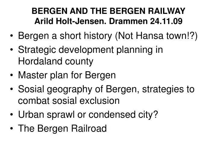
BERGEN AND THE BERGEN RAILWAYArild Holt-Jensen. Drammen 24.11.09 • Bergen a short history (Not Hansa town!?) • Strategic development planning in Hordaland county • Master plan for Bergen • Sosial geography of Bergen, strategies to combat sosial exclusion • Urban sprawl or condensed city? • The Bergen Railroad
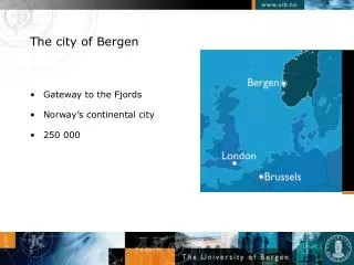
Bergen • Bergen is a medieval town founded by King Olav Kyrre ca 1070. • In 12th century Hansa Town Lübeck established a ’colony’ at Bryggen for trading fish from North Norway with grains and other goods. • Bergen was never a Hanseatic town in the sense that the Hansa merchants ruled the town, but ’Bryggen’ somehow lived its own life, often in conflict with the Danish-Norwegian kings’ representatives at the fortress. • Bergen was up to 1850 the largest town in Norway, not because of its local ’hinterland’, but due to its position as a ’trading post’ on the main ’North Way’: the sailing route along the coast. • When railway and roads became the main transport arteries Bergen lost growth impetus; Oslo got a spiderweb of railway lines and roads. • Bergen got one rail connection in 1909 to Oslo, a technical wonder of that times, but still often stopped by avalanches etc in winter. • Road connection without ferries is only some 20 years old • Oslo have more than 800 000 inhabitants, Bergen started with fast growth again in 1990s and now has ca 250 000 inhabitants; one reason is its maritime industries and oil development, still the SEA in focus!
TRADE ROUTES DOMINATED BY THE HANSA FROM 1300
Bergen: a Hansa town? No, not really, Bryggen was a ’colony’ under Lübeck but the town was ruled by the Norwegian magistrate • Founded by King Olav Kyrre more than 900 years ago.(1070) • But the Hansa traders settled at Bryggen (German Contoir) which had privelege on fish trade from North Norway. All stockfish had to be brought to Bergen and traded there.
Bergen 1864 almenning: open space to stop fires from spreading
Bergen central town area (right) damaged by fire 1915 and rebuilt by ’modern planning’(left)
Strategic development planning in NORWAY • Aim to have both economic growth, environmental sustainability and social welfare/equality • Norway has a periferal location and onesided economy; strength in large sea areas and abundant energy resources • Very open economy due to small population and dependence on trade • Limited value of free movement of capital!? • Consession Laws to secure national control of natural resources (in conflict with EU rules) at stake? • Unemployment almost non existent (compared to rest of Europe 2009) • A rural bias in regional policies
Bergen as the locomotive of development or a ’parasite’ on the production in the ’hinterland’? • More importance placed recently on the Norwegian city regions and their competition internationally with London, Hamburg etc. • But politically still strong forces fighting for the outskirts, the rural values and countryside • Knarvik, the ’urban center’ of Nordhordland was in 1960s picked out as ’growth pole’ for Hordaland in time when restrictions on growth in the cities were in force. Policies have now changed somewhat
The county and municipalities have introduced strategic economic planning in addition to municipal master plans
Strategic Development plan for Hordaland county • Aims: Integrated industrial policy for the whole county • Understand coming challenges • Construct goal-oriented mechanism to make possible to guide industrial development in collaboration with local authorities and private • Make existing regional policies more effective PLAN to consist of LONG TERM STRATEGY and PROGRAMME OF ACTION
Results of SWOT analyses • Weaknesses: Uncompetitive land transportation. Sea and air connections OK. .Lack of equity capital. Raw material exports mainly. Lack of intersector cooperation • Strengths: Energy resources of hydropower, oil, gas. Nice environment. Broad industral base. Fisheries, aquaculture, tourist facilities and attractions. Bergen as educational center and innovative international trading spirit, particularly embedded in the maritime sector.
Oppor-tunities and threats are to a large extent connected to transport situation
ONE HOUR COMMUTING ZONES AROUND BERGEN ENLARGED VERY MUCH DUE TO BETTER ROADS 1950-2005!
BERGEN MASTER PLAN • First regional planning for Bergen and surroundings 1957 • In 1971 Bergen city was amalgamated with 4 surrounding municipalities. Fana (south), Laksevåg (west), Åsane(north) and Arna (east) and became very large in area. • Now suburban development continued west (Fjell), south (Os), north (Lindås and Meland) and also to the east. • Now look at Bergen Master plan 2006- 2017.
On the top of Ulriken 650 m. a.s.level in the middle of Bergen Town!’It is like flying,’ said Pärnu College graduate Galina Dobronogova, our Russian-Estonian translator at field courses in Pärnumaa
Bergen: Life between the mountains • 1997: The first social geographic comprehensive investigation of the town: some parts of the townhad worse living conditions for the population than other by quantitative measures. BUT: the 12 city parts too crude to show essentials • Within each city part there were large internal differences and NOT an East End and a West End as in Oslo • The investigation 2008 used a much finer grain geographical division, but even this is not ’fine grain’ enough! • Is percentage of ’immigrants’ relevant as one indicator of ’living standard’? Not as part of a joint index on living standard, but important for actions on social integration.
LODDEFJORD- problem area?? • ’Happiness also in Loddefjord’ (Elisabeth Johnsen) • Studies show that Loddefjord in general is good today, the way living standard is measured does not give the final answer ’Life standard’ – ’living standard’. Income averages not necessarily best measure. • Loddefjord project – local police – Housing cooperati- ves have done a lot – Centre with ’bathing land’- Ice skating facilities attract people from whole of Bergen
Løvstakksiden needs initiatives • ’Shadow side’ in contrast to Kalfaret sunny side of the Bergen valley • But also inside Løvstakksiden large differences, not problem area all through! • Main problem is the concentration of public social housing. • These types of housing should have been spread more over the whole city, including 10 % in the coops and with small exclusive public social housing units mixed in middle class areas. Social mix in each school intake area
Studies of areas of social mix • MA- research Frønsdal (2006) showed: • The main contribution we can give so that social problems are not inherited from ’social problematic parents’ to next generation is THAT CHILDREN FROM DIFFERENT SOCIAL STRATA attend THE SAME CHILDREN’S SCHOOL ! THIS MEANS THAT PUPILS HAVE TO ATTEND THE NEIGHBOURHOOD SCHOOOL. The parents should not be able to CHOOSE the school they want their children to attend! • The common local public school is crucial!! But a matter of political debate between right wing and left wing parties
Challenges in Norwegian housing sector • Resource demanding housing culture • High consumption of space, energy and materials • Social trends (decreasing household size) • Lifestyle and leisure time habits • High costs • Poor housing quality in cities • Segregated urban areas – marginalization of groups • Few opportunities for innovative thinking • Conservative building industry • Lack of will and/or competence? • Liberalized housing marked • Lack of public government, policy instruments
Sustainable urban development must not impose negative effects on urban, natural and social environment while being implemented in the most efficient way, i.e. consuming the least possible volume of resources Urban sprawl is unplanned, uncontrolled and uncoordinated development with single-purpose land use, where the use of land is functionally not related to the surrounding land use, and which is expressed in low density, strip-shaped, scattered or isolated distribution of settlement (Carruthers, 2003) Sustainable urban development or Urban Sprawl
Urban sprawl in Tallinn area: New residential development areas planned during the period from 1.01.1995 till 1.08.2004 in Harju County
Example of recent ’urban sprawl’ close to Pärnu town in Estonia • AUDRU suburbia: housing projects without infrastructure and with environmental conflicts. • Papasaare (photo): Single family housing w/direct, unregulated access from the only motorway in the county • Meeremetsa: new housing in protected forest, in both cases no infrastructure. • What about Bergen region????
The Bergen Railroad 1909-2009 • Main problem to cross the high mountain plateau (Vidde)= not just cutting through mountain ridge as in the Alps but crossing wide mountain plateau 1100- 1300 m a.s.l. • Finse highest station 1222 m a.s.l. • Second problem: fjord landscape with steep mountain sides down to the fjords: lots of tunnels: Stone and snow avalanches • Almost every year the railway is closed some days in winter • Drammen-Geilo: moderate valley terrain: • Geilo-Bergen: Mountain Vidde and then fjord landscape from Myrdal station.