Download
1 / 16
160 likes | 517 Views
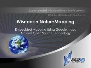
Wisconsin NatureMapping Embedded Mapping Using Google maps API and Open Source Technology Origins of NatureMapping IDAHO Citizen Science Value of Citizen Science Basic Skills Education Resources Stewardship Plans Wisconsin NatureMapping Beaver Creek Reserve Observe Record Resources

E N D
Wisconsin NatureMapping Embedded Mapping Using Google maps API and Open Source Technology
Origins of NatureMapping IDAHO
Citizen Science • Value of Citizen Science • Basic Skills • Education Resources • Stewardship Plans
Wisconsin NatureMapping Beaver Creek Reserve • Observe • Record • Resources connecting people with nature
NatureMapping Basics • http://www.wisnatmap.org/training.htm • http://www.wisnatmap.org/training.htm • http://www.wisnatmap.org/submit.htm • http://www.wisnatmap.org/view.htm • http://www.wisnatmap.org/resources.htm Citizen’s observing and documenting Wisconsin’s wildlife.
Existing Site - New Site • Arc IMS • New Studies • Mapping Tools • Usability Study
Open Source Technologies • GoogleMaps: Base Map Layers • GeoServer: Wildlife sightings layer that interfaces with… • PostGIS extension Spatial data • PostgreSQL: Database
GeoServer’s Job is to Answer Questions -”Talk” to GeoServer over a network. (HTTP) - Ask GeoServer about spatial data that it can read (Shapefiles, PostGIS, ArcSDE, Oracle, etc.) …in a language it understands, (WFS, WMS, WCS) …and it will answer in pictures (JPEG, PNG, GIF, PDF) …or in words (WFS, KML/KMZ, GML). • Details – Maintainer: The Open Planning Project (http://www.openplans.org) – Web Site: http://geoserver.org/ – Implementation Language: Java – Source License: GPL
System Component: Data Storage • Purpose – stores attribute, geometry and projection information – performs spatial calculations (i.e. intersect, buffer) Examples – ESRI ArcSDE + relational database • proprietary + proprietary, limited spatial functions – Oracle Spatial • proprietary, rich set of spatial functions – MySQL • open source, basic geometry storage – PostGIS • open source extension to the PostgreSQL database • implements OGC spatial functions
PostGIS + PostgreSQL • Function – Vector data storage – Spatially-enabled relational database • Compare to: – ESRI ArcSDE + SQLServer (or other RDBMS) – Oracle Spatial • Composed of: – PostgreSQL (OS relational database) – PostGIS (OS spatial extension) • Details – Maintainer: Refractions Research Inc – Web Site: http://postgis.refractions.net – Implementation Language: C – Source License: GPL
REASONS FOR SWITCHING TO OPEN SOURCE TECHNOLGIES • Cost savings for organizations that are dependent on grants • Intuitiveness • Base Layer Maps/Road Layers • Adaptability to changes and updates
QUESTIONS ? • TODAY-Booth 21 Applied Data Consultants • www.adc4gis.com • Copy of presentation? mari.pietz@adc4gis.com
Sources & Contact Info • http://www.wisnatmap.org/default.htm • http://depts.washington.edu/natmap/ Tyler Erickson, Ph.D. Research Scientist Mari Pietz: GIS Business Coordinator mari.pietz@adc4gis.com 715-874-4397 ext 256