Glaciation and O.S maps
60 likes | 355 Views
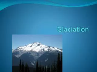
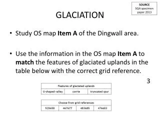
Glaciation and O.S maps. Remember!. Corrie. Arete. Contour lines are very close together showing very steep land. The contour lines are curved showing a bowl-shape Sometimes a tarn is evident. U-Shaped Valley. Where two corries form back to back.

Glaciation and O.S maps
E N D
Presentation Transcript
Remember! Corrie Arete Contour lines are very close together showing very steep land. The contour lines are curved showing a bowl-shape Sometimes a tarn is evident U-Shaped Valley Where two corries form back to back. The arete (ridge) is shown as a black rugged line Contour lines are very close together showing very steep land. There is a long strip of white in the middle showing flat land.
Using the O.S map of Snowdon and your lithosphere notes, answer the following questions; • Describe the evidence which shows that Snowdon was once affected by glaciation. • Explain with the aid of a diagram, the formation of two features that you have identified on the O.S map extract. 4 marks 5 marks
Glaciation and O.S maps When looking for evidence of glaciation look specifically at the contour lines. Contour lines that are very close together, shows steep land (which is particularly important in glaciation, as most features have steep sides) Curved contour lines show corries, also shown on O.S maps (sometimes) as Coire or Cwm. Often with blue inside showing a corrie loch. 2 Corries back to back show an arete 3 corries back to back show a pyramidal peak Two areas of steep land, with an area of flat land (shown by the white of the map) in between is a U-shaped valley.