Download
1 / 99
990 likes | 1k Views
Explore the impact of the 2010 volcanic eruptions in Iceland and Indonesia, the unique hazards they pose, and strategies for reducing disaster risk. Discover the societal impacts, hazard maps, risk assessment, and community preparedness.

E N D
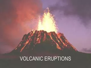
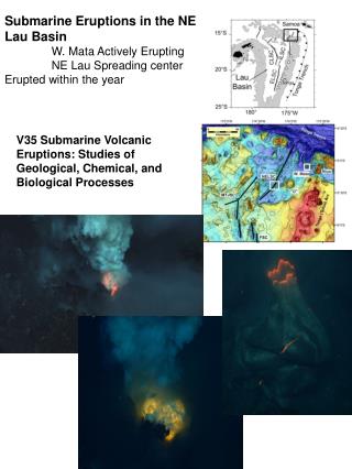
REMEMBERING 2O10’S VOLCANIC ERUPTIONS Walter Hays, Global Alliance for Disaster Reduction, University of North Carolina, USA
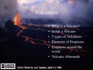
VOLCANOES are awesome manifestations of heat flowing as a result of hot spots (e.g., Hawaii and Iceland) and movement along faults located in subduction zones (e.g., the Pacific Rim).
PLANET EARTH HAS 1,500 “VOLCANO LABORATORIES” EACH VOLCANO HAS A UNIQUE ERUPTION HISTORY, WHICH CONTAINS VALUABLE LESSONS ON DISASTER RISK REDUCTION
2010’S NOTABLE VOLCANIC ERUPTIONS ICELAND March 20 and April 14, 2010 INDONESIA October 25-27 – November 24, 2010
IMPACTED NATIONS Iceland (Europe) Indonesia
The volcanic ash cloud over Europe from Iceland’s Eyjafjallajökull volcanoparalyzed air travel in Europe for weeks and cost the industry over $2 B. The eruption of Mount Merapi immediately after a M7.7 earthquake and a tsunami caused loss of life and a triple disaster in Indonesia. SOCIETAL IMPACTS DURING 2010
INDONESIA A LAND OF ISLANDS AND SUBDUCTION ZONE VOLCANOES
TECTONICS OF INDONESIA REGION • The Australian and Eurasian plates meet in Indonesia, creating a tectonic setting favorable for generating earthquakes, tsunamis, and volcanic eruptions.
Indonesia is home to 129 active volcanoes, with the two most active ones — Mount Kelut and Mount Merapi — located on the island of Java, which also contains the Indonesian capital of Jakarta, roughly 500 km (300 mi) northwest of them.
MOUNT MERAPI, INDONESIA, IS A SUBDUCTION ZONE VOLCANO • Mount Merapi has a history of starting full scale erupt-ions with a pyroclastic cloud and flow.
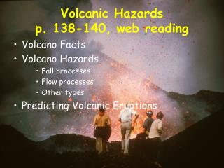
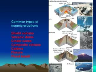
VOLCANO HAZARDS (AKA POTENTIAL DISASTER AGENTS) • LAVA FLOWS • LAHARS • EARTHQUAKES (related to movement of lava) • “VOLCANIC WINTER”
VOLCANO HAZARDS (AKA POTENTIAL DISASTER AGENTS) • VERTICAL PLUME • ASH AND TEPHRA • LATERAL BLAST • PYROCLASTIC FLOWS
ICELAND A LAND OF FIRE (HOT SPOT VOLCANOES) AND ICE
Unlike the subduction zone volcanoes along the Pacific Rim where the slow rise of magma gives early seismic warnings that an eruption is imminent, Iceland's hot spot volcanoes tend to erupt under ice sheets with little warning.
Iceland lies on the Mid-Atlantic Ridge, the highly volatile divergent boundary between the Eurasian and North American tectonic plates that is marked by earthquakes and volcanic eruptions.
CAUSES OF RISK LATERAL BLAST PYROCLASTIC FLOWS FLYING DEBRIS VOLCANIC ASH VOLCANIC ERUPTIONS LAVA FLOWS CASE HISTORIES LAHARS TOXIC GASES
HAZARD MAPS • INVENTORY • VULNERABILITY • LOCATION • PREVENTION/MITIGATION • PREPAREDNESS • EMERGENCY RESPONSE • RECOVERY and • RECONSTRUCTION RISK ASSESSMENT POLICY OPTIONS ACCEPTABLE RISK RISK UNACCEPTABLE RISK VOLCANO DISASTER RISK REDUCTION DATA BASES AND INFORMATION COMMUNITY HAZARDS: GROUND SHAKING GROUND FAILURE SURFACE FAULTING TECTONIC DEFORMATION TSUNAMI RUN UP AFTERSHOCKS
PURPOSE LAND-USE CONTROL EVACUATION TECHNIQUE MAPS: LAVA AND/OR LAHAR FLOW PATHS COMMUNITY EMERGENCY RESPONSE PLAN DISASTER RISK REDUCTION STRATEGIES FOR VOLCANOES
The Eyjafjallajökull (AYA-feeyapla-yurkul) volcano in Southern Iceland, part of the volcanic process that originally formed Iceland, erupted a few minutes before midnight on Saturday, March 20th
ERUPTION HISTORYEyjafjallajökull last erupted in 1821 in what was called a "lazy" eruption, which lasted almost two years.
A dark and spectacular volcanic cloud spread over Britain and toward continental Europe on Thursday, April 15, forcing airlines to cancel thousands of flights as it drifted at high altitude south and east from the continuing eruption in Iceland.
The ash cloud, made up of minute particles of silicate that can severely damage jet engines, left airplanes stranded on the tarmac at some of the world’s busiest airports.
A week of airspace closures caused by the ash threat to planes created the worst breakdown in civil aviation in Europe since World War II, which caused more than 100,000 flights to be canceled and airlines to lose over $2 billion.