Download
1 / 12
120 likes | 134 Views
This project aims to evaluate the condition of each Great Lake and the Great Lakes as an IOOS region, assess changes over time, and understand spatial differences within the lakes. It also focuses on the condition of vulnerable coastal systems, such as nearshore waters and embayments, and their response to landscape stressors. Integrated monitoring and assessment methods are used to provide lakewide estimates and identify ecological significance. This study connects water column biology to landscape and aims to establish a reliable indicator for assessing the health of the Great Lakes and coastal systems.

E N D
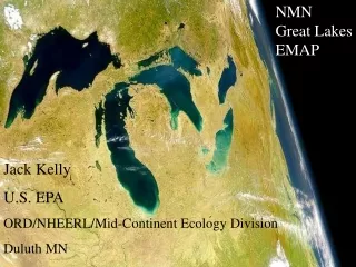
NMN Great Lakes EMAP Jack Kelly U.S. EPA ORD/NHEERL/Mid-Continent Ecology Division Duluth MN
NMN - National Monitoring Network Great Lakes • What is the condition of each of the Great Lakes and the Great Lakes as an IOOS region? • Are conditions changing over time? How do conditions differ spatially within the lakes? • What is the condition of nearshore waters and embayments —coastal systems that are vulnerable to landscape stressors?
Spatially balanced, Lakewide estimates (EMAP design) • Recognizes ecological significance of depth • Nearshore as explicit design component
Integrated Lakewide Monitoring and Assessment Offshore Medium Nearshore Shallow Nearshore Measure or Condition Trends over Time (Hypothetical)
Condition assessment - US coastline • Landscape sentinel in the continuum to lake
Integrated Lakewide Monitoring and Assessment Offshore Medium Nearshore Shallow Nearshore Measure or Condition Embayments Trends over Time (Hypothetical)
Landscape Signal Across A Coastal Continuum Patterns moving “downstream” Decreasing Stressor Signal Strength (Concentrations) Decreasing Slope of Enrichment Decreasing Fidelity of Signal (weaker correlation, more variability) Tributaries Log (TP) or other WQ measure Coastal wetlands Embayments Nearshore Offshore Very low Very high Landscape disturbance gradient (Defined by GLEI project)
Can we connect water column biology to landscape? ….How do we sample? How read indicator? 537-Km Track in Nearshore, targeted ~20-25 m depth contour Ag Chem- PC (One index of watersheds from GLEI project)
Grand Marais MN Gratiot River MI Duluth/Superior Bayfield WI Ontonagon MI An environmental ‘CAT’ scan with multiple sensors From Yurista and Kelly
Connecting Nearshore Biology to Landscape Raw R^2 0.43 CONST 2.278 AC 0.1014 PD 0.1028 SO -0.0373 Raw R^2 0.73 CONST 3691.2 AC 401.4 AD 127.3616 SL 139.1
Nearshore Offshore Coastal watersheds and streams Coastal Wetlands Nearshore Nearshore A Embayments Offshore Nearshore B GREAT LAKES Integrated Monitoring and Assessment… ONE VERY BIG LAKE ...Including Coastal Systems