Download
1 / 11
110 likes | 126 Views
EU-funded research project aiming to assess the ecological status and recovery of water bodies in Europe. The project focuses on identifying reliable indicators, comparing and integrating different assessment methods, examining the response of indicators to recovery, and quantifying and minimizing uncertainty. The project utilizes existing data sources, harmonizes and evaluates data, and develops tools and models for ecological status assessment.

E N D
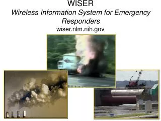
WISERWater bodies in Europe:Integrative Systems to assess Ecological status and Recovery
Project overview • EU-funded research project (FP7) • 25 partners • Duration: 3 years • Planned starting date: February 2009 (depends on contract negotiations)
Project objectives • Which indicators are best suited for the assessment of ecological status? Which are most reliable? Which are redundant? (lakes, transitional and coastal waters) • How can results of different BQEs best be compared, intercalibrated and combined into an integrated appraisal of ecological status? (all water categories) • How do BQEs respond to recovery? (all water categories) • How is assessment and restoration affected by global change? (all water categories) • How can uncertainty be quantified and minimised? (all water categories)
Existing data sources used • 97 databases built in previous EU-funded and national projects • Lakes: 47 databases • Rivers 39 databases • Transitional waters: 14 databases • Coastal waters: 12 databases • “Real world data” form ongoing national WFD monitoring always welcome (particularly in early 2009!) • Close cooperation with GIGs in the fields of data harmonization and evaluation planned
Data harmonization, evaluation and modelling • Central harmonization effort (sampling sites, taxalists, environmental data) • Tailor-made databases for each workpackage • Correlation of biotic metrics to stress gradients using a wide variety of statistical methods • Modelling the impact of restoration and emerging stressors (such as climate change) on ecological status
Targeted field exercise • Limited to lakes and to transitional / coastal waters • Addressing all relevant BQEs • Main target: Quantification of uncertainty through parallel sampling • Programming of a general applicable tool for uncertainty estimation • Additional sampling effort will be sought from Member States through the GIGs (following the same protocols as WISER)
Selected products and deliverables • Methods and tools for ecological status assessment (for water type / BQE combinations which still need to be addressed) • Tools for uncertainty estimation • Databases on different water categories and BQEs (subject to data licence agreements) • Online databases on assessment methodologies • Models to estimate the effects of restoration and emerging stressors
Further information... • ... soon on www.wiser.eu