Download
1 / 15
150 likes | 286 Views
Ocean color products in support of EEA indicator CSI023. Giovanni Coppini, ETC - Water, INGV With the essential contribution of: Nadia Pinardi (INGV), Slava Lyubarstev (CMCC), Simone Colella (CNR-ISAC), Rosalia Santoleri (CNR-ISAC) and Trine Christiansen (EEA)

E N D
Ocean color products in support of EEA indicator CSI023 Giovanni Coppini, ETC - Water, INGV With the essential contribution of: Nadia Pinardi (INGV), Slava Lyubarstev (CMCC), Simone Colella (CNR-ISAC), Rosalia Santoleri (CNR-ISAC) and Trine Christiansen (EEA) Ocean color data provided by JRC and CNR, in situ data provided by ICES (EIONET data,…)
Outline • Ocean Color principles and data from GMES Marine Core Service • Objectives of the ETC-Water work • Design of the Ocean color CSI023 indicator • Preliminary products and applications in the European Seas • Comparison with in situ data • Conclusions, future steps and questions
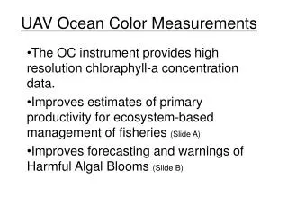
Ocean Color principles • Chlorophyll-a (Chl-a) is estimated as an indirect measurement from Water Leaving radiance emitted in the euphotic zone by living organic material. • Water Leaving radiance in coastal waters is strongly affected by ‘yellow substances (CDOM)’ and sediments: • Chl-a estimates have accuracies approx. of 35% in open ocean • Accuracy less than 50% in coastal waters affected by CDOM (if open ocean algorithm is used) • Accuracy of Chl-a retrieval is increased if ocean color regional algorithms are developed using in situ data
The Ocean Color satellites • Ocean Color satellites available to GMES service now are: • Sea-WIFS (1997-2008), MERIS-Envisat (March 2002-onward) and MODIS-AQUA (July 2002-onward) • Sentinel-3 GMES satellite (planned for launch in 2013) will also have an ocean color sensor ensuring continuous monitoring for the period 1997-2030 • Widely available at daily time scales in all European coastal/shelf and open ocean waters (higher temporal resolution can be achieved in southern European regional seas).
Objectives of ETC/WTR work • Make available to EEA the GMES OC (JRC-MERSEA and CNR and then MyOcean)spatial distributionsof Chl-a onall the European Seas • Use the OC Chl-a data to estimate an “ocean color” CSI023 • Validate the ocean color CSI023 with existing in situ data sets • Note that dataset used are based on global and regional algorithms for open ocean water
The “ocean color” CSI023: strategy of implementation • Standard in situ CSI023: • Chl-a measured from in situ fluorimetry • May(June)-September average values • Uppermost 10 meters average • Trend analysis on each station • Ocean color CSI023 • Define preliminary product: summer chl-a Climatology • Use Daily and monthly GMES OC Chl-a products • Temporal average as in standard CSI023 • Subdivision of the daily OC image in different coastal, shelf and open ocean areas (so-called the Chl-a areas) • Trend analysis pan european and on each Chl-a area • Comparison of the OC Chl-a values with in situ measurements for validation
Preliminary product: Summer chl-a climatology for European Seas • INPUT DATA: JRC/MERSEA monthly, 9 km resolution, SeaWiFS sensor, GMES Chl-a product for all European Seas • Summer period (May-September) • At each pixel we average the chl-a concentration for the summer period
The first application in European Seas Pan European trends • INPUT DATA: JRC/MERSEA monthly, 9 km resolution, SeaWiFS sensor, GMES Chl-a product for all European Seas • Each pixel is considered as an in situ station • Summer period (May-September) • Trend analysis is carried out based on the time series from 1998 to 2007. • Comparison with in situ trends
European Seas Chl-a trends (May-September, 1998-2007) Chl-a trends (Sens slope) in mg/m3/year
Statistically significant Chl-a trends (Sens Slope) at the 95% confidence level (Mann-Kendall test)
Comparison of in situ trends with OC ones1997-2006 In situ trends Ocean Color trends OC over estimates In situ trends General good agreement
The second application in the Mediterranean Sea Trends for each chl-a areas in the Mediterranean Sea • INPUT DATA: CNR daily, 1 km resolution GMES Chl-a product for the entire Mediterranean Sea and Black Sea • Summer period (May-September) • Trend analysis is carried out (1998 to 2008) at each pixel level and for each chl-a areas Definition of GMES Chl-a areas The different European Seas are subdivided into the areas limited by: • Ocean sub basins; • River Basin Districts (RBDs) coastline extensions • 3 bathymetric zones (0-30 meters,0-200 meters , >200 meters)
Example: North Western Mediterranean Chl-a areas and trends (1998-2008) ALS - Alboran Sea IBS Iberian Sea (Balearic Sea)
Conclusions and future steps Conclusions • The on going work has defined a preliminary methodology to estimate trends from GMES ocean color products to support the in situ CSI023 • Chl-a trends from ocean color products can provide information in areas where we have no in situ data • Chl-a trends from ocean color show spatial correlation in large areas Future steps • Improve the product by using more regional/coastal products (MyOcean MCS and other regional-national products) • Extend the analysis to each European Sea using the chl-a areas. ‘Chl-a areas’ concept should be finalised with NRC • Perform more validation against in situ Chl-a trends • Use MODIS and MERIS data to get longer and updated ocean color timeseries
Questions for NRC • What is your perception of the value of using ocean color? Could you imagine using it in your own work? • Would you be interested in collaborating on interpretation of the detected chl-a trends? • Would you be interested in participating in a more specific test of using ocean color in your coastal waters and would you provide more data for such an exercise than what is available to the EEA already? • Would you be interested in collaborating to establish the access to regional/coastal ocean color dataset in your nations? Are you aware of regional/local ocean color dataset that you would like to provide for this analysis? Kindly feedback by the 30th of November 2009 to Trine Christiansen Trine.Christiansen@eea.europa.eu