Enhancing GBRA's Web Mapping Experience: Interactive Solutions by Geo-Tex Spatial Solutions
Geo-Tex Spatial Solutions (GTSS) aims to revolutionize the Guadalupe-Blanco River Authority's (GBRA) online mapping by transitioning from a static map to interactive GIS solutions. Currently, GBRA's website only features a basic static map outlining watershed boundaries. This project will develop interactive maps that provide users with detailed, downloadable data across 11 different layers. Utilizing Arc-GIS and Manifold software, GTSS will enhance user engagement and access to vital geospatial information, significantly enriching visitor experience on www.gbra.org.


Enhancing GBRA's Web Mapping Experience: Interactive Solutions by Geo-Tex Spatial Solutions
E N D
Presentation Transcript
Geo-Tex Spatial Solutions CONSULTANTS:
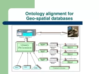
INTRODUCTION • AT ISSUE: Develop New Maps for GBRA’s Web Site • Current map is a static map only • Shows watershed boundaries only with no other info GOAL OF THE PROJECT: • Create new maps for addition to their web site • Interactive maps for visitors to see and use • Create data which can be downloaded from site
Current Map: Prepared for GBRA’s 2007 Basin Highlights Report Source: GBRA Web Site www.gbra.org
Methodology • DATA MUST UNDERGO THE FOLLOWING STEPS • Phase 1: Data Collection and Development • Phase 2: Data Assembly (Arc-GIS Software) • Phase 3: Web-GIS Assembly (Manifold Software)
PHASE 1: Data Collection Source: touringtexas.com
Task • Geo-Tex Spatial Solutions (GTSS) must collect data to built GIS-web interactive maps • GTSS must make available about 11 different types of layers to help inform the wide range of GBRA website users • Data must be from reliable sources
Data Collection Methods • Internet • Phone • Excel files Source: www.churchinuptown.com
Issues with Data • The rights to use the data • Waiting to receive data • Finding incomplete data • Size of data • Overall time spent looking for data Source: www.ilmfinder
Phase 2: Data Assembly • The purpose of the Data Assembly is to determine which map data is most suitable for the needs of GBRA. The data will be assembled using a GIS software and will include : • Data provided by GBRA • Data discovered from outside agencies • Develop data collected from raw data • However, even after the completion date, it is expected Geo-Tex may need to continue to collect and assemble data as needed.
PHASE 3: WEB GIS • By using the Manifold Program (Web GIS) it makes the maps interactive with the user in many ways. • The World-Wide Web opens doors for everyone with internet to make available GeoSpatial Information.
Phase 3: WEB GIS • Benefits to the User: • View only layers they would like to see • Makes the maps easier and faster to download • Easy to Navigate • GIS information available to all society members
Time Line IMPORTANT DATES: Monday, March 2 Proposal Presentation to client Wednesday, April 6 Progress Report to Client Monday, May 11 Final Report Presentation Final Deliverables to Client
References - Journals • Sebillo, Monica; Tortora, Genny; and Vitiello, Giuliana. “Cultural institutions and digital technology.” • DipartimentodiMatematica e Informatica University of Salerno – Italy. 2003. 25 Feb. 2009. <www.ichim.org> • Su, Yafang; Slottow, Joan; and Mozes, Avi. “Distributing proprietary geographic data on the World Wide • Web – UCLA GIS Database and Map Server.” Elsevier Science Ltd. 15 Aug. 2000. 25 Feb. 2009. • <http://www.sciencedirect.com/science?_ob=PublicationURL&_tockey=%23TOC%235840%232000%23999739992%23198147%23FLA%23&_cdi=5840&_pubType=J&view=c&_auth=y&_acct=C000059537&_version=1&_urlVersion=0&_userid=158229&md5=5a2daf8632e5dc7c5dbe959c22f56937> • Tuyen V. Dang; Hanh D. Do; and Hung, Tran. “Developing a flash-based tool for GIS applications on the • web.” GeoViet Consulting Co. Ltd. 25 Feb. 2009. • < http://www.geoviet.vn>
References – Data • Barron, Robert, “Geographic Information Systems Data” Texas General Land Office: GIS Data. 12 Feb. 2009. http://www.glo.state.tx.us/gisdata/gisdata.html • “Download GIS Data.” Edward Aquifer Authority. (Edwards Aquifer (TCEQ) Projection Info: UTM Zone 14N NAD 83). 13 Feb 2009. http://maps.edwardsaquifer.org/eaagis/DownloadData.aspx • “GIS Lab Data Downloads” Texas Parks and Wildlife. 12, Feb. 2009. http://www.tpwd.state.tx.us/landwater/land/maps/gis/data_downloads/ • Lett, Chris, “Brach of Data & Systems Services,” U.S. Fish & Wildlife Services. Feb. 9, 2009. 12 Feb. 2009. http://www.fws.gov/gov/data/datafws.html • “Map Layers.” The National Atlas of the United States. April 29, 2008. Feb. 12, 2009. http://nationalatlas.gov/maplayers.html?openChapters=chpwater#chpwater