Geo-Tex Spatial
Watershed Mapping Project Public Interest G.I.S. Mapping Project for the Guadalupe Blanco River Authority – 2009. Geo-Tex Spatial. Solutions. CONSULTANTS:. Introduction: Summary.


Geo-Tex Spatial
E N D
Presentation Transcript
Watershed Mapping ProjectPublic Interest G.I.S. Mapping Project for the Guadalupe Blanco River Authority – 2009
Geo-Tex Spatial Solutions CONSULTANTS:
Introduction:Summary • More and more, companies across the nation are turning to Geographic Information Systems (GIS) to distribute information, answer problems, and communicate more effectively - both within their organizations, as well as to the public who seek to utilize that data. • One way to share this information is to publish interactive maps, which allow users to access manipulate and gain specific information via the internet. • We have been contacted by the GBRA to create interactive maps for the organization’s web site. This new resource will further accomplish the goal of the mission statement of the GBRA - “to protect, conserve, reclaim, and steward the resources” of the water conservation district it oversees.
Introduction:Problem Statement GBRA website has a single “Main Basin Map” which is a static map that shows the contiguous boundaries of the ten-county statutory district that the GBRA oversees, with no additional data about the district provided. Production of these interactive maps will allow the GBRA to better serve the public, and will provide a valuable data resource for educational purposes and recreational use of the 10-county water conservation district they oversee.
Purpose • The purpose of this project is to create web-accessible public interest maps to be included on the GBRA’s web site.
Scope • The scope of this project is comprised of 10 of the 11 watersheds the GBRA oversees. These 10 contiguous watersheds originate at the headwaters of the Guadalupe River in Kerr County above Comfort, Texas, and extend southeastward across the state, culminating in the terminus of the Guadalupe River near Port Lavaca, Texas.
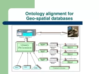
Data:Quality • All of the data was subjected to an extensive review process before it was determined suitable for use. • During this review process, all data was closely examined by our team in order to determine the best documented and most accurate data for the project. All the third-party data sources used in the project are considered reliable and fit for use for this project.
Data:Creation • It was necessary to create data sets – in this case the “paddling trails” data - from raw data acquired from Texas Parks and Wildlife. • In order to turn this raw data into a form that could be utilized by the software, it was necessary to convert the GPS coordinates into decimal degrees, then input the newly created latitude/longitude values into an excel spreadsheet for import into the Arc-GIS software.
Metadata • The metadata follows the Federal Geographic Data Committee (FDGC) standards, as well as the standards provided for geographic information by the International Organization for Standardization (ISO).
Methodology • DATA MUST UNDERGO THE FOLLOWING STEPS • Phase 1: Data Collection and Development • Phase 2: Data Assembly (Arc-GIS Software) • Phase 3: Web-GIS Assembly (Manifold Software)
Result • We produced the final interactive maps which were the goal of this project.
Result • This new resource will allow the GBRA to further its goal of educating the public by providing an interactive map that will allow users to manipulate and gain specific information via the internet. • The inclusion of interactive maps on the GBRA web site not only provides users with a visual representation of the existing resources within the boundaries of the 10-county statutory district, but allows users to see how those resources are related to each other.
Result • Website: http://geo-305592.evans.txstate.edu/index.htm • Web Map: http://localhost/IMS/default.asp
Discussion/Data Collection • 1) data received directly from the GBRA • 2) data retrieved from outside sources • 3) original data, which was created by our team
Discussion/Data Assembly • 1) importing the data into GIS software (Arc-GIS ver. 9.3) • 2) creating the metadata for the project
Discussion/Web GIS Assembly • Over the course of the Web GIS assembly, we continually worked to locate and identify bugs, optimize user performance, and increase page download times.
Discussion/Web Site Assembly • The web site includes hyperlinks to all documents and PowerPoint created during this project, as well as all static maps and the interactive map.
Conclusion • We, Geo-Tex Spatial Solutions, believe that this project will achieve the needs of GBRA. The interactive Web-GIS map will provide the user with valuable information about the recreational and educational resources in the watershed. This new resources will further enable GBRA to “protect, conserve, reclaim, and steward the resource,” that they oversee. • In the course of this project, we have learned how to work with the private sector, time management, and work as a group. This was a valuable experience that we will be able to take with us as we move into looking for jobs and enter the working force. We have been able to learn from your mistakes and come to understand that everything will not work as planned, so it is best to set aside extra time to reorganizes initial ideas and plans. Overall, this was a valuable experience that we thank Dr. Giordano and Cinde Thomas-Jimenez for letting us be a part of.