Download
1 / 5
50 likes | 211 Views
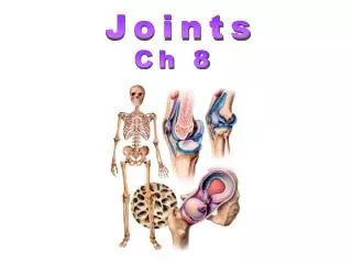
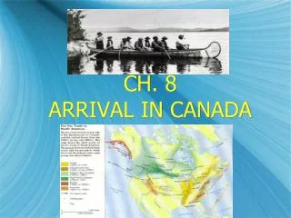
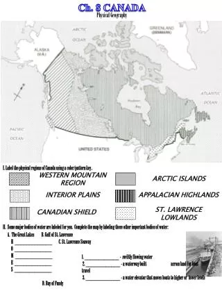
Ch. 8 CANADA. Physical Geography. I. Label the physical regions of Canada using a color/pattern key. WESTERN MOUNTAIN REGION. ARCTIC ISLANDS. INTERIOR PLAINS. APPALACIAN HIGHLANDS. APPALACIAN HIGHLANDS. ST. LAWRENCE LOWLANDS. CANADIAN SHIELD.

E N D
Ch. 8 CANADA Physical Geography I. Label the physical regions of Canada using a color/pattern key. WESTERN MOUNTAIN REGION ARCTIC ISLANDS INTERIOR PLAINS APPALACIAN HIGHLANDS APPALACIAN HIGHLANDS ST. LAWRENCE LOWLANDS CANADIAN SHIELD II. Some major bodies of water are labeled for you. Complete the map by labeling these other important bodies of water: A. The Great Lakes B. Gulf of St. Lawrence H _____________ C. St. Lawrence Seaway O _____________ M _____________ E _____________ S _____________ D. Bay of Fundy 1. ____________ - swiftly flowing water 2. ____________ - a waterway built across land for boat travel 3. ____________ - a water elevator that moves boats to higher or lower levels
Fill in the blanks to help describe and identify each of the regions and physical features of Canada. • The ____________ _____________ _____________ is an extension of the ____________ _____________ which cover much of the western part of the United States. • The ____________ ____________ is located in the western part of Canada. The region is known for its ____________ ____________. The rich soil was brought to the area by ____________ as they moved southward. The area stretches from the _____________ ___________ in the north to the _____________ ____________ in the south. • The largest region in Canada is the _______________ ____________. It is a vast plain that forms a horseshoe around ____________ ____. The elevation here rises no more than ________ feet above sea level. This characteristic is also one caused by ____________ erosion during the ____________ ____________. Because the land is so low, it is often called ____________ an Indian word for “wet and spongy.” It is often called ‘Canada’s Storehouse’ because of its rich ________________ _____________. • The ____________ ____________ are located in the Arctic Ocean, which is most often covered in ice. Unique landforms here are deep, narrow inlets of the sea bordered by steep cliffs called ___________. • On the eastern coast of Canada is a region made up of islands and peninsulas called the _______________ _______________, due to a higher elevation. It is in this region where fishermen come to experience the highest tides in the world at the _______ ____ _____. • The southernmost region of Canada is the __________ ___________ ________________ surrounding the _______ ____________ _______. This body of water is nicknamed the “__________________________” because of its great importance to the settlers. It is now very important in providing Canada with ______________ ____________. This region is small in size, but it has a large ___________________. • If you were to look at Canada from the air you would see a line at which trees cannot grow. This is called the ________________. North of this area is the ____________ which is a vast, treeless plain. As you continue further north, you will reach the ________________ which is land that is permanently frozen.
CANADA I. Explorers of Canada Leif Ericsson A. Create a key by highlighting each explorer’s name with a different color. Then trace that explorers route in or through Canada. John Cabot Jacques Cartier Henry Hudson Alexander Mackenzie Samuel de Champlain B. Match each explorer in the list to his accomplishment below. In the second blank include the country for which he sailed. Make sure you label each underlined location on the map. • __________________ French navigator who discovered the St. Lawrence River • __________________ Scottish – Canadian who discovered the Mackenzie River • __________________ Italian explorer who named the island of Newfoundland • __________________ Norse discoverer of North America (offspring of Eric the Red) • __________________ Founder of Quebec City • __________________ First European to ascend the Hudson River