Download
1 / 12
120 likes | 214 Views
This study assesses VIIRS ocean color products using in-situ data and other satellites. Evaluation includes spectral water radiance and chlorophyll-a data for climate studies and operational uses in coastal areas.

E N D
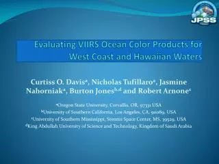
Evaluating VIIRS Ocean Color Products for West Coast and Hawaiian Waters Curtiss O. Davisa, Nicholas Tufillaroa, Jasmine Nahorniaka, Burton Jonesb,d and Robert Arnonec aOregon State University, Corvallis, OR, 97331 USA bUniversity of Southern California, Los Angeles, CA, 90089, USA cUniversity of Southern Mississippi, Stennis Space Center, MS, 39529, USA dKing Abdullah University of Science and Technology, Kingdom of Saudi Arabia
VIIRS on the Suomi NPP satellite • The VIIRS (Visible Infrared Imaging Radiometer Suite) sensor on the Suomi National Polar-Orbiting Partnership (NPP) satellite • Launched on November 28, 2011 • Providing good data since February 2012 • five spectral channels centered at 410, 443, 486, 551 and 671 nm that are used to characterize spectral ocean color with additional channels for atmospheric correction. • Ocean Environmental Data Record (EDR) products are spectral water leaving radiance and chlorophyll-a • A key use is to continue the climate time series of ocean color data began with SeaWiFS and MODIS • Additionally NOAA and Navy are using the data operationally particularly in the coastal ocean. • Both uses require a validation of the VIIRS Open and Coastal Ocean EDRs • This work is part of the JPSS VIIRS Ocean Color Cal/val team lead by Menghua Wang and Robert Arnone
Ocean Color EDR Validation Data Sets • To evaluate VIIRS Ocean color products we compare them with in situ data and other satellite data. Examples using data from the Ocean Color AERONET site `Platform Eureka,’ in the Southern California Bight, and cruises as part of the Hawaiian Ocean Time Series (HOT). • Data Sources: • VIIRS data sources: • VOCCO (JPSS standard products from NOAA CLASS) • APS (from NRL-SSC) • In situ • HyperPRO (Hawaii from OSU) • SeaPRISM (West Coast from NASA Ocean Color AERONET) • Satellite • MODIS-AQUA (from NASA Ocean Color) • HICO (OSU HICO website: http://hico.coas.oregonstate.edu )
OSU Validator • Validator designed in collaboration with NRL-SSC, and CCNY • Satellite and in situ data collected and added to a `mySQL’ data base • Comparison of 5 x 5 pixel scenes to in situ data (mean and standard deviation) • Daily, weekly and seasonal comparisons • Compare APS VIIRS with VIIRS standard processing, with and without flags.
Hyperspectral Imager for the Coastal Ocean (HICO) • HICO is an experiment to see what we gain by imaging the coastal ocean at higher resolution from space. • The HICO sensor: • samples coastal regions at 90 m (400 to 900 nm: at 5.7 nm; 88 channels) HICO image of the San Francisco Bay Area, Nov. 14, 2011 http://hico.coas.oregonstate.edu
Hawaiian Ocean Time Series (HOT) data Above and in-water light field measurements are routinely made with a Satlantic HyperPRO at Station ALOHA, 100 km north of Oahu, Hawaii (22.75 oN, -158.00 oE) as part of the Hawaiian Ocean Time Series (HOT) program. Additionally, measurements are made of HPLC and fluorometric pigments and primary productivity. HyperPRO Ed spectra with depth and normalized water leaving radiance for 17 August 2012 (23:43 GMT
VIIRS and HOT data Above and in-water light field measurements are routinely made at Station ALOHA, 100 km north of Oahu, Hawaii (22.75 oN, -158.00 oE) as part of the Hawaiian Ocean Time Series (HOT) program. Spectral matches at Station ALOHA of VIIRS data with HyperPRO cruise data collected one minute apart (23:43 and 23:44 GMT). VIIRS image over Hawaii from 17 August 2012 (23:43 GMT). The star marks Station ALOHA.
Platform Eureka SeaPRISM SeaPRISM hourly aerosol and ocean color data at the AERONET site ‘Platform Eureka’ on an oil platform in the Southern California Bight. (a) (19.5 km) (214 m)
Platform Eureka SeaPRISM Matchup Spectral matchups at Platform Eureka between the in situ data (blue), HICO hyperspectral measurements (red), and VIIRS measurements (green). Data are from Sept. 6, 2012.
March 2012 MODIS - VIIRS comparison • Top, Chlorophyll-a images from MODIS-AQUA, Middle, VIIRS APS chlorophyll, Bottom VOCCO VIIRS (standard algorithm). The red dot in the center of each image is the location of Platform Eureka. Flags for high reflectance cause a loss of VIIRS chlorophyll products (March 2,7,8,9).
Platform Eureka fall-winter 2012 time series Time series of chlorophyll-a data from VIIRS and Platform Eureka SeaPRISM showing periodic spikes and extensive loss of VIIRS data due to flags. Day 318 Clear image but Chl-a flagged
Continued Studies • Use HOT in situ data to validate open ocean products: • Monthly cruises and clouds and sunglint limit match-up opportunities • But provides open ocean validation data • Platform Eureka SeaPRISM site is excellent and data is key for our work: • Need to validate products in AERONET system (level 3 ) • Planning full year (March 2012-March 2013) analysis of VIIRS match-up data. • Continue analysis of flags and suggestion for changing flags • Vicarious calibration based on MOBY now available. Test effects of Vicarious calibration on the HOT and Platform Eureka matchups.