Download
1 / 20
230 likes | 641 Views
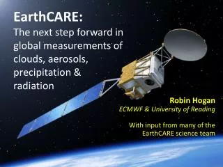
EarthCARE : The next step forward in global measurements of clouds, aerosols, precipitation & radiation. Robin Hogan ECMWF & University of Reading With input from many of the EarthCARE science team. Earth Clouds, Aerosols and Radiation Explorer ( EarthCARE ).

E N D
EarthCARE:The next step forward in global measurements of clouds, aerosols, precipitation &radiation Robin Hogan ECMWF & University of Reading With input from many of the EarthCARE science team
Earth Clouds, Aerosols and Radiation Explorer (EarthCARE) Joint ESA/JAXA mission, launch 2017, budget 700 MEuro • EarthCARE will quantify will measure clouds, aerosols, radiation and precipitation with unprecedented accuracy • EarthCAREwill be used to retrieve profiles of radiative fluxes and heating rates at a target accuracy of 10 W m-2 • It will provide essential data to evaluate weather and climate models, and to improve their representation of cloud-aerosol-precipitation-radiation interactions • Level-1 data available in real time for dataassimilation EarthCARE combines four instruments: radar, lidar, imager and broad-band radiometer
The A-Train versus EarthCARE EarthCARE (launch 2017) • ESA and JAXA • Single platform • 393-km: higher sensitivity • 94-GHz Doppler radar • 355-nm High spectral res. lidar • 3-view broad-band radiometer • Multi-spectral imager The A-Train (fully launched 2006) • NASA • Multiple platforms • 700-km orbit • CloudSat 94-GHz radar • Calipso 532/1064-nm lidar • CERES broad-band radiometer • MODIS multi-wavelength radiometer
EarthCARE Viewing geometry • Satellite mass: 2000 kg • Solar panel area: 21 m2 • Altitude: 393 km to maximize sensitivity • Radar and lidar power consumption: 2.5 kW
Principle of high spectral resolution lidar (HSRL) • EarthCARE will derive extinction profile (crucial for radiativetransfer) unambiguously from attenuated air backscatter
Aerosol classification from lidar • Exciting potential for aerosol classification via two independent pieces of information: • Lidar depolarization (a measure of non-spericity) • Extinction-to-backscatter ratio (affected by size and absorption) Extinction-to-backscatter ratio, sr
Example A-train observations • CAPTIVATE retrieval: Cloud, Aerosol and Precipitation from Multiple Instruments using a VariationalTechnique • Error estimates include contrib. from measurement and model error • Looks good but is it right? Classification: Ceccaldi et al. (JGR 2013) Illingworth et al. (BAMS 2014)
CAPTIVATE retrieval Applied to an A-Train profile containing ice/snow and rain • Synergy of radar, lidar and visible/infrared narrow-band radiances used to retrieve best estimate of cloud, precipitation and aerosol properties • Works also with EarthCARE instrument specification
What would EarthCAREsee? • Use radar and lidar forward models for the EarthCARE instrument specifications: • Note EarthCARE radar’s higher sensitivity: most ice clouds will be detected by both radar and lidar, enabling accurate particle size in a much higher fraction of clouds
3D scene reconstruction • CAPTIVATE retrievals under the radar-lidar curtain will be used to reconstruct the 3D scene based on visible/infrared radiances • 3D radiation calculations then used to continually test reconstructed scene by comparing to 3-view broadband shortwave and longwave radiances Barker et al. (QJRMS 2011)
1D-Var assimilation of cloud radar reflectivity ECMWF are ready to assimilate EarthCARE radar and lidar data in realtime Tested offline on CloudSat and CALIPSO • Case 20070123 • over Pacific • Observations • First guess Improved match to observations after assimilation • Analysis Janiskovaet al. (2012)
Impact of 1D+4D-Var assimilation on subsequent forecast Positive impact on forecasts felt up to 48 hours ahead Next step: full 4D-Var • Case 20080424 • 10m simulated TB from 9-hour forecast: • |obs-exp|- • |obs-ref| • GOES-12 observations • 3-hour accumulatedNEXRAD precipitation Janiskovaet al. (2012)
EarthCARE: UK Involvement • Lead European Scientist • Professor Anthony Illingworth (University of Reading) • Development of synergy algorithms • Professor Robin Hogan (ECMWF and University of Reading) • Development of Doppler radar simulator and radar retrievals • Dr Alessandro Battaglia (University of Leicester) • Prime contractor • Astrium UK • Multi-Spectral Imager • Surrey Satellite Technology Ltd. (Sevenoaks) • Broad-Band Radiometer • SEA, Bristol • Thermodynamic data for forEarthCARE retrievals; Real-time assimilation of EarthCARE data • European Centre for Medium Range Weather Forecasts (Reading)
Key pre-launch scientific questions • How can we exploit the new radar information for better rain and snow retrievals? • High latitude and mountain snowfall rates are very important but uncertain. Radar reflectivity from space ambiguous: riming leads to uncertain snow density. Rimed snow falls faster so constrained by Doppler observations but pre-launch validation urgently needed. • Extra constraint on rain rates available from Doppler, path-integrated attenuation from the ocean reflectivity and the 94-GHz brightness temperature (using radar as a radiometer). How do we best combine this information as well as accounting for multiple scattering? • How can we exploit new radiative closure information? • Balance of longwave and shortwave radiative effect of ice clouds very important for climate but sensitive to uncertain ice scattering properties. How can we exploit EarthCARE (particularly lidar and imager) to constrain assumptions on ice scattering in models? • Long-standing error in marine cumulus in models is that they are too few and too bright. How can we use EarthCARE’s 3D cloud reconstructions to solve this problem? • Currently no pre-launch funding to address these questions!
Doppler in convective clouds • NASA ER2: high flying aircraft Ice fall speed: important uncertainty in global models Convective updrafts: first time they will be sampled globally
EarthCARE Payload Atmospheric Lidar (ATLID) • 355 nm (UV) with depolarization channel • High spectral resolution capability providing direct cloud/aerosol extinction measurements Cloud Profiling Radar (CPR) • 94 GHz • 2.5-m dish • Doppler capability • Min detectable signal -35 dBZ Broadband Radiometer (BBR) • Long-wave & total-wave • 3 views to get fluxes Multispectral Imager (MSI) • 4 solar and 3 thermal infrared channels • 150-km swath
EarthCARE products Lidar Radar Imager BB Radiometer • ATLID Level 1 • Attenuated backscatter in • Rayleigh channel • Co-polar Mie channel • Cross-polar Mie channel CPR Level 1 Radar reflectivity profile, Doppler profile MSI Level 1 TOA radiances for 4 solar channels, TOA brightness temperatures for 3 thermal channels BBR Level 1 TOA long-wave and total-wave radiances Raw measurements ATLID Level 2 Feature mask and target classification, extinction, backscatter and depolarization profiles, aerosol properties, ice cloud properties CPR Level 2 Radar echo product, feature mask, cloud type, liquid and ice cloud properties, vertical motion, rain and snow estimates MSI Level 2 Cloud mask, cloud micro-physical parameters, cloud top height, aerosol parameters BBR Level 2 Unfiltered TOA short-wave and long-wave radiances, TOA short-wave and long-wave fluxes Single instrument products Synergistic Level 2 Cloud and aerosol products derived from synergistic retrievals using combinations of ATLID, CPR, MSI Synergy products Radiation and closure products Assessment Comparison of Radiative Transfer Products (fluxes, radiances) to BBR radiances and fluxes Radiative Transfer Products Fluxes, heating rates, TOA radiances calculated from constructed 3D cloud-aerosol scenes (1D & 3D rad. transfer)
Evaluation of model ice clouds using A-train retrievals Gridbox-mean ice water content • Both models lack high cirrus; Met Office has too narrow a distribution of in-cloud IWC • Using this work, ECMWF have developed a new scheme that performs better • Ice water content and particle size will be considerably more accurate from EarthCARE Delanoe et al. (QJRMS 2011) In-cloud mean ice water content