Download
1 / 18
180 likes | 403 Views
FNR 402 – Forest Watershed Management. Forest Watershed Management. Course Objective:

E N D
Forest Watershed Management Course Objective: Understand the purposes and procedures of watershed management, the impact of forest management activities on water yield and quality, the role of best management practices (BMP’s), and the role of foresters in BMP implementation and watershed management.
Historically focus was forest hydrology Hydrological effects of vegetation and land management practices on water quantity and quality, erosion, and sedimentation at specific sites Hydrology Science of water concerned with the origin, circulation, distribution, and properties of the waters of the earth. Why Study Forest Watershed Management?
Grading Grades are based on: • Three quizzes - 20% • Final examination - 30% • Project - 40% • Class participation - 10%
Research Paper • Due Date: November 1, 2006 • Length: 1,200 words • Topic: Describe a typical forested watershed for your forest cover type. The description should include • (1) geomorphology and soils, • (2) terrain, • (3) annual and seasonal precipitation patterns (use graphs), • (4) frequency and severity of storm events (use graphs), • (5) steam flow patters (include a hydrograph for a storm event if available), • (6) stream sedimentation rates with continuous forest cover and with haul roads and skid trails (do literature search), • (7) the composition of the forest layers associated with the cover type, including the duff layer, if any.
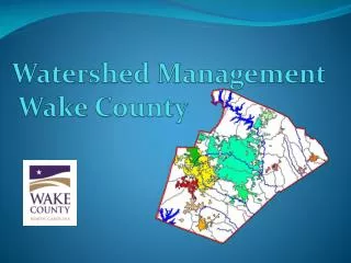
What Is A Watershed? Also referred to as a “catchment” • Topographically delineated area drained by a stream system • No specific scale implied • Must be defined for a given point – the outlet • Total land area above a designated point on a stream or river that drains past that point
What Is A Watershed? • For planning and management purposes it’s a • Physical-biologic unit • Socioeconomic-political unit
Delineation – Old Way • USGS Topographic Maps - Quad Sheets • Covers 7.5 minutes of longitude and latitude. • Typically have a scale of 1:24,000 • Contour intervals of the elevation data are 5 feet or 1.5 meter in Midwest. • More detailed analysis requires detailed topographic survey
Delineation – New Way • Digital Elevation Models (DEM’s) store topographic data as grid cells. • Typically have a resolution of 30 meters and elevation intervals of 1 foot or 1 meter. • Using a DEM within a Geographical Information System (GIS), we can perform digital terrain analysis (DTA) • calculating slopes, flow lengths, and delineate watershed boundaries and stream networks. • http://data.geocomm.com/dem/
DEM – L-THIA • http://www.ecn.purdue.edu/runoff/
Watersheds on EPA Website Watershed Name: TippecanoeUSGS Cataloging Unit: 05120106 http://cfpub.epa.gov/surf/locate/index.cfm
Important Watershed Characteristics • Drainage area (A) • Watershed length (L) • Watershed slope • Watershed shape
Drainage area (A) • Single most important characteristic • Reflects water volume that can be generated from rainfall. • Hydrologic models generally assume a constant depth of rainfall occurring uniformly over the watershed. • Makes volume of water available for runoff product of rainfall depth and A.
Watershed Length (L) • L increases with area drained • L important in hydrologic computation. • L usually defined as the distance along the main channel from the watershed outlet to the basin divide. Thus, the length is measured along the principal flow path. • L used to compute travel time of water through a watershed.
Watershed Slope (S) • Flood magnitudes reflect momentum of runoff. Slope is an important factor in the momentum. • S is the rate of change of elevation with respect to distance along the principal flow path: S = E/L • Elevation difference E not necessarily maximum elevation difference within the watershed • point of highest elevation may occur along a side boundary of the watershed
Watershed Shape • Basin shape not usually used directly in hydrologic design methods; however, parameters that reflect basin shape are used occasionally and have a conceptual basis. • Shape supposedly reflects the way that runoff will “bunch up” at the outlet. • Circular - runoff from various parts of the watershed reaching the outlet at the same time. • Elliptical - cause the runoff to be spread out over time, thus producing a smaller flood peak than that of the circular watershed.
Shape Parameters • Length to the center of area (Lca): the distance in miles measured along the main channel from the basin outlet to the point on the main channel opposite the center of area. Generally, the shape factor (Ll) is the best descriptor of peak discharge. It is negatively correlated with peak discharge (i.e. as the Ll decreases, peak discharge increases). • Circularity ratio (Fc): • Fc = P/(4A)0.5 • Where P and A are the perimeter (ft) and area (ft2) of the watershed, respectively. • Circularity ration (Rc): • Rc = A/Ao • Where A0 is the area of a circle having a perimeter equal to the perimeter of the basin. • Elongation Ration (Re): • Re = 2/Lm(A/)0.5 • Where Lm is the maximum length (ft) of the basin parallel to the principal drainage lines.
Other Important Watershed Factors • Land Cover and Use • Surface Roughness • Soil Characteristics • Texture • Soil Structure • Soil Moisture • Hydrologic Soil Groups