Download
1 / 17
170 likes | 197 Views
Learn about river hydraulics, discharge duration, watershed effects, and sediments transport in this comprehensive hydrology guide by T. Huttula.

E N D
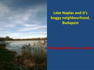
Lake and Stream Hydrology 2009 UJ,UH, &TPU Timo Huttula JY/BYTL& SYKE/VTO www.environment.fi
Contents • River characteristics • River hydraulics • Example from wet temperate region Lake and stream hydrology T.Huttula
River characteristics • Water movement is determined by a slope along the longitudinal axis of the channel • In general we limit ourselves to one dimensional spatial analysis • Variables: Length, (m), water level W (m), cross sectional area A (m2) • Cross sectional area can vary significantly • Most important variable is the discharge Q (or flow rate). It’ s unit is m3s-1. For small rivers or creeks it can be expressed as ls-1 • Water body is expected fully mixed, incompressible and acting as an ideal fluid • Short retention time as compared to lakes Lake Päijänne surface level is about 76 m above sea. Distance from Kalkkinen is about 100 km from sea. What is the mean slope of a hypothetical river from lake to sea? Slope= 76 m/(100*1000 m)=0,00076 Lake and stream hydrology T.Huttula
Time and space scales of hydrological phenomena • Note that the storage units are expressed hear as mm over the surface! Lake and stream hydrology T.Huttula
Duration curves Lake and stream hydrology T.Huttula
What determines the discharge duration? Example from Japan Lake and stream hydrology T.Huttula
Examples from humid temperate region • Temperate: no extremes • Humid: abundant water storages, still large varions. Mean annual evaporation 500<E0<1000 mm and precipitation P>E0 • Well known ecohydological region, rich in research • Long cultural history diverse land use • Anthropogenic effects to H-processes are significant locally and also regionally Lake and stream hydrology T.Huttula
Formation of runoff and discharge in this region • Stream discharge is here a sum of groundwater flow, surface runoff and overland flow • Their share varies in space and time • ”Quick flow” , in UK 40 % from precipitation of a certain precipitation event . It can vary from 1% (chalky soil)…77% (clay) Lake and stream hydrology T.Huttula
Annual water balance • In this region run off is R=f( annual precipitation, water vapor deficit in air, soil properties) • Figure: Beult good correlation , Pang bad correlation, because soil is very porous (chalk) Lake and stream hydrology T.Huttula
Monthly Q-duration curves 1(2) • Expresses the duration as % of the time in each month. • The duration curves or surface are expressed as 100, 90, 75, 50,25,10, 5 ja 0%:n Lake and stream hydrology T.Huttula
Monthly Q-duration curves for seasonal studies 2(2) • Comparing the curves we can see the effects of watershed factors on river Q- regime • The two rivers here are only 100 km apart • Danube obtains waters from Alps. Watershed is mainly in regions of permanent snow. This means that rain (P) and melting are important factors forming Q steady duration curves in II…VIII. Dry winter months • Tisza: waters come from North. No permanent snow on watershed => peak and valley in duration curves happens in the same time for each curve tells about the similar repeated behavior of the Q in the years cycle. Lake and stream hydrology T.Huttula
River discharge • Several classifications for rivers. • Comparisons can be made most effectively if the homogenous and representative catchments • Left we see the share of monthly discharge about the annual total ( catchments) • most have max during winter • In West Europe P max is in winter and evaporation max in summer large variations in winter and summerQ • In continental regions P max is in summer as evaporation max steady Q over the year • In regions with snow we have spring melting and then also spring flood Lake and stream hydrology T.Huttula
River discharge 2(2) • Geological effects can be seen in figures on left • Pang: Catchment soil is chalky slow changes in hydrographs • Kym, clay soil drastic changes • Q-Pang (SE UK ) ja Q-Wurm(N Germany) are comparable different inputs summed up produce similar Q time series Lake and stream hydrology T.Huttula
Substances transported in a river: Sediments transport • Total substance transport=sediment transport + soluble substance transport • Sediment transport or suspended solids transport happens in suspension and as a bottom transport • Bottom transport in the ecohydrolgical region is small: 1….11 % of the sediment total transport • Suspended solids yield is inversely related to watershed area. Load decreases as A increases. • In Germany: yield is mostly 50 t/km2 /y, range 6…300 t/km2 /y • UK: also 50 t/km2, on wet upper lands even 500 t/km2 /y and less than 1 t/km2 great flat watersheds or watersheds with impervious soil • Largest yields: Waipoa/NZ 7000 t/km2 /y Lake and stream hydrology T.Huttula
Suspended solids distribution in a river u=velocity C=suspended solids concentration Lake and stream hydrology T.Huttula
Transport of soluble substances, natural streams • The variation is normally less that the suspended solids transport • It is a function of atmospheric load, soil chemistry and precipitation • In UK the soluble substances yield is : 10…400 t/km2 /y • In wet regions soluble substance transport has larger values as the suspended solids transport • In SW UK the solutes consists 55…77 % of the total river substance transport • In France 68% of the total river substance transport • In Poland 93-95% of the total river substance transport Lake and stream hydrology T.Huttula
Suspended solids transport in River Tornionjoki Lake and stream hydrology T.Huttula