Download
1 / 26
260 likes | 398 Views
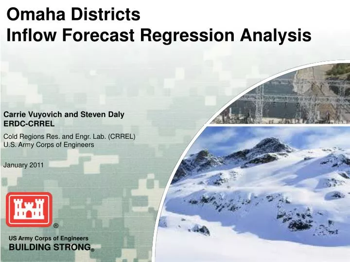
Omaha Districts Inflow Forecast Regression Analysis. Carrie Vuyovich and Steven Daly ERDC-CRREL Cold Regions Res. and Engr. Lab. (CRREL) U.S. Army Corps of Engineers January 2011. Overview. Background Multiple linear regression analysis to forecast spring inflows to reservoirs

E N D
Omaha Districts Inflow Forecast Regression Analysis Carrie Vuyovich and Steven DalyERDC-CRREL Cold Regions Res. and Engr. Lab. (CRREL)U.S. Army Corps of Engineers January 2011
Overview Background • Multiple linear regression analysis to forecast spring inflows to reservoirs • 6 snow-dominated watersheds • Monthly forecasts beginning in January Goals • Update regressions with recent data, improve accuracy • Develop better estimate of SWE • Work towards a more automated process • Identify possible climate trends
Parameters • Q (106 ac-ft) = Forecasted total volume inflow to reservoir (+ Holdouts) • SWE (in) = Average station SWE on first of month • ANTQ (106 ac-ft) = Total antecedent inflow from Oct – Nov of previous year (+ Holdouts) • ANTPREC (in) = Total annual precipitation in previous year • P (in) = Total precipitation since beginning of year Holdout Calculation:
Canyon Ferry Area = 15,886 mi2 Average Apr-Jul total volume inflow = 1.9 M ac-ft (2 M ac-ft Natural) Average Oct-Nov total volume inflow = 0.56 M ac-ft (0.56 M ac-ft Natural) Average monthly total precipitation (in)
Clark Canyon Area = 2,315 mi2 Average Apr-Jul total volume inflow = 0.08 M ac-ft (0.09 M ac-ft Natural) Average Oct-Nov total volume inflow = 0.04 M ac-ft (0.05 M ac-ft Natural) Average monthly total precipitation (in)
Tiber Area = 4,724 mi2 Average Apr-Jul total volume inflow = 0.43 M ac-ft Average Oct-Nov total volume inflow = 0.04 M ac-ft Average monthly total precipitation (in)
Yellowtail Area = 19,693 mi2 Average Apr-Jul total volume inflow = 1.0 M ac-ft (1.4 M ac-ft Natural) Average Oct-Nov total volume inflow = 0.30 M ac-ft (0.32 M ac-ft Natural) Average monthly total precipitation (in)
Boysen Area = 7,750 mi2 Average Apr-Jul total volume inflow = 0.56 M ac-ft (0.6 M ac-ft Natural) Average Oct-Nov total volume inflow = 0.11 M ac-ft (0.11 M ac-ft Natural) Average monthly total precipitation (in)
Glendo Area = 15,562 mi2 Average Apr-Jul total volume inflow = 0.60 M ac-ft (0.88 M ac-ft Natural) 0.14 M ac-ft below Alcova Average Oct-Nov total volume inflow = 0.13 M ac-ft (0.09 M ac-ft Natural) 0.03 M ac-ft below Alcova Average monthly total precipitation (in)
Percent Error *2011 Yellowtail forecast of Actual reservoir inflow for Apr – Jul (USACE and BoR) USACE Forecast for May-Jul, includes holdouts from Boysen, Buffalo Bill and Bull Lake
Automation • Goals: • Link regression equations, data and statistics to final forecast sheet • Links to data sources (semi-automated) • Limit data entry and calculation errors • Easily transfer regression coefficients each year • Easily transfer annual data to regression analysis workbook
2011 Issues • Late snowfall in April • Switched from 1 Apr SWE to Max(1 Apr, 1 May) • Real-time precipitation data • Difficult to automate • Canyon Ferry results • Not capturing complete water balance by the end of the season
Proposed Improvements to Inflow Forecasting • Daily estimates of forecasted inflow for monitoring • Need to automate regression analysis and data stream • Climate change impacts to regression analysis • Temperature appears to be increasing, Precipitation neither increasing or decreasing • Changes in climate will reduce the accuracy of regressions over time • Limit data used in analysis to recent years rather than entire period of record
Proposed Improvements to Inflow Forecasting • Further investigation of better SWE estimation • Test in different basins • Field measurements to better understand distribution of snow Canyon Ferry
Proposed Improvements to Inflow Forecasting • Passive Microwave Satellite Observations of SWE in the Great Plains • Algorithms developed in Great Plains region of Canada. • Shown promising results in Red River of the North Basins • Independent estimate of SWE, available real-time • Long period of record (1987 – present) • Evaluate by comparison to NOHRSC, ground and flight observations, hydrologic analysis
Proposed Improvements to Inflow Forecasting • Passive Microwave detection of snowmelt and runoff • Affected by presence of wet snow • Research into detection of “ripe” snow and rain-on-snow events • May provide information on timing of melt and flood forecasting • Hydrologic Analysis of Plains snowpack • Correlation between timing and volume to SWE in Plains to discharge • Terrain-state modeling • Statistical analysis/rank-order